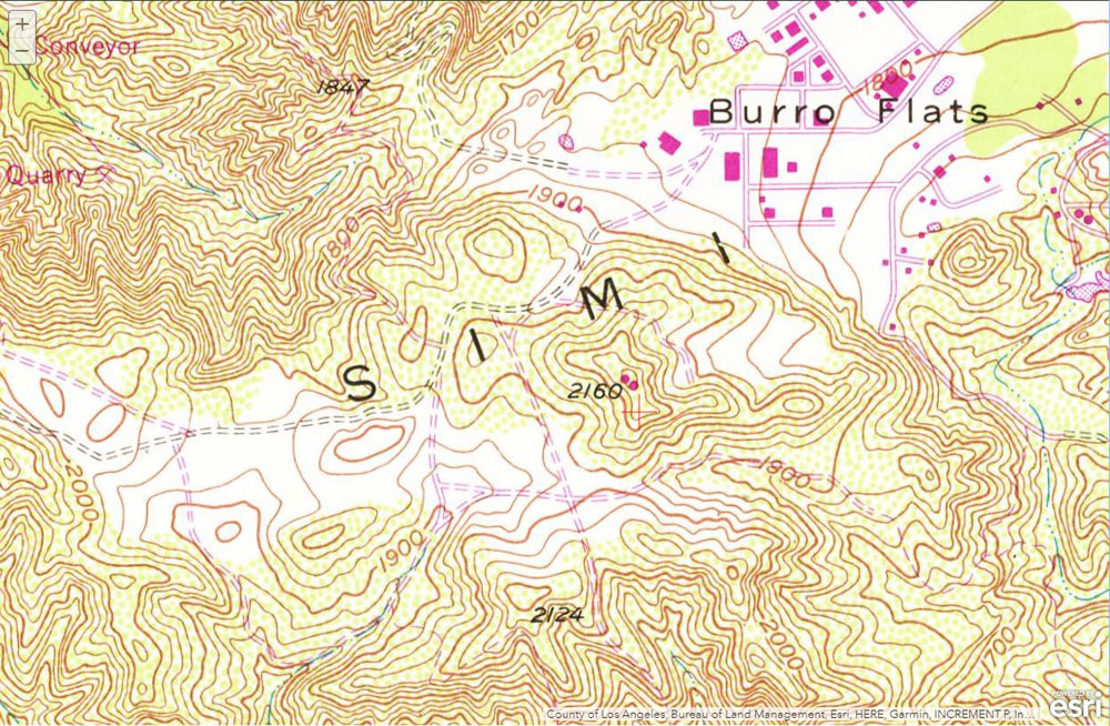
Approximate location of the high point of Upper Las Virgenes Canyon Open Space Preserve
 alt="Approximate location (crossmark) of the high point of Upper Las Virgenes Canyon Open Space Preserve, near hill 2160. Hill 2124 is "windmill hill." The map is a section of the USGS 1967 7.5 minute 1:24000 Calabasas topo map. High resolution Lidar data indicates the high point has an elevation of about 2162'." border="0">
Approximate location (crossmark) of the high point of Upper Las Virgenes Canyon Open Space Preserve, near hill 2160. Hill 2124 is "windmill hill." The map is a section of the USGS 1967 7.5 minute 1:24000 Calabasas topo map. High resolution Lidar data indicates the high point has an elevation of about 2162'.
Click this link to read more about this photograph.
Click on any of the following categories to see additional photography:
ABSTRACT - QUIRKY - LANDSCAPE - WILDLIFE - INSECTS - WILDFLOWERS - ADVENTURES
PHOTOGRAPHY
ON THE RUN
Copyright © 1995-2025 Gary Valle'. All Rights Reserved.
![]()