LIDAR elevations of the high point of Upper Las Virgenes Canyon Open Space Preserve & nearby hills
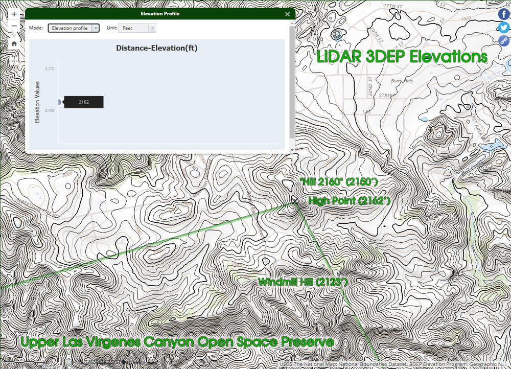 alt="High resolution LIDAR 3DEP elevations of the high point of Upper Las Virgenes Canyon Open Space Preserve, and nearby hills." border="0">
High resolution LIDAR 3DEP elevations of the high point of Upper Las Virgenes Canyon Open Space Preserve, and nearby hills.
Click this link to read more about this photograph.
Click on any of the following categories to see additional photography:
ABSTRACT - QUIRKY - LANDSCAPE - WILDLIFE - INSECTS - WILDFLOWERS - ADVENTURES
PHOTOGRAPHY
ON THE RUN
Copyright © 1995-2025 Gary Valle'. All Rights Reserved.
![]()