High resolution (1m) 3DEP Lidar data for the top of San Gorgonio Mountain
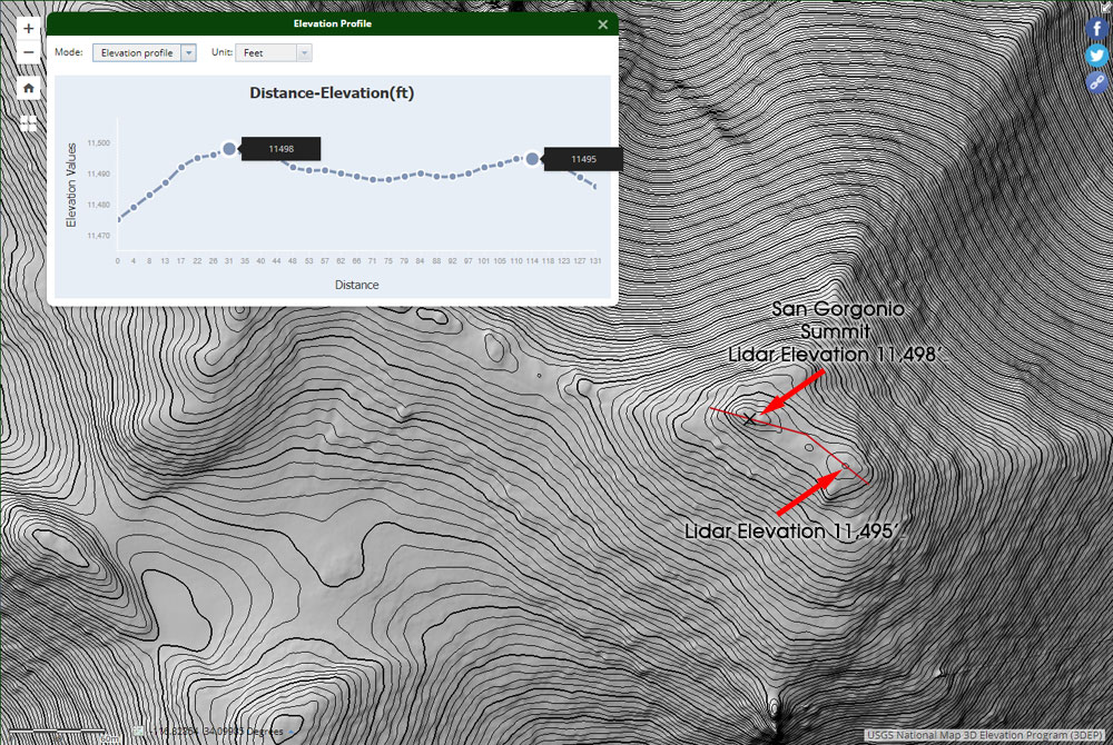 alt="High resolution (1m) 3DEP Lidar data for the top of San Gorgonio Mountain. It resolves the twin summits, and indicates the official (west) summit is about three feet higher." border="0">
High resolution (1m) 3DEP Lidar data for the top of San Gorgonio Mountain. It resolves the twin summits, and indicates the official (west) summit is about three feet higher.
Click this link to read more about this photograph.
Click on any of the following categories to see additional photography:
ABSTRACT - QUIRKY - LANDSCAPE - WILDLIFE - INSECTS - WILDFLOWERS - ADVENTURES
PHOTOGRAPHY
ON THE RUN
Copyright © 1995-2025 Gary Valle'. All Rights Reserved.
![]()