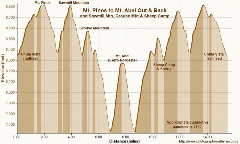
Elevation profile of the out & back run/hike from Mt. Pinos to Mt. Abel, with side trips
 alt="An elevation profile of the out and back adventure run/hike from the Chula Vista parking area on Mt. Pinos to Mt. Abel, with short side trips to Sawmill Mountain, Grouse Mountain, and Sheep Camp. Elevations have been corrected using one meter, 3DEP Lidar-based data. Specified elevations and placename locations are approximate." border="0">
An elevation profile of the out and back adventure run/hike from the Chula Vista parking area on Mt. Pinos to Mt. Abel, with short side trips to Sawmill Mountain, Grouse Mountain, and Sheep Camp. Elevations have been corrected using one meter, 3DEP Lidar-based data. Specified elevations and placename locations are approximate.
Click this link to read more about this photograph.
Click on any of the following categories to see additional photography:
ABSTRACT - QUIRKY - LANDSCAPE - WILDLIFE - INSECTS - WILDFLOWERS - ADVENTURES
PHOTOGRAPHY
ON THE RUN
Copyright © 1995-2025 Gary Valle'. All Rights Reserved.
![]()