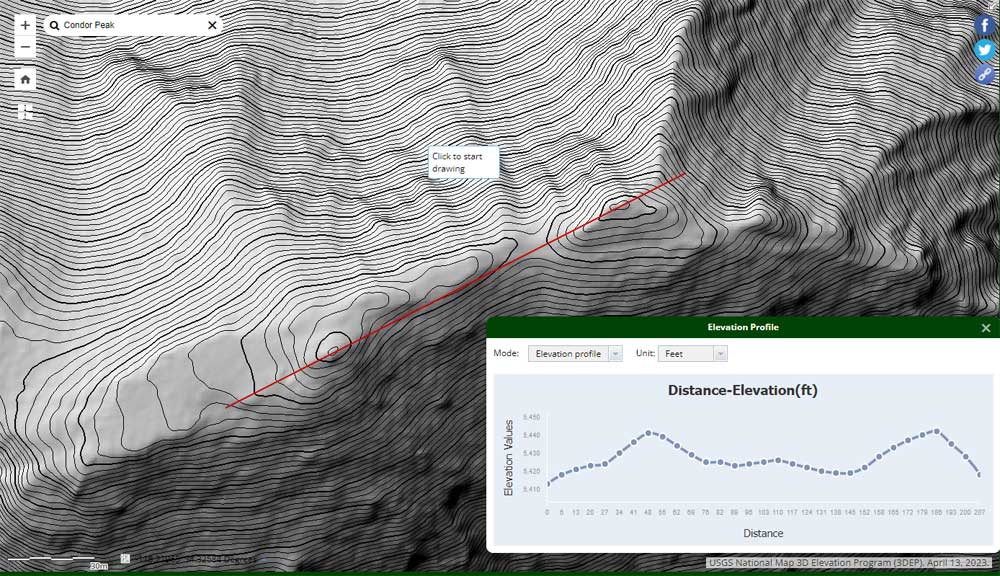
U.S.G.S. Lidar-based 3DEP elevation of Condor Peak with 1m contours.
 alt="U.S.G.S. Lidar-based 3DEP elevation of Condor Peak with 1m contours. The West and East peaks are virtually at the same elevation." border="0">
U.S.G.S. Lidar-based 3DEP elevation of Condor Peak with 1m contours. The West and East peaks are virtually at the same elevation.
Click this link to read more about this photograph.
Click on any of the following categories to see additional photography:
ABSTRACT - QUIRKY - LANDSCAPE - WILDLIFE - INSECTS - WILDFLOWERS - ADVENTURES
PHOTOGRAPHY
ON THE RUN
Copyright © 1995-2025 Gary Valle'. All Rights Reserved.
![]()