Google Earth image of a GPS trace of a run from the Victory trailhead of Upper Las Virgenes Canyon
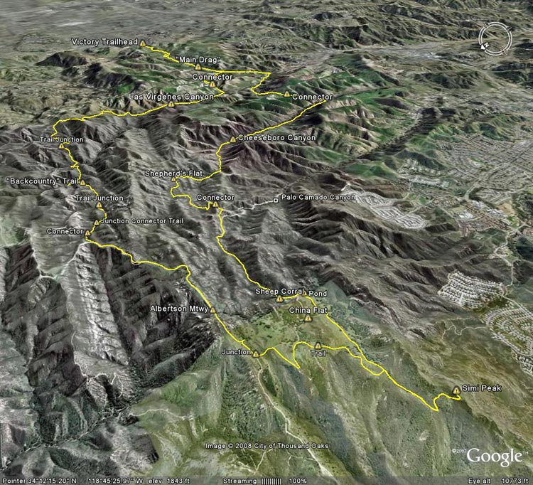 alt="Google Earth image of a GPS trace of a run from the Victory trailhead of Upper Las Virgenes Canyon Open Space Preserve to Simi Peak." border="0">
Google Earth image of a GPS trace of a run from the Victory trailhead of Upper Las Virgenes Canyon Open Space Preserve to Simi Peak.
Click on any of the following categories to see additional photography:
ABSTRACT - QUIRKY - LANDSCAPE - WILDLIFE - INSECTS - WILDFLOWERS - ADVENTURES
PHOTOGRAPHY
ON THE RUN
Copyright © 1995-2025 Gary Valle'. All Rights Reserved.
![]()