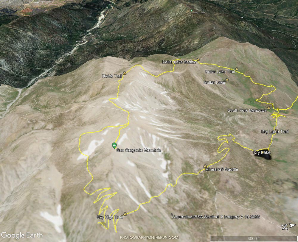
Google Earth image of San Gorgonio Mountain with Sentinel 2 overlay from July 19, 2023
 alt="Google Earth image of San Gorgonio Mountain overlain with Copernicus/ESA Sentinel 2 imagery taken on July 19, 2023. The GPS track (yellow) is the upper portion of the Dollar Lake - Dry Lake Loop, a keyhole loop that starts at the South Fork Trailhead. The GPS track is subject to errors. Not all ice and snow may be evident in the imagery." border="0">
Google Earth image of San Gorgonio Mountain overlain with Copernicus/ESA Sentinel 2 imagery taken on July 19, 2023. The GPS track (yellow) is the upper portion of the Dollar Lake - Dry Lake Loop, a keyhole loop that starts at the South Fork Trailhead. The GPS track is subject to errors. Not all ice and snow may be evident in the imagery.
Click this link to read more about this photograph.
Click on any of the following categories to see additional photography:
ABSTRACT - QUIRKY - LANDSCAPE - WILDLIFE - INSECTS - WILDFLOWERS - ADVENTURES
PHOTOGRAPHY
ON THE RUN
Copyright © 1995-2025 Gary Valle'. All Rights Reserved.