Google Earth image of a GPS trace of our route from Walker Pass to Owens Peak Saddle on the PCT and
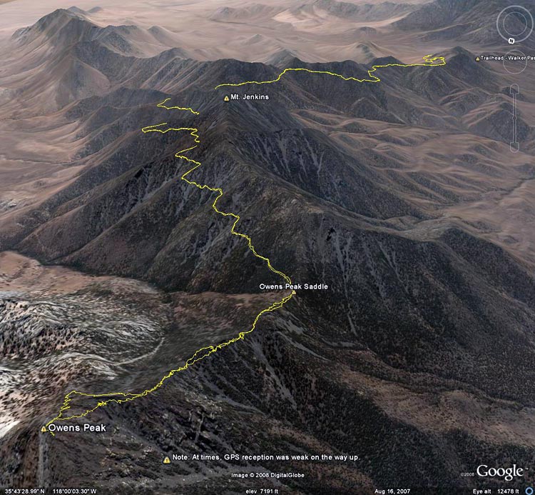 alt="Google Earth image of a GPS trace of our route from Walker Pass to Owens Peak Saddle on the PCT and then up the ridge to Owens Peak. GPS reception was poor at times." border="0">
Google Earth image of a GPS trace of our route from Walker Pass to Owens Peak Saddle on the PCT and then up the ridge to Owens Peak. GPS reception was poor at times.
Click on any of the following categories to see additional photography:
ABSTRACT - QUIRKY - LANDSCAPE - WILDLIFE - INSECTS - WILDFLOWERS - ADVENTURES
PHOTOGRAPHY
ON THE RUN
Copyright © 1995-2025 Gary Valle'. All Rights Reserved.
![]()