Google Earth image of MODIS fire detections (9-4-09 0600 PDT) and GEOMAC fire perimeter (9-3-09 0327
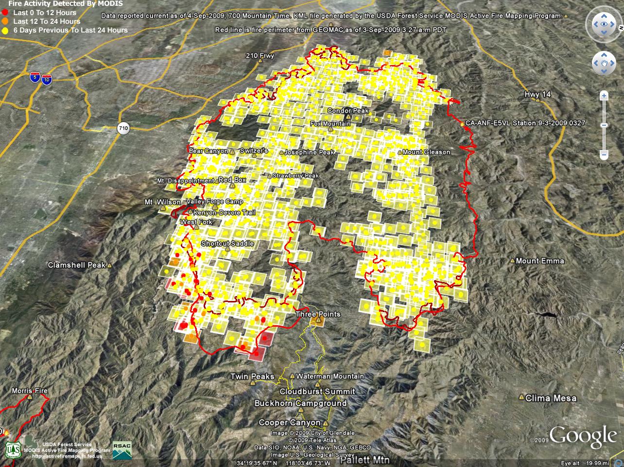 alt="Google Earth image of MODIS fire detections (9-4-09 0600 PDT) and GEOMAC fire perimeter (9-3-09 0327 PDT) indicates the approximate extent of Station Fire." border="0">
Google Earth image of MODIS fire detections (9-4-09 0600 PDT) and GEOMAC fire perimeter (9-3-09 0327 PDT) indicates the approximate extent of Station Fire.
Click on any of the following categories to see additional photography:
ABSTRACT - QUIRKY - LANDSCAPE - WILDLIFE - INSECTS - WILDFLOWERS - ADVENTURES
PHOTOGRAPHY
ON THE RUN
Copyright © 1995-2025 Gary Valle'. All Rights Reserved.
![]()