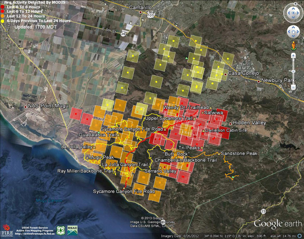
Google Earth image of 2013 Springs Fire MODIS fire detections as of 05/03/13 1700 MDT. Placemark
 alt="Google Earth image of 2013 Springs Fire MODIS fire detections as of 05/03/13 1700 MDT. Placemark locations are approximate. The yellow GPS track is the Ray Miller 50K course and the orange track the 50 mile extension. The red track is Sycamore Canyon Fire Road." border="0">
Google Earth image of 2013 Springs Fire MODIS fire detections as of 05/03/13 1700 MDT. Placemark locations are approximate. The yellow GPS track is the Ray Miller 50K course and the orange track the 50 mile extension. The red track is Sycamore Canyon Fire Road.
Click this link to read more about this photograph.
Click on any of the following categories to see additional photography:
ABSTRACT - QUIRKY - LANDSCAPE - WILDLIFE - INSECTS - WILDFLOWERS - ADVENTURES
PHOTOGRAPHY
ON THE RUN
Copyright © 1995-2025 Gary Valle'. All Rights Reserved.
![]()