Elevation profile of the Burger Run course on the Whiskey Flat Trail near Kernville, California.
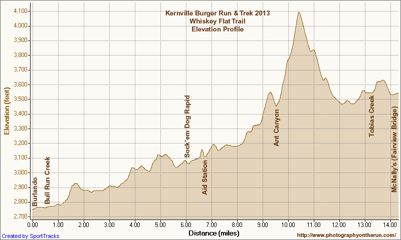 alt="Elevation profile of the Burger Run course on the Whiskey Flat Trail near Kernville, California. Generated by SportTracks from my GPS trace of the course using corrected SRTM-based elevations. Mileages and locations are approximate." border="0">
Elevation profile of the Burger Run course on the Whiskey Flat Trail near Kernville, California. Generated by SportTracks from my GPS trace of the course using corrected SRTM-based elevations. Mileages and locations are approximate.
Click this link to read more about this photograph.
Click on any of the following categories to see additional photography:
ABSTRACT - QUIRKY - LANDSCAPE - WILDLIFE - INSECTS - WILDFLOWERS - ADVENTURES
PHOTOGRAPHY
ON THE RUN
Copyright © 1995-2025 Gary Valle'. All Rights Reserved.
![]()