NRL GOES-15 Satellite image from 8:45 am, October 25 showing the approaching cold front, strong
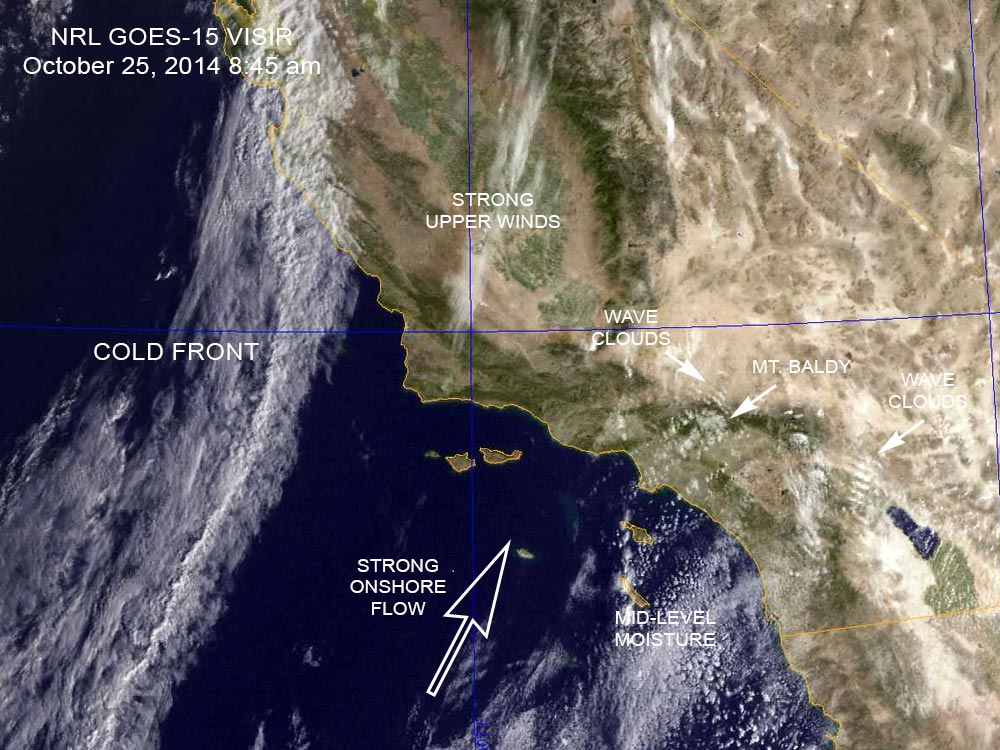 alt="NRL GOES-15 Satellite image from 8:45 am, October 25 showing the approaching cold front, strong onshore flow ahead of the front, and the source of the moisture that resulted in the mid-level clouds. Wave clouds typically form when wind flows into, and then up and over a mountain range, creating a series of "roller coaster" atmospheric waves downwind of the range." border="0">
NRL GOES-15 Satellite image from 8:45 am, October 25 showing the approaching cold front, strong onshore flow ahead of the front, and the source of the moisture that resulted in the mid-level clouds. Wave clouds typically form when wind flows into, and then up and over a mountain range, creating a series of "roller coaster" atmospheric waves downwind of the range.
Click this link to read more about this photograph.
Click on any of the following categories to see additional photography:
ABSTRACT - QUIRKY - LANDSCAPE - WILDLIFE - INSECTS - WILDFLOWERS - ADVENTURES
PHOTOGRAPHY
ON THE RUN
Copyright © 1995-2025 Gary Valle'. All Rights Reserved.
![]()