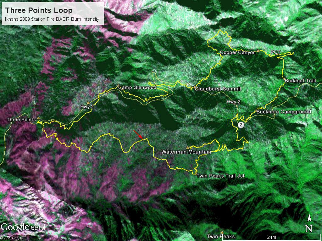
Part of a Burned Area Emergency Response (BAER) image taken of the Station Fire Burn Area by the
 alt="Part of a Burned Area Emergency Response (BAER) image taken of the Station Fire Burn Area by the NASA Ikhana remotely piloted aircraft in 2009 with a GPS track (yellow) of the Three Points - Mt. Waterman loop. The hues of purple indicate burn intensity. (Ikhana image courtesy of NASA Dryden and NASA Ames. Composite image created using Google Earth Pro.)" border="0">
Part of a Burned Area Emergency Response (BAER) image taken of the Station Fire Burn Area by the NASA Ikhana remotely piloted aircraft in 2009 with a GPS track (yellow) of the Three Points - Mt. Waterman loop. The hues of purple indicate burn intensity. (Ikhana image courtesy of NASA Dryden and NASA Ames. Composite image created using Google Earth Pro.)
Click this link to read more about this photograph.
Click on any of the following categories to see additional photography:
ABSTRACT - QUIRKY - LANDSCAPE - WILDLIFE - INSECTS - WILDFLOWERS - ADVENTURES
PHOTOGRAPHY
ON THE RUN
Copyright © 1995-2025 Gary Valle'. All Rights Reserved.
![]()