Google Earth image and my GPS track, showing the connection from the Mt. Wilson Trail to the Kenyon
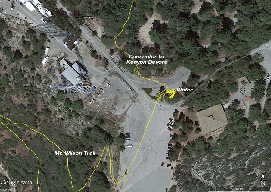 alt="Google Earth image and my GPS track, showing the connection from the Mt. Wilson Trail to the Kenyon Devore connector trail." border="0">
Google Earth image and my GPS track, showing the connection from the Mt. Wilson Trail to the Kenyon Devore connector trail.
Click this link to read more about this photograph.
Click on any of the following categories to see additional photography:
ABSTRACT - QUIRKY - LANDSCAPE - WILDLIFE - INSECTS - WILDFLOWERS - ADVENTURES
PHOTOGRAPHY
ON THE RUN
Copyright © 1995-2025 Gary Valle'. All Rights Reserved.
![]()