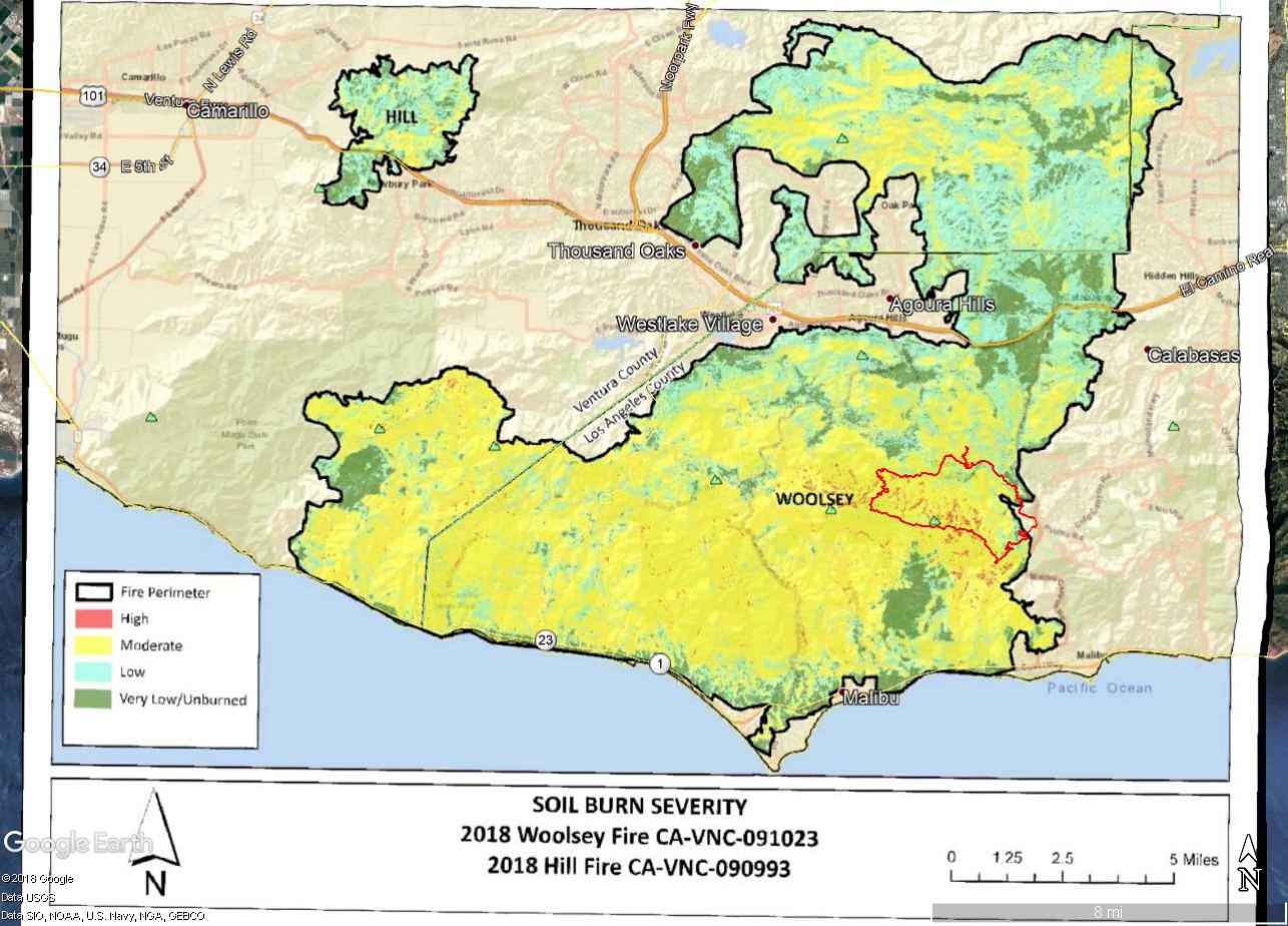
Watershed Emergency Response Team (WERT) Soil Burn Severity Map for the Woolsey and Hill Fires.
 alt="Watershed Emergency Response Team (WERT) Soil Burn Severity Map for the Woolsey and Hill Fires. A track of our run -- a variation of the Bulldog Loop -- has been added." border="0">
Watershed Emergency Response Team (WERT) Soil Burn Severity Map for the Woolsey and Hill Fires. A track of our run -- a variation of the Bulldog Loop -- has been added.
Click this link to read more about this photograph.
Click on any of the following categories to see additional photography:
ABSTRACT - QUIRKY - LANDSCAPE - WILDLIFE - INSECTS - WILDFLOWERS - ADVENTURES
PHOTOGRAPHY
ON THE RUN
Copyright © 1995-2025 Gary Valle'. All Rights Reserved.
![]()