Google Earth image of Apple Fire perimeter and some trails in the San Gorgonio Wilderness
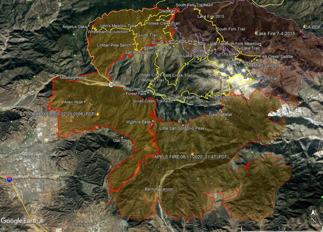 alt="A Google Earth image of El Dorado and Apple Fire perimeters and some of the trails in the San Gorgonio Wilderness. The perimeter is from the National Interagency Fire Center (NIFC) and its timestamp is indicated. The locations of all placemarks and trails are approximate." border="0">
A Google Earth image of El Dorado and Apple Fire perimeters and some of the trails in the San Gorgonio Wilderness. The perimeter is from the National Interagency Fire Center (NIFC) and its timestamp is indicated. The locations of all placemarks and trails are approximate.
Click this link to read more about this photograph.
Click on any of the following categories to see additional photography:
ABSTRACT - QUIRKY - LANDSCAPE - WILDLIFE - INSECTS - WILDFLOWERS - ADVENTURES
PHOTOGRAPHY
ON THE RUN
Copyright © 1995-2025 Gary Valle'. All Rights Reserved.
![]()