A Google Earth image of a Bobcat Fire perimeter and some nearby trails
 alt="A Google Earth image of a Bobcat Fire perimeter and some trails in Angeles National Forest. The perimeter is from the NIFC and its timestamp is indicated. Perimeters for the 2002 Curve Fire, 2002 Williams Fire, 2009 Morris Fire and 2009 Station Fire are also shown. The area inside the Bobcat perimeter is transparent yellow. Where the Bobcat perimeter overlaps older perimeters the area appears transparent orange. All map data are approximate." border="0">
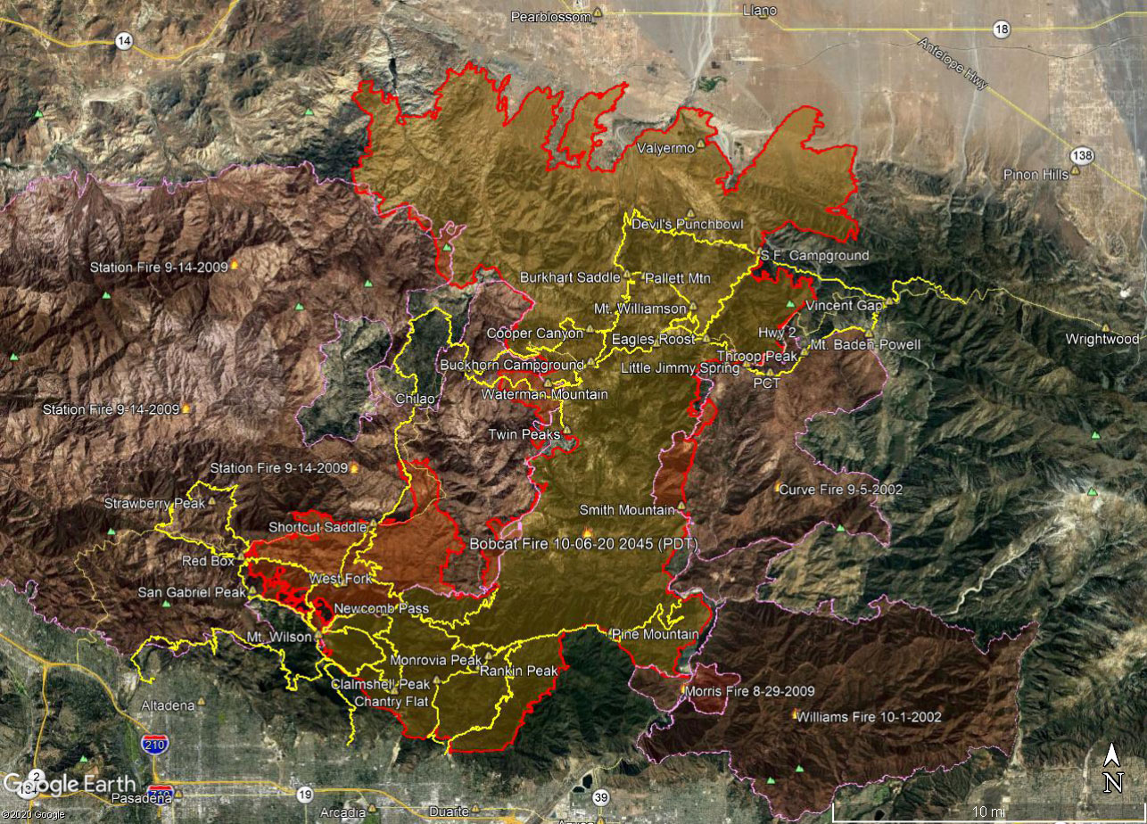
A Google Earth image of a Bobcat Fire perimeter and some trails in Angeles National Forest. The perimeter is from the NIFC and its timestamp is indicated. Perimeters for the 2002 Curve Fire, 2002 Williams Fire, 2009 Morris Fire and 2009 Station Fire are also shown. The area inside the Bobcat perimeter is transparent yellow. Where the Bobcat perimeter overlaps older perimeters the area appears transparent orange. All map data are approximate.
Click this link to read more about this photograph.
Click on any of the following categories to see additional photography:
ABSTRACT - QUIRKY - LANDSCAPE - WILDLIFE - INSECTS - WILDFLOWERS - ADVENTURES
PHOTOGRAPHY
ON THE RUN
Copyright © 1995-2025 Gary Valle'. All Rights Reserved.
![]()