Google Earth image of a GPS trace of a trail run on the Condor Peak and Trail Canyon trails,
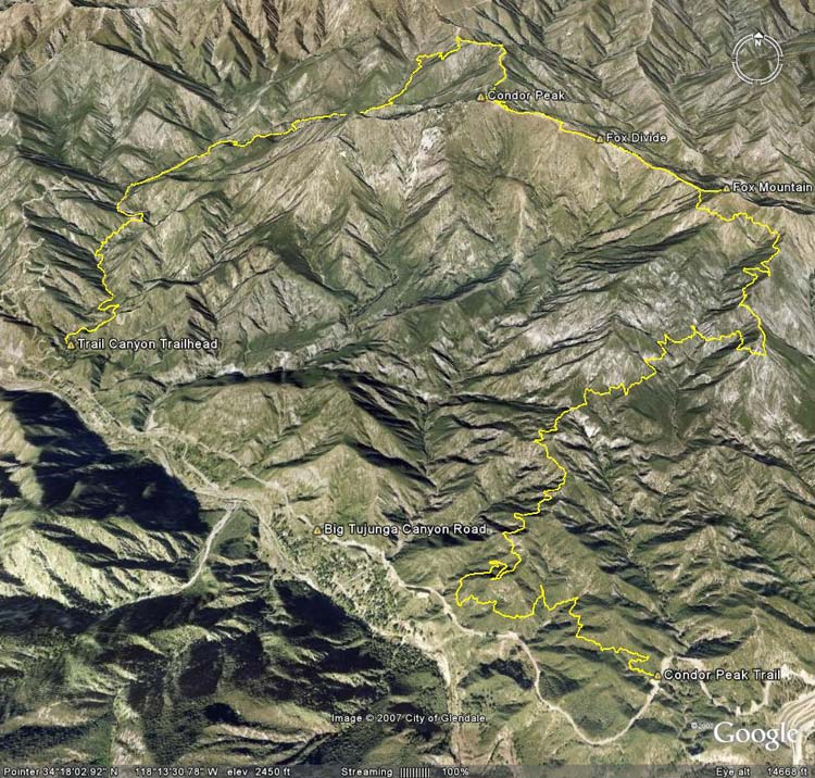 alt="Google Earth image of a GPS trace of a trail run on the Condor Peak and Trail Canyon trails, including ascents of Fox Mountain and Condor Peak." border="0">
Google Earth image of a GPS trace of a trail run on the Condor Peak and Trail Canyon trails, including ascents of Fox Mountain and Condor Peak.
Click this link to read more about this photograph.
Click on any of the following categories to see additional photography:
ABSTRACT - QUIRKY - LANDSCAPE - WILDLIFE - INSECTS - WILDFLOWERS - ADVENTURES
PHOTOGRAPHY
ON THE RUN
Copyright © 1995-2025 Gary Valle'. All Rights Reserved.
![]()