Three Points - Mt Hillyer and Three Points - Mt Waterman loops and Bobcat Fire Soil Burn Severity
 alt="An overview of the Three Points - Hillyer Loop (yellow) and the Three Points - Mt. Waterman Loop (red). An overlay of the Bobcat Fire BAER Soil Burn Severity has ben added to the Google Earth image. The burn severity classes are high (red), moderate (yellow), low (light green), unburned/very low (dark green), and no data (black)." border="0">
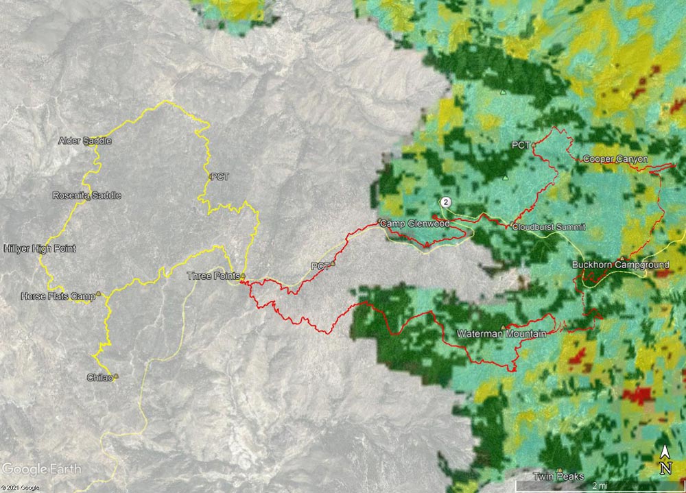
An overview of the Three Points - Hillyer Loop (yellow) and the Three Points - Mt. Waterman Loop (red). An overlay of the Bobcat Fire BAER Soil Burn Severity has ben added to the Google Earth image. The burn severity classes are high (red), moderate (yellow), low (light green), unburned/very low (dark green), and no data (black).
Click this link to read more about this photograph.
Click on any of the following categories to see additional photography:
ABSTRACT - QUIRKY - LANDSCAPE - WILDLIFE - INSECTS - WILDFLOWERS - ADVENTURES
PHOTOGRAPHY
ON THE RUN
Copyright © 1995-2025 Gary Valle'. All Rights Reserved.
![]()