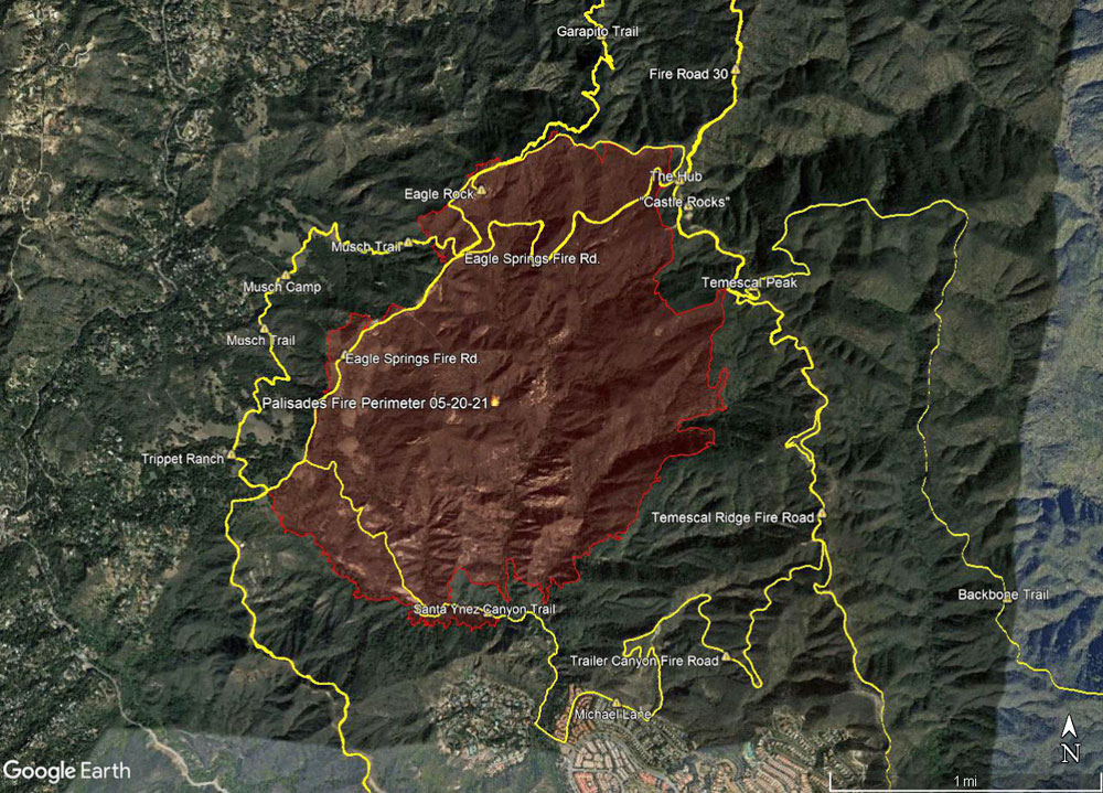
A Google Earth image of the 2021 Palisades Fire perimeter and some area trails.
 alt="A Google Earth image of the 2021 Palisades Fire perimeter and some area trails. The perimeter has a timestamp of 2021/05/20 08:36:18+00 and was downloaded from the NIFC. The locations of placemarks, trails, and other data is approximate and subject to error." border="0">
A Google Earth image of the 2021 Palisades Fire perimeter and some area trails. The perimeter has a timestamp of 2021/05/20 08:36:18+00 and was downloaded from the NIFC. The locations of placemarks, trails, and other data is approximate and subject to error.
Click this link to read more about this photograph.
Click on any of the following categories to see additional photography:
ABSTRACT - QUIRKY - LANDSCAPE - WILDLIFE - INSECTS - WILDFLOWERS - ADVENTURES
PHOTOGRAPHY
ON THE RUN
Copyright © 1995-2025 Gary Valle'. All Rights Reserved.
![]()