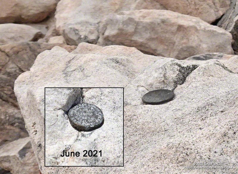
Defaced survey marker on the summit of San Gorgonio Mountain.
 alt="Defaced survey marker on the summit of San Gorgonio Mountain. Placed in 1989, the marker indicated the elevation of San Gorgonio Mountain was measured at 11501.6 feet. Photo taken September 24, 2022." border="0">
Defaced survey marker on the summit of San Gorgonio Mountain. Placed in 1989, the marker indicated the elevation of San Gorgonio Mountain was measured at 11501.6 feet. Photo taken September 24, 2022.
Click this link to read more about this photograph.
Click on any of the following categories to see additional photography:
ABSTRACT - QUIRKY - LANDSCAPE - WILDLIFE - INSECTS - WILDFLOWERS - ADVENTURES
PHOTOGRAPHY
ON THE RUN
Copyright © 1995-2025 Gary Valle'. All Rights Reserved.
![]()