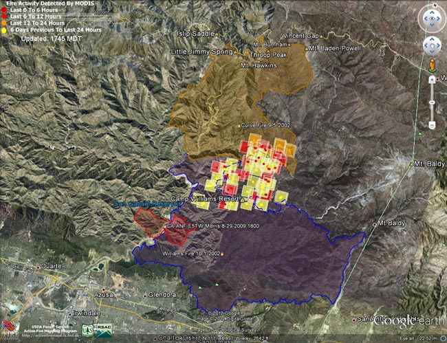
Williams Fire MODIS fire detections as of 09/04/12 1745 MDT
Here’s an interactive Cesium browser View of the most recently available Williams Fire MODIS fire detections and perimeter, and perimeters for the Curve (2002), Williams (2002) and Morris (2009) fires. This is a 3D view that can be zoomed and tilted. Fire detection overlay may take a few moments to load. Placemark locations are approximate. Requires Google Earth plugin.
Snapshots:
Williams Fire MODIS fire detections as of 09/07/12 0800 MDT.
Williams Fire MODIS fire detections as of 09/06/12 0800 MDT.
Williams Fire MODIS fire detections as of 09/05/12 1615 MDT.
Williams Fire MODIS fire detections as of 09/05/12 0900 MDT.
Williams Fire MODIS fire detections as of 09/04/12 1745 MDT.
Williams Fire MODIS fire detections as of 09/04/12 0815 MDT.
Williams Fire MODIS fire detections as of 09/03/12 1600 MDT.
MODIS Google Earth fire data is from the USDA Forest Service Remote Sensing Applications Center Active Fire Mapping Program website. The 2002 Curve and 2002 Williams perimeters are from the CDF/FRAP website, and the 2012 Williams and 2009 Morris fire perimeters are from the GEOMAC website.
