
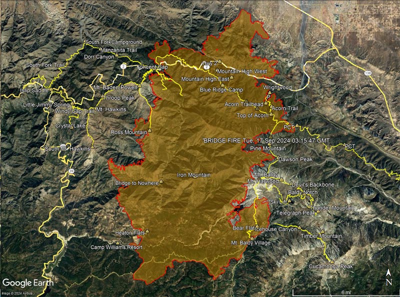
Updated 09/17/24 to perimeter with poly_DateCurrent of Tue, 17 Sep 2024 03:15:47 GMT.
For official information see the Bridge Fire incident page on Inciweb, the Angeles National Forest updates on Facebook, and the Angeles National Forest website.
The perimeters are from the Wildland Fire Interagency Geospatial Services (WFIGS) Group and National Interagency Fire Center (NIFC) website. The timestamp for the perimeter is the poly_DateCurrent specified with the perimeter data.
GPS tracks of some trails in the area are also shown. Placename and trail locations are approximate and may be incorrect.
Following are several 3D terrain views of the Bridge Fire perimeter from various perspectives:
– Overview of the Bridge Fire perimeter
– View of the Bridge Fire perimeter zoomed in on the Wrightwood area.
– View of the Bridge Fire perimeter zoomed in on the Mt. Baldy area.
– View of the Bridge Fire perimeter zoomed in on the Mt. Baden-Powell area.
The initial view can be changed using the control on the upper right side of the screen, the CTRL key and your mouse, or touch gestures.