
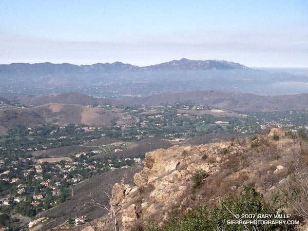
Sandstone Peak and Boney Mountain from Simi Peak
I hadn’t done this course in midsummer, but a long run close to home, and an early morning ascent of Simi Peak sounded like a nice change of pace. A dawn start from El Scorpion Park put me on the peak and back to the car before temps got out of hand.
On the way out to Simi Peak I usually run up Las Virgenes Canyon and then follow a single track popular with mountain-bikers to Shepherds’ Flat. From here the Sheep Corral Trail leads west to the Palo Comado Canyon fire road, which can be followed up to China Flat. On the way back, from Shepherds’ Flat I run down the Cheeseboro Canyon trail to a connector that can be followed east back to Las Virgenes Canyon. Done this way, and tacking on a short scenic tour of China Flat, the route works out to be about 22.5 miles, with an elevation gain and loss of about 2200 ft. Here’s a Google Earth image and Google Earth KMZ file of a GPS trace of the run.
There is an extensive network of trails in Upper Las Virgenes Canyon Open Space Preserve (trail map) and Cheeseboro/Palo Comado Canyons (trail map) , and many routes to Simi Peak are possible. El Scorpion Park is the most distant trailhead from Simi Peak. Starting at the Victory trailhead will decrease the round-trip mileage by about 2.5 miles, and from the Las Virgenes trailhead by about 6 miles. Simi Peak can also be accessed from the Cheeseboro Canyon, Lindero Canyon, Lang Ranch, and Long Canyon trailheads.