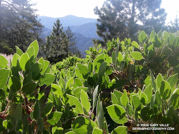
A day that begins on a trail winding its way through manzanita and Jeffery pine is probably going to be a good one. You’re in the mountains, and most likely starting a hike, run, climb, or some other adventure. In this case, it was the San Gabriel Mountains, and I was on the Pacific Crest Trail, near the start of a 20 mile run that began at Three Points and would circuit Mt. Waterman.
From Three Points (5,920′), I followed the PCT up to Cloudburst Summit (7018′), and then down into Cooper Canyon (~5735′). Reminiscient of a Rousseau painting, Cooper Canyon is one of the most idyllic spots in the San Gabriels. The old roadbed the trail follows into the canyon is a telltale sign of its lasting popularity. One of its attractions is Cooper Canyon Falls, which is on the PCT a short distance beyond where the Burkhart Trail, and my run, branched off and climbed to Buckhorn Campground (6300′).
The last time I had done this run, the linkup from Buckhorn Campground to the Mt. Waterman trail had been a little unclear. This time I knew I had to follow the camp roads to the entrance of the campground, rather than the exit. From the entrance of the campground, if I turned right onto Hwy 2, the Mt. Waterman trail could be picked up a few hundred feet north along the highway.
The Mt. Waterman trail winds a couple of miles through open yellow pine forest to within about 0.7 mile of the Mt. Waterman summit. At this point, a spur trail leads to the peak, and the main trail continues to the junction with the Twin Peaks trail. This spur trail leads to Twin Peaks Saddle, and from there to Twin Peaks.
The rocky, isolated summit of Twin Peaks is a worthwhile ascent, adding about 4 miles and 1700′ of elevation gain to the loop. It has a unique character, and is one of my favorite summits in the San Gabriels. On one ascent, as I reached the summit, the music of Bach wafted in on the wind from a subsidiary peak. Played with skill and feeling on a concert flute, the notes seemed to dance among the trees and rocks, and fill the expanse that lay beyond the peak.
There would be no Bach on the summit of Twin Peaks on this run. At the junction with the Twin Peaks trail I briefly debated the ascent, but continued on my way to Three Points.
Here’s a Google Earth image and Google Earth KMZ file of a GPS trace of the loop.
