
Climbing up a scenic ridge is a great way to start a trail run, especially when it ends at an interesting vantage point and can be extended into a loop.
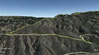
The Topanga Lookout Ridge is a mile and a half long ridge that extends from near the junction of Calabasas Peak Motorway and Red Rock Road to the Topanga Lookout.
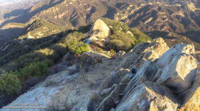
Well-defined ridges of this length are uncommon in the Santa Monica Mountains, especially those with trails along their crest. This one owes it existence to the Red Rock/Calabasas Peak Fault.
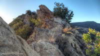
The path following the ridge is well-used and generally non-technical, but there are a few spots where it is necessary to scramble up, over, or around a short rocky section.
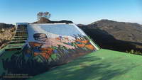
Normally a mass of graffiti, the lookout currently hosts artwork by @neonsuperblack painted “as a birthday surprise.”
From the Lookout the loop can be completed by following the Topanga Tower Mtwy southwest to the junction of Stunt, Schueren and Saddle Peak roads, then picking up the Backbone Trail and continuing west to the top of the Stunt High Trail. The Stunt High Trail can then be followed down to the trailhead at Cold Canyon Preserve on Stunt Road.
The total length of the loop is a little under 8 miles, with an approximate elevation gain/loss of 2000′. A side trip to Saddle Peak adds about 0.8 mile.