Gary Valle's Photography on the Run

Gary Valle's Photography on the Run

Search
Skip to content
  • About
  • Contact
  • Warning
  • Search
nature, nature|weather, photography, photography|landscape, photography|trail running, running, trails, trails|bay area

home » nature » Tennessee Valley Loop: Coyote Ridge

Tennessee Valley Loop: Coyote Ridge

published August 20, 2011 Gary Valle
Click on thumbnails for more info & larger image.

Running along Coyote Ridge in the Marin Headlands

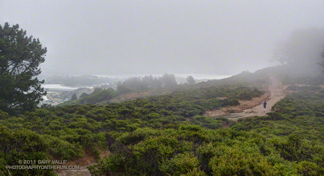
Running along Coyote Ridge in the Marin Headlands.

NPS maps of the Marin Headlands and the Presidio can be downloaded from the NPS Golden Gate National Recreation Area Maps page.

Post navigation

Previous PostCooler RunningNext PostPresidio Loop: Wood Line

Photography and inspiration from running and other adventures in the Open Space and Wilderness areas of California, and beyond. All content, including photography, is Copyright © 2006-2022 Gary Valle. All Rights Reserved.

Subscribe: RSS

Twitter Feed

Photo Albums

Recent Posts

  • Interactive 3D Terrain View of Sheep Fire Perimeter, Near Wrightwood
  • Not So Flat Las Llajas Canyon
  • Forest Run
  • Dawn Songs, Wildflowers, and a Rocket Launch from the Phantom Trail
  • Encelia Eruption
  • Exploring the Santa Clarita Ultra & Trail Runs 50K Course
  • High Point (Goat Peak) Via the Rivas Ridge Use Trail
  • Old Boney to Serrano Valley, Plus Fireline and Overlook
  • Revitalized Valley Oak at Ahmanson Ranch
  • A Lot of Bluster, But Not Much Rain
  • Is This the Future of Trail Use?
  • Malibu Creek December 2021 Floods

Archives

Categories

July 2022
M T W T F S S
 123
45678910
11121314151617
18192021222324
25262728293031
« Jun    

Meta

  • Log in
  • Entries RSS
Running WordPress