Topanga Lookout Ridge Loop


Looking down Topanga Lookout Ridge

Climbing up a scenic ridge is a great way to start a trail run, especially when it ends at an interesting vantage point and can be extended into a loop.

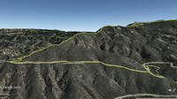
Googlr Earth view of Topanga Lookout Ridge

The Topanga Lookout Ridge is a mile and a half long ridge that extends from near the junction of Calabasas Peak Motorway and Red Rock Road to the Topanga Lookout.

Well-defined ridges of this length are uncommon in the Santa Monica Mountains, especially those with trails along their crest. This one owes it existence to the Red Rock/Calabasas Peak Fault.

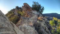
Upthrust rocks along Topanga Lookout Ridge.

The path following the ridge is well-used and generally non-technical, but there are a few spots where it is necessary to scramble up, over, or around a short rocky section.

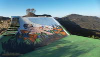
Normally a mass of graffiti, the lookout currently hosts artwork by @neonsuperblack painted “as a birthday surprise.”

Artwork at Topanga Lookout created by @neonsuperblack.
Artwork at Topanga Lookout

From the Lookout the loop can be completed by following the Topanga Tower Mtwy southwest to the junction of Stunt, Schueren and Saddle Peak roads, then picking up the Backbone Trail and continuing west to the top of the Stunt High Trail. The Stunt High Trail can then be followed down to the trailhead at Cold Canyon Preserve on Stunt Road.

The total length of the loop is a little under 8 miles, with an approximate elevation gain/loss of 2000′. A side trip to Saddle Peak adds about 0.8 mile.

What’s the Fastest Route Up Mt. Baldy?

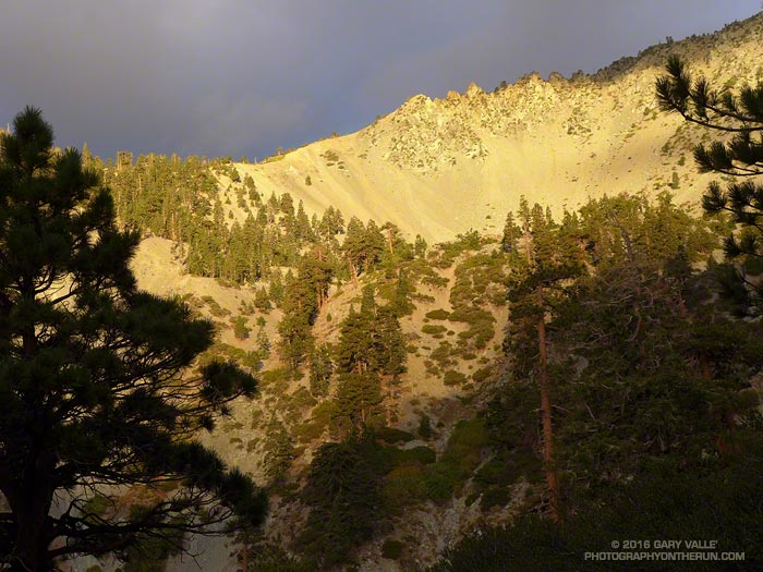
Baldy Bowl

There’s no getting around it. Sometimes it just feels good to go all out and push the pace up a peak. Just ask the 500+ that do the Mt. Baldy Run to the Top each year.

There are three routes up Mt. Baldy from Manker Flat on which I like to push the pace: the Ski Hut Trail, Register Ridge and the Run to the Top route via the Notch.

The 3.5 mile Register Ridge route is the shortest of the three routes. Since all three routes gain about 3900 feet in elevation, Register Ridge is also the steepest. From where the Register Ridge route leaves the Ski Hut Trail to where it joins the Devil’s Backbone Trail, it gains about 2600′ over about 1.5 miles — an AVERAGE grade of nearly 33%.

Since the Register Ridge route is about a half-mile shorter than the Ski Hut Trail, and the Ski Hut Trail is about 3 miles shorter than the R2T, it might seem either Register Ridge or the Ski Hut Trail would have to be the fastest route to the top of Baldy. For someone equally adept at running and steep hiking, this isn’t necessarily the case.

For a “short” ascent for which fatigue is not a major factor, it’s the elevation gain and not the distance that determines the time. Basically it’s a matter of the rate of climb the runner or hiker can sustain. The winning time of the Baldy R2T is usually just over an hour, which works out to about 3900 ft/hour. Pikes Peak Ascent winners average about 3600 ft/hour.

In round numbers to do Baldy in an hour you need to average:

• 7 mph or 9 min/mile on the R2T course.

• 4 mph or 15 min/mile on the Ski Hut Trail.

• 3.5 mph or 17 min/mile via Register Ridge route.

Following are some Strava Segments associated with these routes and the current Course Records:

Mt Baldy Summit via Ski Hut Trail (3.9 mi)
Brad Harris CR 1:06:58 Apr 17, 2015
Segment starts at Falls Road gate.

Mt. Baldy Run to the Top (6.8 mi)
Lucas Matison CR 1:05:24 Sep 5, 2016
Records are 1:00:49 by Matt Ebiner (1987), and 1:15:32 by Carrie Garritson (1988).
Segment starts at the ski area parking lot. Subtract about 1:00 to compare to the Ski Hut Trail time. This adjusts for running down to the Falls Road gate from the R2T start and for the R2T finish not being quite on the top.

Register to Summit (From base of Register Ridge)
Erik Schulte CR 1:08:56 Jun 19, 2015
Segment starts at the Register Ridge – Ski Hut Trail junction. Add about 10:00 to adjust for the time from Falls Road gate.

So even though the R2T course via the Notch is about 3 miles longer than the Ski Hut Trail route, the fastest (reported) times up Baldy have been by the R2T route. The Ski Hut Trail route is a close second, with the Register Ridge route is a distant third.
Glimpse of Autumn

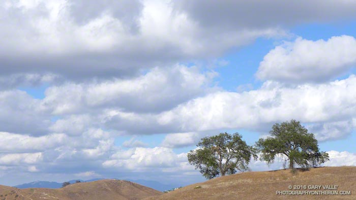
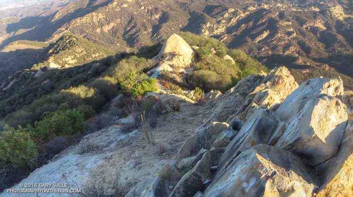
Oaks and clouds Upper Las Virgenes Canyon Open Space Preserve

I was running in the hills along the western margin of the San Fernando Valley and reveling in the Autumn-like weather. The hills were parched, brown, and the soil dessicated. In 128 days it had not rained.

An area of low pressure was producing some clouds and even a little rain in some parts of Los Angeles County. The last time it had been this cool in the afternoon was in mid-June. The pleasant temperature was a welcome change from the 80s, 90s and 100s of Summer.

Precipitation from the 2015-16 Godzilla El Nino fell short of expectations, with Downtown Los Angeles only recording 65% of normal rainfall and the drought continuing into its fifth year. How long would we have to wait  until we received widespread rainfall?

At the moment the expectation is for ENSO Neutral conditions to prevail this Winter. Neutral conditions give forecasters little leverage on which to base their Winter outlook, but based on last year’s Southern California precipitation forecasts, we didn’t have much leverage then either.

With a warming planet, we appear to be in a new regime. Forecasts based on 1950-2000 analogs may no longer be applicable. As of September 15 the Climate Prediction Center’s Precipitation Outlook for Southern California for December, January and February is the equivalent of flipping a three-sided coin.

We may just have to wait and see what the Winter brings.