Category Archives: weather

Feeling a Little Like Fall on the Three Points – Mt. Waterman Loop

Rabbitbrush along the PCT east of Winston Peak.

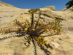
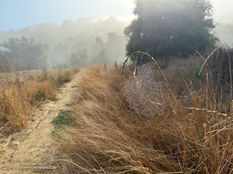
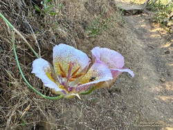
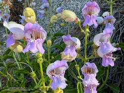
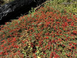
Even with the warm weather, it was beginning to feel a little like Fall in the San Gabriel Mountains. Yellow goldenrod and red California fuchsia bloomed along the trail,  and the canyon live oaks were covered in green acorns.

Mt. Pacifico (7124') from low on the Three Points - Mt. Waterman Trail.
Mt. Pacifico (7124′) from low on the Three Points – Mt. Waterman Trail.

I was back on the Three Points – Mt. Waterman Loop and having a better time of it than in June. The June run had been near the Summer Solstice, with in-the-sun temperatures reaching 100°F. Today’s run was a few days away from the Fall Equinox. Not only was the temperature about 10 degrees cooler, the sun was lower in the sky and less intense.

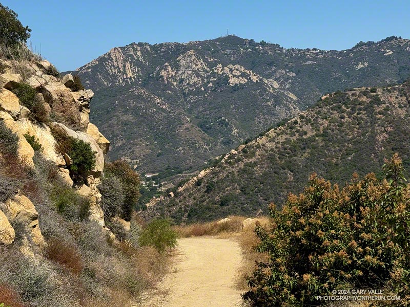
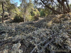
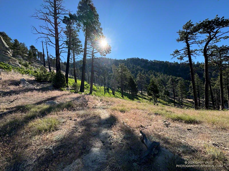
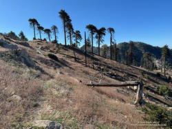
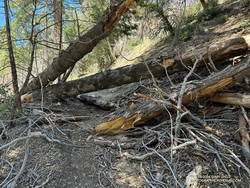
But much was the same as in June. There was still plenty of whitethorn on the first couple of miles of the Three Points – Mt. Waterman Trail — and a few prickly passages for anyone wearing shorts and short sleeves. Some trailwork had been done higher on the mountain, but a few fallen trees were still on the trail. Most of these were easy to step over, around, under, or through.

Late season Bigelow's sneezeweed at Waterman Meadow.
Late season Bigelow’s sneezeweed at Waterman Meadow.

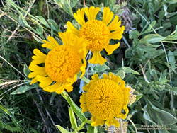
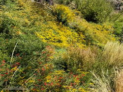
There was very little monsoon rainfall this Summer, but consecutive wet rainy season and a tropical storm had already recharged the seeps and small creeks. The creeks were only slightly lower than in June, and the places that had been wet and muddy in June were still wet and muddy. At Waterman Meadow, a few late-season blooms of sneezeweed beamed yellow in the midst of the greens of the grass and ferns.

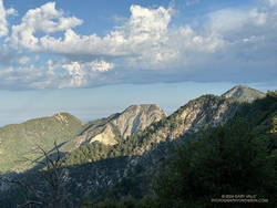
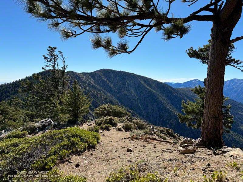
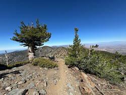
The high point of the Three Points – Mt. Waterman Trail is near the junction with the trail to the summit of Waterman and the trail that comes up from Highway 2. It’s at an elevation of about 7686′. Including detours to get around downed trees, the junction is a bit more  than 6 miles from Three Points. The junction marks the start of a nearly 2000′ descent over 4.7 miles to the PCT in Cooper Canyon.

A dazzling display of California fuchsia along the Burkhart Trail.
California fuchsia along the Burkhart Trail.

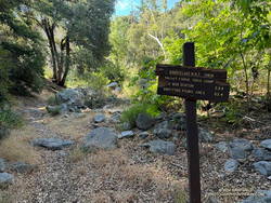
This morning, I encountered no one on the Three Points – Mt. Waterman Trail and only one pair of hikers on the normally busy Mt. Waterman Trail. Buckhorn Campground was nearly empty. I topped off my water at a convenient faucet at the campground and then started down the Burkhart Trail.

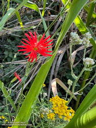
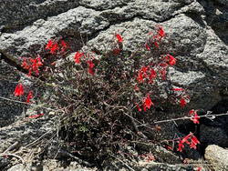
The creek in the canyon below the Burkhart Trail happily bubbled and gurgled, its water easily outpacing me as I descended to the PCT. Some work had been done on the trail to help those hiking to Cooper Canyon Falls cross the muddy seeps. Near one seep, a patch of dazzling red California fuchsia contrasted sharply with the coal black of a tree burned in the Bobcat Fire.

A black bear track on the Three Points - Mt. Waterman Trail.
Black bear track.

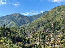
I wouldn’t say the trail has been abandoned, but it’s been quite a while since any trailwork has been done on the PCT between the Burkhart Trail and Cloudburst Summit. A mass of trees is still blocking the trail near the creek crossing at the bottom of Cooper Canyon. As expected following a fire, trees continue to fall on the trail. Parts of the trail along the creek or near seeps are overgrown with “Hey Bear!” willows.

The PCT in Cooper Canyon has been isolated by the 19-year closure to protect the critically endangered mountain yellow-legged frog. In December 2005, Angeles National Forest “temporarily” closed the Williamson Rock climbing area and the PCT between Eagle’s Roost and the Burkhart Trail. This Summer, the Forest Service extended the closure to at least December 31, 2026.

It’s difficult to accept that the Forest Service, conservation groups, and involved agencies have not agreed on a solution. Can’t the short stretch of the PCT that impacts frog habitat be rerouted? Only a few climbs at Williamson Rock directly impact the frog habitat. Does the entire climbing area need to be closed? Can’t bridges, walkways, and other structures be used to protect and even enhance frog habitat? There has to be solution. In 2005, I could not have imagined that 21 years later Williamson Rock would still be closed, and I might not have the opportunity to climb there again.

Goldenrod and California fuchsia cover a slope along the PCT in Cooper Canyon.
Goldenrod and California fuchsia along the PCT in Cooper Canyon.

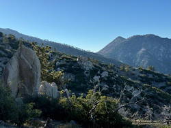
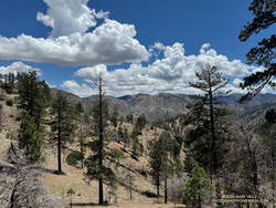
On this run, it wasn’t necessary to stop at Cooper Camp to cool off. Although the temperature was in the 90s on the south-facing slopes traversed by the PCT, there was a bit of a cooling breeze. This and the lower sun angle made it far more pleasant than earlier in the year.

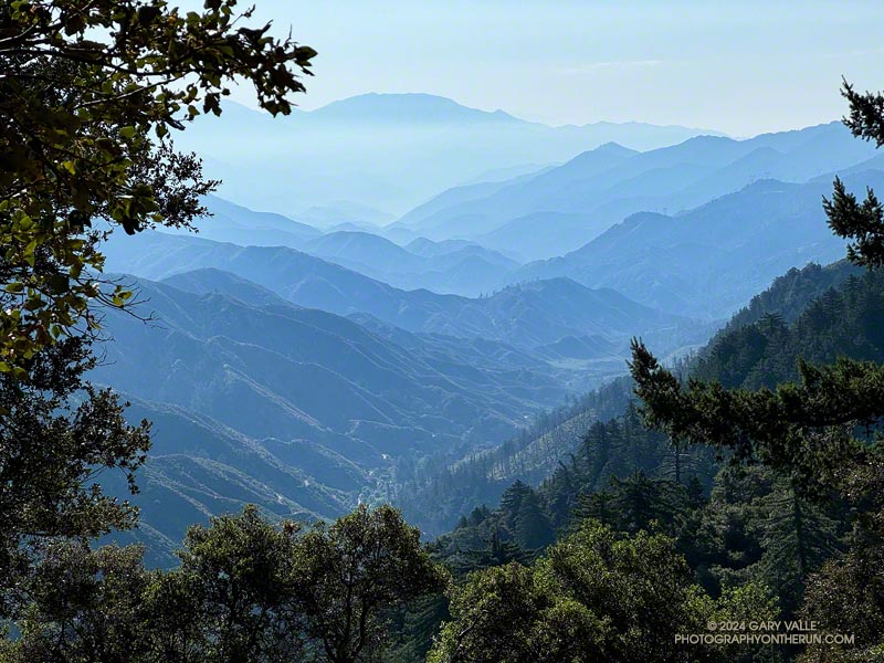
Continuing up the trail above Cooper Camp, I could see smoke from a flare-up on the north flank of the Bridge Fire. Closures related to the Bridge Fire will further isolate the Cooper Canyon segment of the PCT. Multi-year closures are common on the Angeles, and often the closures include popular trails that were not burned.

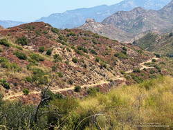
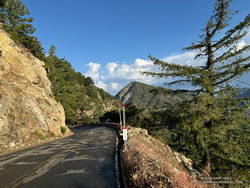
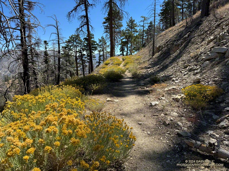
From Cloudburst Summit, it’s a little over five miles of (mostly) downhill to Three Points. Most of the running is on an old road bed. Although it can be tedious — especially when it’s hot — the segment is relatively fast-paced. Depending on the year, there are usually a couple of places to soak a hat and pour water over your head. But, as I learned one hot day, a rattlesnake may take exception to your intrusion!

Some related posts:
Bridge Fire Perimeter and Some Area Trails
Facing a Future of Runaway Wildfires in Southern California
Hot Weather on the Three Points Loop
Williamson Rock

Late Start on the Bulldog Loop

Saddle Peak from the Mesa Peak Mtwy on the Bulldog Loop.

It was near dawn, and I was driving west on the 101 Freeway, going to the Wendy Drive Trailhead to do a run in Pt. Mugu State Park.

I’d just passed Moorpark Road and changed lanes to exit at Lynn Road. Suddenly, the whole car started to shake. The vibration was so intense it took a moment to realize I had a flat tire. [Expletive deleted!] I pulled onto the shoulder of the freeway and cursed again.

After decades without a flat, I had managed to have two in just three weeks. Both were early on Sunday morning and on the way to do a run. The first happened on Angeles Forest Highway while driving to Islip Saddle. That time, I was able to pull into a large turnout and change the tire. Traffic wasn’t an issue. Not so on the Ventura Freeway. The flat was on the driver’s side, and the shoulder was narrow. I called for service.

Apparently, there aren’t many roadside service vehicles out and about before sunrise on a Sunday. An hour and a half later, I was finally headed back to the San Fernando Valley.

I was first in line when Tires Buy Mark opened at 10:00. While waiting for the tire to be patched, I debated a Plan B for a run. Eventually, I decided to do an extended version of the Bulldog Loop. The run would be in the middle of the day, which wasn’t ideal, but it was nearby.  It would be an excellent 16-mile run, even if a little on the toasty side.

At 11:30, I started up the short hill at the beginning of the Cistern Trail. Even though it wasn’t an unusually hot day, the temperature in the sun was already in the 90s, and there wasn’t a cloud in the sky.

It was slightly cooler on the trail along Malibu Creek. There was still water pooled in the creek, and I was glad the seasonal footbridge was in place. A pool near the M*A*S*H site was surprisingly large.

A section of Bulldog Mtwy low on the climb.

I expected it to be warm on the Bulldog climb, and it was. I just pretended I was on the second loop of the Bulldog 50K and continued chugging up the hill. Speaking of which… The Bulldog Ultra was the previous weekend, and a new course record was set in the 50K. Anthony Fagundes did the 29 mile course in the remarkable time of 3:30:03. This works out to an AVERAGE pace of 7:15 min/mile! His race analysis on Strava lists a split on the downhill on Mesa Peak Mtwy fire road at 5:25 min/mile. I don’t have the exact time, but on the first loop it looks like he did the Bulldog climb — from Crags Rd. to Castro Crest Mtwy — in about 30 minutes.

It took me a little longer than that to get up Bulldog. There was a noticeable drop in temperature as I worked up to the top of the long climb. On Castro Crest and Mesa Peak fire roads, the temperature was a relatively comfortable 80-something. The breeze from the ocean was intermittent, but when present, felt like air conditioning.

There weren’t many wildflowers. One interesting exception was Santa Susana tarweed (Deinandra minthornii). It was blooming on the sandstone rocks where the Backbone Trail goes through a prominent rock gateway, east of the Corral Canyon Trailhead.

Santa Susana tarweed along the Backbone Trail, east of the Corral Canyon Trailhead.

The plant has a California Rare Plant Rank of 1B.2, which means it is considered “rare, threatened, or endangered in California and elsewhere…” The plant normally blooms after Winter rains. In the ANF technical notes** accompanying its description on SMMflowers.org, B. A. Prigge & A. C. Gibson describe how the plant may produce out-of-season flowers in the Summer, following a wet rain season with late Spring precipitation.

Here is an interactive, high-resolution, 3D terrain view of a variation of the Bulldog Loop that starts at the Cistern Trail. The notations assume the route is being done counterclockwise. An optional out-and-back on the Forest Trail is shown as a red track. Two routes are shown for crossing Malibu Creek in Tapia Park. One route uses a trail that rock-hops across the creek, and the other the bridge on Malibu Canyon Road, near the Piuma Road junction.

The option on Malibu Canyon Road requires crossing the highway twice. There is a pedestrian walkway on the east side of the bridge and a traffic light and crosswalk at Piuma Road. The trail that crosses the creek directly can be a little tricky to find because of other use trails in the area. When there is heavy rain, the flow may be too high to cross the creek safely.

Today, I decided to use the highway. There was a never-ending line of cars headed to and from the beach. It probably would have been faster — and safer — to use the trail. After crossing the creek on the highway bridge, and before doing the climb on the Tapia Spur Trail, I topped off my water at a faucet in the Tapia Day Use Area. Later, I also grabbed a quick drink at the water faucet next to the restrooms at the main Malibu Creek State Park parking lot.

From the main parking lot, it’s about 1.4 miles along Crags Road to the bottom of the Lookout Trail, and from there another three-quarters of a mile back to the Cistern Trailhead on Mulholland Highway.

Some related posts:
A Displaced Bridge, Exceptional Backbone Trail Views, and a Card Table Along the Bulldog Loop
Forest Run
Best Trailhead to Start the Bulldog Loop?
Bulldog Loop Plus the Phantom Loop

**A Naturalist’s Flora of the Santa Monica Mountains and Simi Hills, California by Barry A. Prigge and Arthur C. Gibson

A Morning Thunderstorm, Debris-Covered Trail, Fast-Paced Fire Road, and Tough Climb on the ANFTR 25K Course!

The canyon of the West Fork San Gabriel RIver and Rincon-Red Box Road from the Mt. Disappointment/Bill Riley Trail.
The ANFTR courses follow Rincon-Red Box Road down this rugged canyon to West Fork.

Update October 2, 2024. I ran the ANFTR 25K Course on Sunday and the cuttings on the Mt. Disappointment/Bill Riley Trail had been removed. The trail was clear and back to normal!

As I drove east on the 210 Freeway, a long bolt of lightning erupted from high in the clouds and pierced the valley below. The thunderstorm near Mt. Lukens looked spectacular. It was backlit by the rising sun, and intermittent lightning flashed against its dark gray clouds.

Theoretically, I was headed to Mt. Wilson. It was July. It was hot. It was time to get on the ANFTR/Mt. Disappointment race course! But was that going to be a good idea? A slight chance of a thunderstorm was forecast for the afternoon and already there was an active storm right in front of me.

Clouds over Mt. Lowe (left), Mt. Markham, Occidental Peak, and San Gabriel Peak. (thumbnail)
Clouds over Mt. Lowe (left), Mt. Markham, Occidental Peak, and San Gabriel Peak.

The Angeles National Forest Trail Races (aka Mt. Disappointment) is a popular event usually run in the heat of Summer after the Fourth of July. Because of the pandemic, Bobcat Fire, and trail and road closures, the race has been on hiatus since 2020, but a new race date appears to be in the works!

Another ragged bolt flashed horizontally across the clouds. The cell looked isolated and appeared to be moving to the north. I decided to take a chance and bet that the morning storm was a quirk. Still, it suggested a real possibility of a thunderstorm later in the day.

About the time I passed Trail Canyon on Big Tujunga Canyon Road, it started to rain, and the rain continued much of the way to Red Box. The activity was actually more extensive than the cell near Mt. Lukens — a band of thunderstorms had swept through the San Gabriel Mountains between Mt. Lukens and Mt. Wilson.

Running down still wet Mt. Wilson Road following a morning thunderstorm. (thumbnail)
Running down still wet Mt. Wilson Road following a morning thunderstorm.

Mt. Wilson Road was still wet as I started down the first leg of the ANFTR/Mt. Disappointment 60K/50K/25K courses. If you have to run on pavement, running downhill on super-scenic Mt. Wilson Road after a thunderstorm is about as good as it gets! The cleansed atmosphere and vivid smells in the wake of the storm were remarkable — as were the views down into the canyon of the West Fork San Gabriel River.

This morning, I was doing the 25K course, but all the distances follow the same route to Red Box. They start by running down Mt. Wilson Road to Eaton Saddle and then following Mt. Lowe Fire Road through Mueller Tunnel to Markham Saddle and the San Gabriel Peak Trail. The San Gabriel Peak Trail leads up to the Mt. Disappointment service road and, surprisingly, the high point of the 60K/50K/25K courses. This stretch of service road is higher than the start/finish on Mt. Wilson!

Cuttings from a forest-thinning project blocking the Mt. Disappointment/Bill Riley Trail. (thumbnail)
Cuttings from a forest-thinning project blocking the Mt. Disappointment/Bill Riley Trail.

Even if you have run a trail many, many times — and think you’re familiar with it — sooner or later, you’re going to encounter something you didn’t expect. From the Mt. Disappointment service road, the ANFTR/Mt. Disappointment courses turn onto the Mt. Disappointment/Bill Riley Trail. After the first couple of switchbacks, there were an increasing number of cut limbs on the trail. Initially, the cuttings were not much of an issue, but became worse as I continued down the trail.

Partway down, I encountered two very upset hikers who had lost the trail. They had just decided to leave the trail and hike on the service road. They cautioned me that the section where they had problems was just below. They weren’t kidding. I’ve done this trail innumerable times and at one point also had difficulty locating it. I had to wade through an expanse of cuttings to stay on the trail.

I’ve been on trails impacted by forest thinning projects before. The crews that worked on those projects at least made an effort to keep the trails clear. No such attempt was made here — the cuttings were left where they fell, and if that was on the trail, too bad!

It was a relief to get off the Mt. Disappointment/Bill Riley Trail and down to Mt. Wilson Road and Red Box.

Update October 2, 2024. I ran the ANFTR 25K Course on Sunday and the cuttings on the Mt. Disappointment/Bill Riley Trail had been removed. The trail was clear and back to normal!

The towers on Mt. Wilson -- where the car is parked -- from Rincon-Redbox Road. (thumbnail)
The towers on Mt. Wilson – where the car is parked – from Rincon-Redbox Road.

Unlike last year, Rincon-Red Box Road was in great shape. It was so well-graded that a Prius might have been able to drive down to West Fork. Much of the 5.5 miles down to West Fork are in full sun, so the temperature has a substantial impact. In the 2019 ANFTR/Mt. Disappointment 50K, the thermometer on my pack read about 80 degrees. In the 2017 50K, the temp on the same stretch was about 100 degrees. Today, it was around 90.

Whatever the temperature, there are excellent views down the West Fork and of the Mt. Wilson area. The towers on Mt. Wilson always look tantalizingly close, and the climb up Strayns Canyon doesn’t look that bad. (Ha!) Like last year, there were four or five creek-like crossings of the West Fork San Gabriel River.

The area around the spring at West Fork was a bit overgrown, but a trampled path through the grass below the cistern led to the outflow pipe. I refilled my hydration pack and drank my fill before setting off on the Gabrielino Trail. With the temperature in the sun at West Fork around 95, I should have spent more time at the spring cooling down.

Gabrielino Trail sign at West Fork. (thumbnail)
Gabrielino Trail sign at West Fork.

It’s only about 1.6 miles from the spring to where the Kenyon Devore Trail forks left off the Gabrielino Trail, but it often seems longer. Probably because I’m anticipating the turnoff and don’t want to miss it. This morning, it was also the hottest stretch on the course, with the temperature in the sun topping out at around 100 degrees.

Based on some recent runs, I expected the Poodle-dog bush on this stretch to be a problem, but most of the Poodle-dog bush had been trimmed or was wilting. It wasn’t the only thing that was wilting. Shortly after turning off the Gabrielino Trail and onto the Kenyon Devore Trail, the combination of heat and humidity hit me like the proverbial brick. I had to back off the pace.

Not long after that, I was startled by a runner coming up behind me. It turned out to be another runner from the West San Fernando Valley! Charlie was training for UTMB and putting in a tough 27-mile, 8700′ gain day. We had a great conversation about races, running, and adventures in the mountains. Despite the heat, he was moving well and soon disappeared up the trail.

Dome of the Hooker 100 inch Telescope on Mt. Wilson. (thumbnail)
It’s about a half-mile to the top of the Kenyon Devore Trail!

I continued chugging up the trail, noting familiar features as I climbed higher and higher. Eventually, the white dome of the Hooker 100 inch Telescope came into view, and I knew I just about done!

As I worked up the final half-mile of trail, I could see only a couple of  isolated build-ups of cumulus clouds. One was over the desert  and the other was to the east near San Gorgonio.  The sky over Mt. Wilson was mostly clear.

Here’s a high-resolution, interactive, 3D-terrain view of the Mt. Wilson – Red Box – West Fork – Kenyon Devore Loop. The loop is a slightly shorter version of the ANFTR/Mt. Disappointment 25K.

Some related posts:
After the Bobcat Fire: Running the ANFTR 25K Course
An ANFTR/Mt. Disappointment 2020 Adventure

Fog, Flowers and an Ingenious Spider on the Trippet Ranch Loop

Ingenuity meets Opportunity. Photography by Gary Valle.
Ingenuity meets Opportunity

In their forecast discussion for today, the NWS Los Angeles Oxnard commented, “A long-lasting and extreme heatwave will continue across the region, and especially the interior…” The high temperature was expected to range from 105 to 115 across the interior valleys, mountains and deserts.

Indian pink, golden yarrow, and California everlasting along the Garapito Trail.
Indian pink, golden yarrow, and California everlasting.

I was doing the Trippet Ranch Loop from the Top of Reseda. The highs on the San Fernando Valley side of the Santa Monica Mountains were expected to be in the 90s. But keep in mind that’s essentially the temperature in the shade. In full sun, the temperature could be 10 to 15 degrees higher. When I reached the Hub, at 7:00 in the morning the in-the-sun temperature was already around 90 degrees.

Nearer the coast, temps were expected to be a little cooler. From the Hub, I could see why. A shallow marine layer had developed along the coast. A couple of miles later, as I neared Trippet Ranch, I descended into a bank of wonderfully cool fog. It wouldn’t last, but I enjoyed the coolness as I continued down to Trippet Ranch and around to the Musch Trail.

I hadn’t run very far on the Musch Trail when I came across a remarkable spider web. The spider had ingeniously bowed a flexible stalk of tall grass to build its web. This solution avoided having to span the web between two stalks. I also wondered if the added tension would make the web more efficient.

At Musch Camp, I topped off my water bottle and then continued working up the trail. Near a still-seeping vernal creek, a speckled-orange Humboldt lily bloomed brightly in a patch of poison oak.

Plummer's mariposa lily along the Garapito Trail. (thumbnail)
Plummer’s mariposa lily along the Garapito Trail

From the camp, the Musch Trail climbs about 400′, in a bit over a mile, to the junction of Eagle Rock and Eagle Springs Fire Roads. A left turn here leads past Eagle Rock to the top of the Garapito Trail.

Other than the Bent Arrow Trail—which remains closed—the Garapito Trail is the “End of Reseda” trail most impacted by our back-to-back wet rain seasons. At times, washouts, debris flows, slides, fallen trees, and vigorously growing chaparral plants have made the trail nearly impassable. The Santa Monica Mountains Task Force worked tirelessly over the Winter to restore the trail.

Of course, the rain that caused all the problems on the Garapito Trail has also resulted in numerous wildflowers along that trail. Today, some of the most prominent were scarlet larkspur, scarlet monkeyflower, Indian pink, and Plummer’s mariposa lily. And, Garapito Creek was still trickling in July!

This high-resolution, interactive, 3-D terrain view shows the Trippet Ranch Loop (yellow). The track of the closed Bent Arrow Trail is shown in red.

Some related posts:
Trippet Ranch Loop, Musch and Garapito Trails – February 2024
Trippet Ranch Loop Plus Temescal Peak and Temescal Lookout
Fogbow Near the Top of Hell Hill in Pt. Mugu State Park

Out and Back Trail Run from Islip Saddle to Mt. Baden-Powell – July 2024 Update

Mt. Baden-Powell from the PCT near Throop Peak.

Update July 22, 2024. The Poodle-dog bush along the PCT near Islip Saddle has been cleared by Gary Hilliard and the AC 100 Trail Team!

When I reached the summit of Mt. Baden-Powell (9,399′), it was empty, save an opportunistic raven who was evaluating the chances that the Larabar I was eating might fall to the ground.

On top, the heat of the strong Summer sun was offset by a cooling breeze. There was still a few thin ribbons of snow in the chutes on Mt. Baldy. With the excellent visibility, San Jacinto Peak could be seen in the notch between Mt. Baldy and Dawson Peak, and San Gorgonio Mountain was sharply visible to the left of Pine Mountain.

Poodle-dog bush (Eriodictyon parryi) along the PCT just east of Islip Saddle. (thumbnail)
Poodle-dog bush along the PCT just east of Islip Saddle.

Other than a few people at Little Jimmy hike-in camp, I saw no one on the way up from Islip Saddle. A quarter-mile from the trailhead, there was an astonishing display of Poodle-dog bush along the PCT. In 2011, when a large part of Angeles National Forest reopened following the Station Fire, I developed an extensive rash after bushwhacking through Poodle-dog on overgrown trails. After that experience I’ve been more careful around the plant, and haven’t had a bad case since.

Trees were across the trail in a few places. Most were fairly easy to bypass, but a couple were “inconvenient,” such as this big log, about 0.75 mile east of Windy Gap.

Bright red beaked penstemon (Penstemon rostriflorus) along the PCT above Windy Gap. (thumbnail)
Bright red beaked penstemon along the PCT above Windy Gap

As I worked up the switchbacks above the log, to the southwest I could see the observatory and towers on Mt. Wilson. As a result of the damage to Chantry Flat in the Bobcat Fire, Mt. Wilson was on the Angeles Crest 100 Mile course last year, and will be again this year. As the raven flies, Mt. Wilson was only about 16 miles away, but for someone running the AC100, the miles along its challenging course would total well over 50!

For several years I’ve been following the regrowth of conifers in four places along the PCT that were burned in the 2002 Curve Fire. What has been underscored in my informal study is a) trees take a long time to regrow, and b) frequent fires in an area are particularly devastating. Stand #1 (1.5 miles east of Islip Saddle on the PCT) was recovering nicely from the 2002 Curve Fire when it was burned in the 2020 Bobcat Fire. This comparison shows the result. The other three stands continue to recover well, with south-facing Stand #4, west of Throop Peak, growing particularly vigorously.

View WNW along Mt. Baden-Powell's west ridge. (thumbnail)
Limber pine (left) along Mt. Baden-Powell’s west ridge.

Ascending the final 400′ of gain on Baden-Powell’s west ridge, I was surprised to see a couple of small patches of snow remained on the north side of the ridge. The snowpack here was nowhere near as big as in 2023, but it was still pleasing to see that a little of the white stuff survived until July.

No out and back to Baden-Powell is complete without a quick stop at Little Jimmy Spring. Today, the water from spring was so cold it was painful to hold my hand in the water flowing from the pipe!

Some related posts:
It’s Mid-July And There Is Still Snow in Los Angeles County!
A Cool and Breezy Out and Back Trail Run from Islip Saddle to Mt. Baden-Powell
Contact Dermatitis from Eriodictyon parryi – Poodle-dog Bush
Regrowth of Trees Along the PCT Following the 2002 Curve Fire

Hot Weather on the Three Points Loop

Approaching Waterman Meadow on the Three Points - Mt. Waterman Trail.
Approaching Waterman Meadow on the Three Points Loop around Mt. Waterman.

When Angeles Crest Highway opened between Upper Big Tujunga Road and Islip Saddle last Fall, I jumped on the chance to do the Three Points loop around Mt. Waterman. When in good condition and with good weather, the 20+ mile loop is one of my favorites. That day, the trail conditions could have been better.

Twin Peaks from the Three Points - Mt. Waterman Trail, about 1.5 miles from Three Points. (thumbnail)
Twin Peaks from the Three Points – Mt. Waterman Trail, about 1.5 miles from Three Points.

Turn the clock forward to this Spring, and once again, road closures were limiting access to Three Points. Angeles Crest Highway was still closed between Red Box and Upper Big Tujunga Canyon Road, and the alternate route — Upper Big Tujunga Canyon Road — was “Only Open To Contractors, Residents, & Emergency Vehicles.” Recently, the Los Angeles County Road Closures website updated the status of Upper Big Tujunga Canyon Road to “Access Limited, Expect Delays.”

An easy-to-follow stretch of the Three Points - Mt. Waterman Trail. (thumbnail)
An easy-to-follow stretch of the Three Points – Mt. Waterman Trail.

Excited to get back on the Three Points Loop, on Sunday I found myself motoring up Upper Big Tujunga Canyon Road, headed for the Three Points Trailhead. There were no problems or delays getting to Angeles Crest Highway, and I pulled into the Three Points parking lot at about 6:30 a.m.

Beardtongue penstemon accommodates the bulbous shape of its pollinator -- bumblebees. (thumbnail)
Beardtongue penstemon accommodates the bulbous shape of its pollinator — bumblebees.

Having done the Three Points Loop many times and in a variety of conditions, I didn’t think much about the difficulties on the loop in November. Like others that relish the outdoors, my brain is very good at shaping memories so as to emphasize the positive and downplay — or outright ignore — the negative.

I’d checked the weather — a Heat Advisory had been issued for the San Gabriel Mountains, and there was a chance of thunderstorms from a dissipating tropical storm. A key part of the loop, Cooper Canyon, has a rep for being hot. Much of the PCT on that stretch is on sparsely-forested, south-facing slopes. My thought was that maybe there would be enough clouds to take the edge off the heat.

Downed trees across the PCT in Cooper Canyon. (thumbnail)
Downed trees across the PCT in Cooper Canyon.

Nope! The in the sun temperature in Cooper Canyon was around 100 degrees. The good news was Buckhorn Campground was open and my favorite water faucet had plenty of water. Plus, the creek in Cooper Canyon was running, so I could cool off and supplement my water.

The trail conditions were virtually identical to those last November, but with heat added. The Three Points — Mt. Waterman Trail was a bit overgrown, and there were many downed trees across the trail. In November there was a particularly inconvenient tree blocking the PCT on the north side of the creek, just west of the Burkhart Trail junction, and it was still there today.

Postcard clouds belie the hot weather on the PCT in Cooper Canyon. (thumbnail)
Postcard clouds belie the hot weather on the PCT in Cooper Canyon.

There seemed to be more Poodle-dog bush than back in November, or maybe it was easier to spot because it was blooming. The big winner among the multitude of wildflowers was beardtongue penstemon, which was blooming profusely on some of the slopes burned in the Bobcat Fire. Other wildflowers I saw along the trail included bigleaf lupine, little paintbrush, scarlet monkeyflower, narrow-leaved lotus, golden yarrow, gilia, wallflower, and red columbine.

Because of the trail conditions, heat, and altitude, the Three Points Loop today was more difficult than the 50K I ran two weeks ago!

This high resolution, interactive, 3-D terrain view shows the Three Points Loop (yellow) along with a couple of options (red). The side trip to the summit of Mt. Waterman adds about 1.75 miles to the run.

Some related posts:
Three Points Loop Following the Reopening of Angeles Crest Highway
Cool Weather, Old Trees, Grape Soda Lupine and a Restored Trail
Three Points Loop Adventure – July 2020