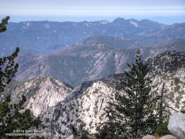
Mt. Wilson, Occidental Peak, Mt. Markham, San Gabriel Peak, Mt. Disappointment, and Mt. Deception from the summit of Twin Peaks, in the San Gabriel Mountains.
Mt. Markham (5742′) is the craggy peak along the skyline, just right of the centerline of the photograph. The bump to the left of Mt. Markham is Occidental Peak (5732′). To the right of Mt. Markham is the highest peak in the group, San Gabriel Peak (6161′). To the right of San Gabriel Peak are Mt. Disappointment (5960′), and Mt. Deception (5796′). The indistinct summit of Mt. Wilson (5710′), and the observatory, are on the left.
Guardian of the rugged San Gabriel Wilderness, Twin Peaks (7761′) has an isolated, high mountain feel. Its flanks drop more than 5000 feet to Devils Canyon on the southwest, and Bear Canyon on the southeast.
We climbed Twin Peaks while doing a point to point run from Buckhorn to Three Points. Including the peak, the run/hike was about 13 miles, with an elevation gain of about 3200′. Here’s a Google Earth image and Google Earth KMZ file of a GPS trace of the route.
Related posts: Manzanita Morning, Three Points – Mt. Waterman Loop
