Thunderstorm

Developing cumulonimbus near Mt. Abel

Developing Cumulonimbus Near Mt. Abel

Saturday, Pierce College in Woodland Hills set an all-time record high temperature of 119°F. Following a preliminary review, a NWS forecaster said this was probably the highest temperature ever recorded at an official weather station in Los Angeles County.

To escape this oppressive heat, and avoid the scorching temperatures of last week’s long run, my intent was to get to the highest elevation possible, as early as possible, and stay as cool as possible. At an elevation of about 8400′, the Mt. Pinos Chula Vista trailhead is nearly 2000′ higher than Islip Saddle in the San Gabriel Mountains, and is usually a good choice for a run on a warm day.


San Gabriel beardtongue (Penstemon labrosus) near Sheep Camp.
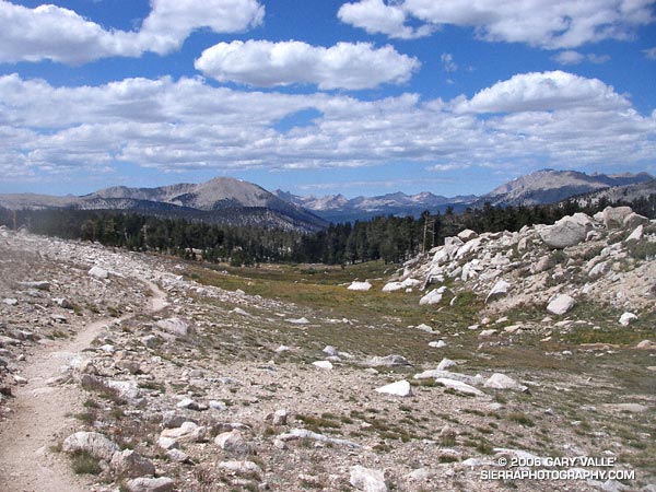
A little after 7:30 a.m., under nearly cloudless skies, I jogged out of the Mt. Pinos parking lot reveling in the cool mountain air. I didn’t have a specific route in mind, but thought I would probably do a longer variation of the Mt. Pinos to Mt. Abel run described in my Vincent Tumamait Trail post. Energized by the cool temperature, it didn’t take long to work up and over the summits of Mt. Pinos (8831′) and Sawmill Mountain (8816′), and then down the North Fork Trail to the spring at Sheep Camp (8200′).

Surrounded by the greens of the spring, and the yellows and reds of wildflowers, I gulped cold water, and thought about where to run. A sign at the “T” with the Tumamait Trail listed the distance to “Lily Meadows Camp” as 3 miles. I hadn’t been on that section of North Fork trail since preparing to run the Inca Trail in 2003.

Deciding to continue down to Lily Meadows Camp, I crossed over the spring and followed the little used, pine needle covered trail southeast along the hillside. The trail dropped steeply along a rounded ridge, where mountain quail fretted among the manzanita and fallen trees, and the minty fragrance of Pennyroyal drifted up from the margins of the trail. Quicly losing elevation, I reminded myself that whatever I ran down, I would have to go back up.

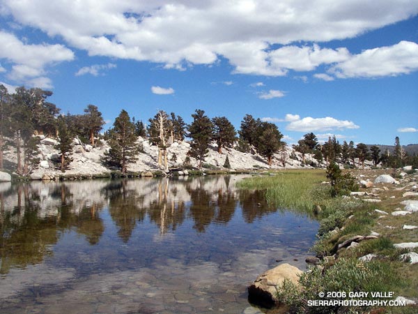
After about a mile and a half, the path switchbacked down to the North Fork of Lockwood Creek. Here, the grade lessened and long stretches of nearly perfect trail running led to Lily Meadows Camp (6250′). Old growth Jeffry pines towered above the camp, and a Monarch butterfly flittered about on a current of air. The pleasant, Sierra-like environment was a welcome change from the 100 degree heat of the previous week!


The first cloud!
An 1800′ climb and an hour later, I’m back at Sheep Camp, refilling my Camelbak®. Suddenly a shadow sweeps over the forest, and a small cloud – the first cloud – looms overhead. It’s just after 11:00 a.m., and the heat of the day has triggered some cloud development. After taking a few photos and eating a Clif® Bar, I decide I better get going, and jog up to the junction with the Tumamait Trail.

Reaching the trail junction at about 11:30 a.m., what had been a single tattered cloud in the sky is now several, and my “inner voice” of experience says, “Turn right, you can be back to the car in under an hour!” But it has been such an enjoyable day, and there aren’t that many clouds… I turn left towards Mt. Abel.

At first, shadow and sun play tag among the trees and I join in, chasing the clouds down the twisting and turning trail. The partly cloudy skies are postcard perfect, and I wonder if my concerns are ill-founded. But as the superb downhill segment transitions to up, a gray gloom invades the forest. At Mt. Abel Road, it’s noon. Rationalizing that the extra minutes required to scramble up to Mt. Abel’s summit won’t hurt, I cross the road and head up the steep slope.


The sun breaks through the darkening sky, illuminating the face of Grouse Mountain.
Seven minutes later, I’m back at Mt. Abel road. For a brief moment, a narrow shaft of sun breaks through the darkening sky, illuminating the face of Grouse Mountain. It washes across the slopes of the mountain, and then suddenly all is in shadow. At that instant, I know I’m in a race that I cannot win.

A quarter mile down the trail, the first cold drops of rain dampen my bare legs, and in another quarter mile, there is a rumble of thunder to the north, and then another rumble behind me. Part way up Grouse Mountain, there is a flash, and then directly above me an immediate ear-splitting, crackling clap of thunder. From the first few clouds to the first lightning has taken little more than an hour!

In an astonishingly short period of time, the rain, lightning and thunder grow in magnitude. Flash – boom! Flash – boom! The storm engulfs me as it grows in intensity. In the expanded microseconds that follow each lightning flash, I  breathe a sigh of relief that I’m not struck, and then bodily recoil from the immediate and overwhelming power of the crashing thunder.

Cresting the shoulder of Grouse Mountain, I think back to a storm in the San Gabriels, where instead of striking an obvious ridge, a bolt of lightning struck a nondescript tree on the slopes below. There is no place to hide from this monster. I adopt a tactic of almost sprinting through open areas, past tall trees, and when the electric motor smell of ozone fills the air. In areas that seem a little safer, I slow my pace.

At the top of another long climb, near the North Fork trail junction, I’m surprised to see a group of 8 or 9 hikers huddled under a pine tree. They are probably surprised to see someone running along the hilltops. From the first rumble of thunder, I’ve been considering whether hunkering down in the forest off the ridge might be a better strategy. If I had my shell pants, or my runner’s emergency bivi sack (a plastic trash bag), it might be. But wearing just my rain shell, a short-sleeve synthetic top and running shorts, I’m under-dressed for this get together.

Off to the east, in the direction of Mt. Pinos, the sky seems lighter. Maybe the wind is shifting the cells to the west and north. I have no idea how long this thing is going to last, and the pounding rain and gusty winds are sleety cold. I don’t want to stop. Not at all sure it is the better choice, I wish the hikers the best, and continue up the trail toward Sawmill Mountain.

The storm, and my emotions, wax and wane in a recognizable, but hard to define pattern. Periods of awe, elation and fear cycle with the storm. It has only been 30 minutes since the rain and thunder began, but in my distorted world, it might have been 30 hours. The steady rain has flooded the trail, and I feel like I am crossing a never ending creek.


Hurried photo near the top of Sawmill Mountain, when the storm was nearing peak intensity.
As I near the summit plateau of Sawmill Mountain, erratic gusts of wind tear at the trees. Then suddenly, as if a dam has broken, a deluge of lightning, thunder, rain and hail spills from the sky. It is the most intense rain I have ever experienced. A pounding rain, thick with hail, driven by a downburst of wind and gravity. Torrents of water cascade down the trail. It is ferocious.

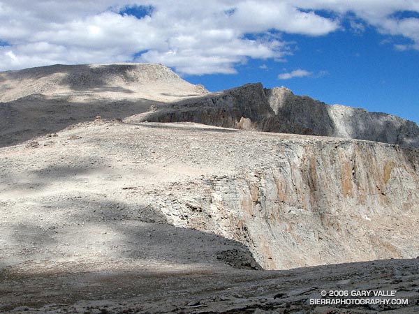
Running through the maelstrom across the plateau, ahead I can see the point where the trail drops off the summit, and descends to a saddle. I just have to get there. Lightning flashes, and thunder booms behind me. My feet are numbed and cold, and I wonder how water on the trail can be calf deep.  Reaching the shoulder of the mountain, I start to descend. From time to time I get a glimpse of Mt. Pinos, and I can see a little smudge of blue under the dark clouds over the summit. As I descend toward the saddle, the intensity of the storm seems to be diminishing. There is still lightning, thunder and rain, but for a moment the focus of the storm seems to be shifting elsewhere. I take a deep breath, and debate what I’m going to do about getting over the exposed summit of Mt. Pinos.


Looking back at ridge on Sawmill Mountain from shoulder of Mt. Pinos.
There are still two groups of active cells. The main thunderstorm complex seems to be behind me, toward Mt. Abel; but there is also an active group of cells just north of Mt. Pinos. While I’ve seen no lightning strike the summit of Mt. Pinos, it is almost a certainty. I decide to work up the switchbacks toward the summit, continuing my tactic of minimizing my time in areas that are exposed. The rain has nearly stopped, and I haven’t smelled ozone since on Sawmill Mountain, but some sections of the trail are frighteningly exposed. Working up to the highest point that appears to offer some protection, I pause and listen. The timing may be right. The thunderstorm activity seems to be in a down cycle.

I leave my alcove. In seconds I’ve rounded a rocky rib of the peak, and am suddenly the tallest and most linear object on its bare shoulder. Thunder rumbles off to the north, a reminder I don’t need. Heart pounding, I’ve already pushed the pace as much as the grade, elevation, and my body will allow, and now there is nothing for me to do but run.

It is not a relief to reach the summit. I see a bolt of lightning strike to the northeast, near a radio tower less than a quarter mile away. Partially hidden from view, I can’t tell if the lightning struck the tower, or a ridge beyond. It doesn’t matter. I have to get off the summit.


Mariposa lily (Calochortus invenustus) west of Mt. Pinos.
Running along the road from the observation point, I’m nervous about going in the direction of the relay tower, and the last lightning strike. I know the road will soon turn downhill, but as hard as I am running, I don’t seem to be getting anywhere. Finally, I see, and then round the turn. Another 50 yards, and for the moment I’m safe. A dash across one meadow, and then another, and the main danger is past.

To the east, I see more blue sky, and broken clouds. Continuing to descend, I hear a group of Chickadees chattering in a nearby tree. They sound happy. So am I.

Here’s a Google Earth image and Google Earth KMZ file of a GPS trace of my route.

Epilogue: According to the American Meteorological Society, lightning kills more people per year on average than hurricanes and tornadoes combined. For more information regarding lightning safety, please see the National Weather Service Lightning Safety page. Here’s what the thunderstorm looked like on radar.

(The title photograph is of a developing cumulonimbus near Mt. Abel. It was taken on a run at Sage Ranch on July, 19, 2006.)

Heat Wave

As I turned into the Vincent Gap parking lot and pulled to a stop, a few sprinkles of rain dotted my windshield. Opening the car door, I wanted to close it again. It was 7:30 in the morning and the temperature was already nearing 70 degrees. It shouldn’t have been a surprise. The previous two days the National Weather Service office had issued an “excessive heat warning” for much of the Los Angeles area, including the lower elevations of the mountains.

Angeles Crest Highway was closed 2.6 miles west of Islip Saddle, so my plan was to do the Islip Saddle – South Fork – Mt. Baden-Powell loop from the Vincent Gap side. (Update May 21, 2009. Angeles Crest Highway has since been re-opened to Islip Saddle, and through to Wrightwood.) This difficult 23 mile loop, and some of its logistical issues, were described in the posting Complications.  The day was really too warm to be doing this route, but with a chance of thunderstorms in the forecast maybe some clouds would help keep temps in check. I’d run at least to Little Jimmy Spring. If it was too hot, I could always head back.

It didn’t take long for the clouds that had spritzed my windshield to move off to the west. Except for a smoky haze from the Sawtooth Fire, mostly clear skies prevailed as I worked up the numerous switchbacks of Mt. Baden-Powell.  Near the summit of of the peak, I paused for a moment to admire the Wally Waldron Tree. At an elevation and in an environment similar to the 4000+ yr. old White Mountain Bristlecone Pines, this gnarled and weather-beaten Limber Pine is estimated to be 1500 years old. Clearly ancient, it has survived wind and weather too extreme to imagine. According to the Forest Service, some Limber Pines in this area may be as much as 2000 years old. Extended longevity doesn’t appear to be limited to Limber and Lodgepole pines; a stunted White Fir near the summit also looks unusually old.

Down from the summit, and back on the Pacific Crest Trail, the running along the ridge was outstanding. Near Mt. Burnham, I stopped to take a few photographs, and watch a bumblebee working through a batch of Grinnell’s Penstemon (Penstemon grinnellii). The throat of this particularly bulbous penstemon perfectly accommodates the bumblebee, and perhaps is an example of a flower adapting to a preferred pollinator. Continuing along the crest, between Throop Peak and Mt. Hawkins, red accents among the rocks marked patches of Bridge’s Penstemon (Penstemon rostriflorus). From time to time, sparse clouds masked the sun, but as I descended toward Windy Gap, the temperature climbed inevitably higher.

One of the pros of doing the loop from Vincent Gap is that it is great to have fresh legs for the exceptional trail running down to Islip Saddle. Except for a short climb over the shoulder of Throop Peak, the running is generally downhill from the summit of Baden-Powell  (9399′), all the way to South Fork Campground (4560′). This is a distance of over 13 miles, with an elevation loss of nearly 5000′. The major con is having to do the lowest elevation segment of the loop, and the climb back to Vincent Gap (6565′), during a warmer time of the day.

Aside from the heat, another concern had been nagging at me. What if the trail was impassable? This wasn’t heat induced paranoia. Last year, several sections of the South Fork trail were buried in small rock slides, and a couple of places where the Manzanita Trail crossed steep erosion gullies were in very bad shape. A Winter had passed, and who knew what recent thunderstorms had done to the trails?

Switchbacking down to Little Jimmy Spring, I had already decided to continue to Islip Saddle. In the battle of “do, or do not” I knew that once at Islip Saddle, “do” would win again. Maybe some clouds would help me on my way…

Epilogue: In sun-baked South Fork canyon, even the downhill was difficult, but the rock slide plagued trail was still passable. Some clouds provided temporary relief at South Fork Campground, but didn’t last. The damage to the Manzanita Trail was worse than last year, but with care I was able to get through. In nearby Valyermo, midday temps reached over 100°F. Here’s a Google Earth image and Google Earth KMZ file of a GPS trace of the route, and a Forest Service diagram of area trails that’s at Vincent Gap.

Laskey Mesa Oak

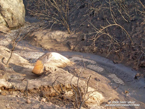
Nine months after the 2005 Topanga Fire, this Valley Oak continues the slow process of recovery.

Nine months after the 2005 Topanga Fire, this Valley Oak* in the Upper Las Virgenes Canyon Open Space Preserve continues the slow process of recovery. The clumps of leaves are the result of epicormic sprouting, where new sprouts grow from dormant buds along the branches, or the trunk, of a tree.

The dense semi-spherical clusters are probably an adaptation that helps to create a more normal leaf environment during foliage replacement. In effect, the assemblage appears to create a scaled down crown.

The Live Oak, which generally resides in a drier, more hostile environment than the Valley Oak, produces (at least in some cases) epicormic sprouts with dense pendant masses of light-colored foliage with much-reduced leaves. These parasitic looking appendages gradually transform into normal branches and foliage.

The Eucalyptus sprouts from cracks in the trunk, and in just a few months can produce a substantial amount of replacement foliage.

*Some oaks in the Laskey Mesa area may be hybrids of Blue and Valley Oaks.

Lemon Lily

Lemon Lily (Lilium parryi)

If somehow you were to miss the bright yellow of this lily amid the greens of a mountain meadow, its arresting fragrance would certainly draw your attention.

In terms of its habitat niche, the Lemon Lily (Lilium parryi) is a higher elevation analogue to the Humboldt Lily, occurring in meadows and near seeps and springs in pine and fir forests up to an elevation of about 9000 feet.

The Lemon Lily is listed by the California Native Plant Society as being rare, threatened, or endangered.

The photograph was taken on the Three Points – Cooper Canyon – Mt. Waterman loop described in Manzanita Morning.

Manzanita Morning

Manzanita

A day that begins on a trail winding its way through manzanita and Jeffery pine is probably going to be a good one. You’re in the mountains, and most likely starting a hike, run, climb, or some other adventure. In this case, it was the San Gabriel Mountains, and I was on the Pacific Crest Trail, near the start of a 20 mile run that began at Three Points and would circuit Mt. Waterman.

From Three Points (5,920′), I followed the PCT up to Cloudburst Summit (7018′), and then down into Cooper Canyon (~5735′). Reminiscient of a Rousseau painting, Cooper Canyon is one of the most idyllic spots in the San Gabriels. The old roadbed the trail follows into the canyon is a telltale sign of its lasting popularity. One of its attractions is Cooper Canyon Falls, which is on the PCT a short distance beyond where the Burkhart Trail, and my run, branched off and climbed to Buckhorn Campground (6300′).

The last time I had done this run, the linkup from Buckhorn Campground to the Mt. Waterman trail had been a little unclear. This time I knew I had to follow the camp roads to the entrance of the campground, rather than the exit. From the entrance of the campground, if I turned right onto Hwy 2, the Mt. Waterman trail could be picked up a few hundred feet north along the highway.

The Mt. Waterman trail winds a couple of miles through open yellow pine forest to within about 0.7 mile of the Mt. Waterman summit. At this point, a spur trail leads to the peak, and the main trail continues to the junction with the Twin Peaks trail. This spur trail leads to Twin Peaks Saddle, and from there to Twin Peaks.

The rocky, isolated summit of Twin Peaks is a worthwhile ascent, adding about 4 miles and 1700′ of elevation gain to the loop. It has a unique character, and is one of my favorite summits in the San Gabriels. On one ascent, as I reached the summit, the music of Bach wafted in on the wind from a subsidiary peak. Played with skill and feeling on a concert flute, the notes seemed to dance among the trees and rocks, and fill the expanse that lay beyond the peak.

There would be no Bach on the summit of Twin Peaks on this run. At the junction with the Twin Peaks trail I briefly debated the ascent, but continued on my way to Three Points.

Here’s a Google Earth image and Google Earth KMZ file of a GPS trace of the loop.

Photography and inspiration from running and other adventures in the Open Space and Wilderness areas of California, and beyond. No ads. All content, including photography, is Copyright © 2006-2024 Gary Valle. All Rights Reserved.