
Due in part to El Nino and the Madden-Julian Oscillation (MJO) Southern California jump-started the 2015-16 rain season with above average rainfall in July and September.
Last year the NWS changed the WATER Year to October 1 – September 30, but the RAINFALL Year remains July 1 – June 30, as it’s been for decades.
Below is the monthly tabulation of rainfall for Downtown Los Angeles (USC) for the 2015-16 Rainfall Year, along with what is considered normal for the month.
| Month | Rainfall | Normal |
|---|---|---|
| July | 0.38 | 0.01 |
| August | T | 0.04 |
| September | 2.39 | 0.24 |
| October | 0.45 | 0.66 |
| November | 0.01 | 1.04 |
So far this rainfall year Downtown Los Angeles (USC) has recorded 3.23 inches. Even with November as dry as it’s been we’re still more than an inch above normal for the rainfall year — about 1.46 inches above normal as of November 25.
Over the next couple of weeks the medium range models and other tools aren’t especially bullish on our chances for a good, soaking rainstorm in Southern California. Longer term guidance suggests an improving chance of precipitation as December progresses, and above average precipitation in January and February. We’ll see!
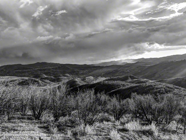
The title photo is from November 3. It shows a band of thunderstorms that moved southward across the San Fernando Valley and into the Santa Monica Mountains. The band produced cloud to ground lightning strikes and some heavy showers. Saddle Peak is in the distance on the left. The shower activity in the distance on the right is in the area of Kanan Rd. and the 101 Frwy.