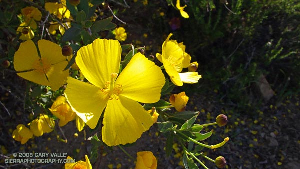
Tree poppy (Dendromecon rigida) on Temescal Ridge Fire Road, on the way to the Hub in Topanga State Park.
From a run in March of the Will Rogers – Temescal Loop in the Santa Monica Mountains.

Tree poppy (Dendromecon rigida) on Temescal Ridge Fire Road, on the way to the Hub in Topanga State Park.
From a run in March of the Will Rogers – Temescal Loop in the Santa Monica Mountains.
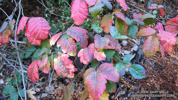
Fall color is not as widespread in chaparral as in some other plant communities. This vividly colored poison oak is along the Garapito Trail in Topanga State Park.
From a run of the Trippet Ranch Loop from Marvin Braude Mulholland Gateway Park at the southern end of Reseda Blvd., in the San Fernando Valley.
Related post: Poison Oak, Ferns Along the Garapito Trail
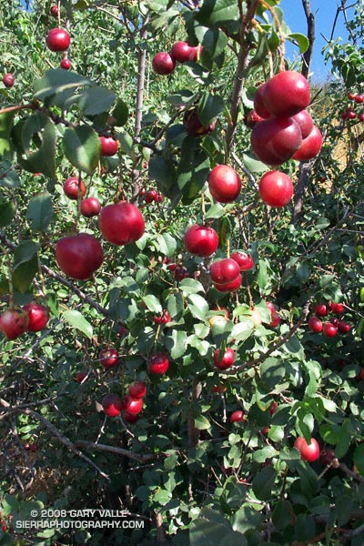
Sometimes growing as large as a supermarket cherry, the sweetish, thin-pulped fruit of hollyleaf cherry (Prunus ilicifolia) is a favorite snack of coyotes.
These are on the Chumash Trail in Rocky Peak Park. This is the first year since the 2003 Simi Fire that there has been a sizable hollyleaf cherry crop along the trail.
It is commonly reported that an “acid treatment” in the digestive tract of a coyote or bird is required for germination. However, according to the University of Texas Native Plant Information Network Native Plant Database, fresh seeds require no treatment.
Related post: Holly-leaved Cherry
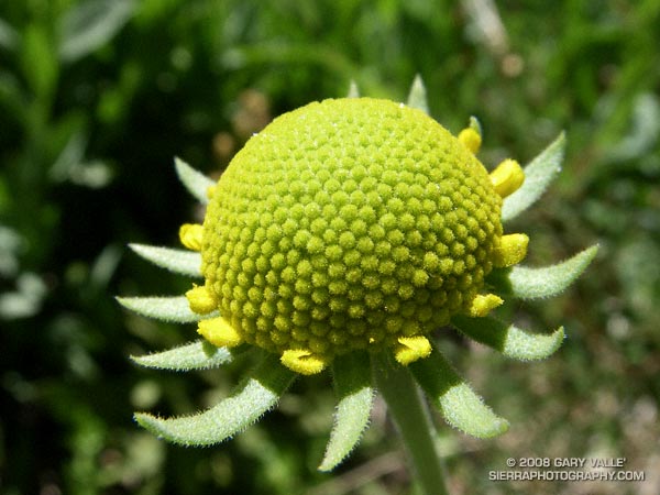
There are some imperfections, but generally the unopened disk florets comprising the head of this immature sneezeweed blossom are arranged so that each floret is surrounded by six other florets. This is an example of hexagonal close packing, and is probably the most dense arrangement of florets that can be achieved in this spherical flower head.
The photograph of the Bigelow’s sneezeweed (Helenium bigelovii) was taken on an out and back run on the Pacific Crest Trail from Vincent Gap to Little Jimmy Spring during July 2007.
Related post: Bigelow’s Sneezeweed & Bee
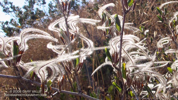
Plumed achenes of curl-leaf mountain mahogany (Cercocarpus ledifolius) on the Chumash Trail. From Tuesday’s run.
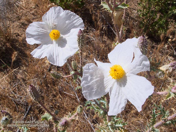
Prickly poppy (Argemone munita) in upper Cheeseboro Canyon.
From today’s run of the Cheeseboro Canyon keyhole loop, starting from the Victory trailhead of Upper Las Virgenes Canyon Open Space Preserve (formerly Ahmanson Ranch).
Here’s a Google Earth image of a GPS trace of the loop, and links to trail maps for Upper Las Virgenes Canyon Open Space Preserve and Cheeseboro/Palo Comado Canyons.