Condor Peak Trail Run – April 2024

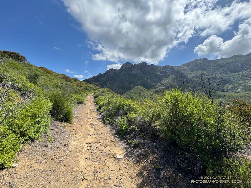
Condor Peak Trail above Fusier Canyon.

After climbing Condor Peak, I paused along the trail between the peak and Fox Mountain to take a photo. That’s when I heard a loud rattling behind me. I slowly turned around… A very upset snake was in the brush about 15 feet away and continuing to buzz.

Many rattlesnakes I encounter don’t rattle — even if directly on the trail. But for some reason this well-hidden snake was really agitated.
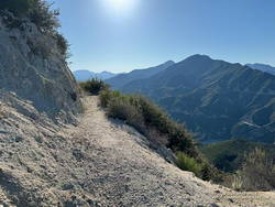
Josephine Peak and Strawberry Peak from the Condor Peak Trail. (thumbnail)
Josephine Peak and Strawberry Peak

The rattle sounded like that of a mature snake. I briefly considered looking for it. But, I reasoned, if the snake had been kind enough to rattle, then I should return the favor and leave it alone. It was already amped and clearly knew where I was. While I was curious, I didn’t need to see THIS snake. I turned and continued down the trail.

It had been one of those runs where everything goes as planned. Other than the first 50 yards or so of the Vogel Flat Trail — which was in terrible condition — it had been a nice change to be on a “normal” trail. By that, I mean a trail that (generally) wasn’t rutted, overgrown, or washed out. Consecutive wet rain seasons have been hard on lower elevation trails in the Los Angeles area.
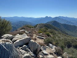
The San Gabriel Mountains from East Condor Peak. (thumbnail)
The San Gabriels from East Condor Peak.

I was the first up to the peak, and on the way down passed several small groups of hikers. The topmost group was resting in the shade near Fox Mountain, and the others working up the trail farther down the mountain. All were enjoying the day.

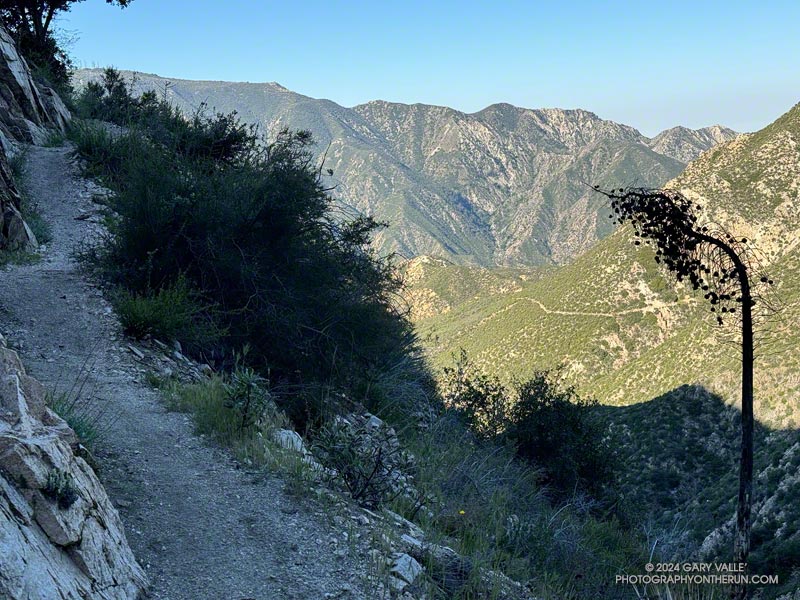
According to the Tempe thermometer on my pack, the temperature climbed steadily from 60 degrees at the start of the run to around 75-80 degrees on Condor Peak. The day wasn’t forecast to be particularly hot — around 85 in the warmer valley locations. But on the return from Condor, the temperature in the sun in the south-facing bowl at the head of Fusier Canyon was in the 90s. This was offset somewhat by the shaded little streams in the corners of the canyon. In some years these have been completely dry.
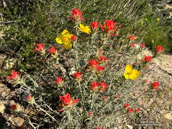
Paintbrush mixed with bush poppy along the Condor Peak Trail. (thumbnail)
Paintbrush and bush poppy.

As elsewhere this Spring, the wildflowers along the trail were spectacular. Some of those in bloom included woolly paintbrush, yellow monkeyflower, chaparral whitethorn, hoary-leaved Ceanothus, bush poppy, collarless California poppy, chia, and black sage. The paintbrush and bush poppy were especially striking.

Here’s an interactive 3D-terrain map of my GPS track (yellow) of the route to Condor Peak, starting near Vogel Flat on Big Tujunga Canyon Road. It’s a strenuous 16-mile run, hike, or ride, with an elevation gain of about 4000′. The summit of Condor (either one) is at about 5441 feet.

Some related posts:
Condor Peak and Fox Mountain Adventure Run
Condor Peak Out and Back Adventure Run
Condor Peak Trail Run

Boney Mountain – Old Boney Loop from Wendy Drive

Western Ridge and escarpment of Boney Mountain from the Old Boney Trail

For months, it seems wet weather has had a particular affinity for Saturdays and Sundays. This has resulted in some wet, chilly runs. It’s also put a damper on other outdoor activities. A long-time rock climber, I enjoy going to Stoney Point and doing a circuit of easy bouldering problems. That’s been hard to do because 1) muddy climbing shoes don’t work so well, and 2) sandstone hand/footholds tend to break when wet.

That’s one of the reasons I was back on the western ridge of Boney Mountain — at least I’d get to climb something!

Near the halfway point on the Western Ridge of Boney Mountain. (thumbnail)
Near the halfway point on the Western Ridge.

Following a well-worn route, I scrambled up Boney’s western ridge to the crest and worked over Tri Peaks to the Backbone Trail. This time, after descending the Chamberlain Trail, I turned right (north) on the Old Boney Trail and looped back to where the western ridge route began. From there, I retraced my steps back to Wendy Drive. Here’s an interactive 3-D terrain map of my GPS track.

There were other reasons for doing this route. It’s been a very wet couple of years, and there is little trail infrastructure to handle the runoff from all the storms. Last weekend, another strong storm drenched Southern California, and on Friday, there was additional rain. The Boney – Old Boney route crosses just one creek (twice), and it usually has a decent limb/log/rock bridge. I suspected other routes would involve soaked socks and shoes.

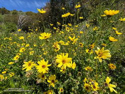
Bush sunflower along the Old Boney Trail. (thumbnail)
Bush sunflower along the Old Boney Trail.

I’d also read that the Santa Monica Mountains Trails Council (SMMTC) recently worked on the Old Boney Trail. After experiencing the challenges of brush on that trail firsthand, I was curious to see what the trail was like now. In addition, the Old Boney return has fantastic views of Boney Mountain’s impressive western escarpment. It’s fun to look up at where you’ve been!

Another consideration — not necessarily positive or negative — is the Boney Mountain – Old Boney keyhole loop has nearly a 1000′ more elevation gain than the similar length (16-mile) Blue Canyon, Sycamore Canyon, Upper Sycamore route.

Here are a few photos taken along the way, including some of the vibrant wildflowers.

Some related posts:
Looking for Boney Mountain
An End of Year Boney Mountain Adventure
Boney Mountain Western Ridge & Loop