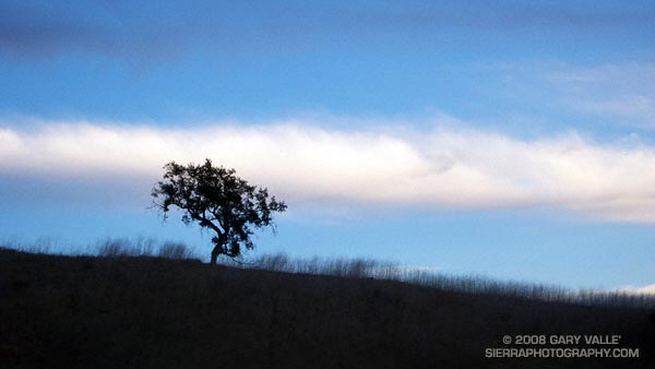
Oat Mountain from Rocky Peak Road

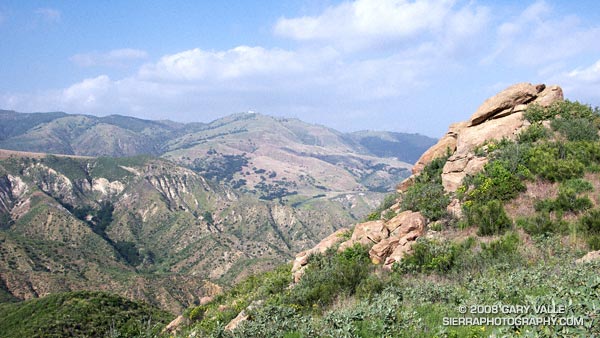
View across Blind Canyon to Oat Mountain from the Rocky Peak fire road.

View across Blind Canyon to Oat Mountain from the Rocky Peak fire road. At one time slated to become a Los Angeles County landfill, Blind Canyon is now part of Rocky Peak Park.

From an out and back run on Rocky Peak Road to the top of the Chumash Trail.

Related post: San Fernando Valley from Rocky Peak

Google search: $g(Rocky Peak), $g(Blind Canyon), $g(landscape photography)

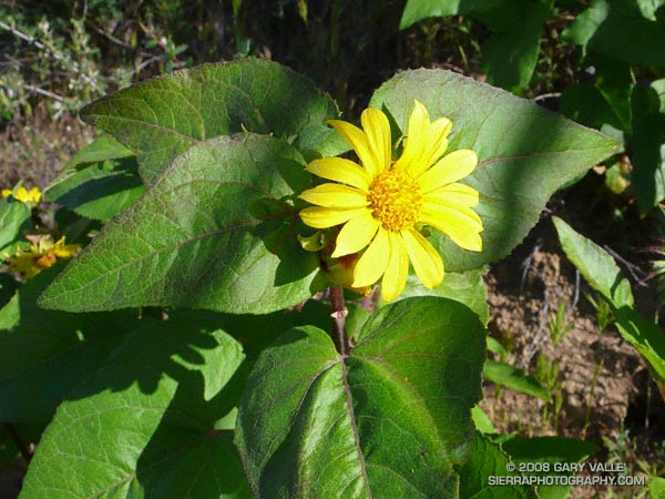
Canyon Sunflower

Canyon sunflower on a north facing section of the Chumash Trail at an elevation of about 2350 ft.

Canyon sunflower (Venegasia carpesioides) tends to grow along cooler sections of chaparral trail. Its rich green leaves and yellow composite flowers are a refreshing sight on a thirsty run.

This canyon sunflower is on a north facing section of the Chumash Trail at an elevation of about 2350 ft. The canyon sunflower population in this area expanded following the 2003 Simi Fire.

On a separate note, it’s that time of year again — at the end of my run this Southern Pacific Rattlesnake was in the street at the Chumash Trailhead on Flanagan Drive in Simi Valley, California.

Related post: Southern Pacific Rattlesnake

Google search: $g(canyon sunflower), $g(rattlesnake), $g(Simi Valley)

Whitewater Slalom Racing

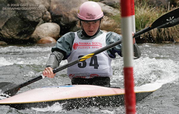
2002 World Champion and 2004 Olympic Silver Medalist Rebecca Giddens zeroes in on a red up gate while racing in the T.J. Slalom at the 2007 Kern River Kayak and Raft Festival.

2002 World Champion and 2004 Olympic Silver Medalist Rebecca Giddens S-turns through a red “up” gate while racing in the T.J. Slalom at the 2007 Kern River Kayak & Raft Festival.

A whitewater slalom course consists of a series of red gates and green gates that are paddled sequentially through a set of rapids. The paddler must pass through red gates moving in the upstream direction, and green gates moving downstream. Racers are timed, and a 2 second penalty is added for each gate that is touched, and a 50 second penalty added for each gate that is missed.

Typically, there are 18 to 25 gates, with 6 to 7 up gates, and the rest downs. The gates are placed to create challenges for the paddler, and the difficulty of a slalom course is usually about a grade higher than if the same rapids were paddled without gates.

In national and International races a specialized whitewater slalom boat is required, but at local citizen races paddlers also use plastic river-running kayaks and even playboats. Paddling slalom gates is a great way to improve your river-running skills!

At the elite level, higher performance boats and custom built whitewater venues have upped the adrenalin factor for competitors and spectators alike. The whitewater events were one of a few that sold out at the attendance plagued Athens Olympics. The Beijing Olympic Canoe/Kayak Slalom venue  looks challenging, and should warrant good television coverage by NBC.

In the past decade, whitewater kayaking has grown in popularity, but the sport hasn’t lost its “small sport” appeal. The  sport’s medal winning athletes, such as Rebecca Giddens, are not only superb paddlers, but are also very humble, hard working and hard playing people, willing to share their expertise and ideals. Rebecca and her husband Eric — also an elite paddler — now live in Kernville, California and operate the very popular brewpub, the Kern River Brewing Company. Eric will be setting the courses (gate sequences) for the whitewater events at the Beijing Olympics.

1992 Olympic Gold Medalist Joe Jacobi also works hard and plays hard. Joe, along with his partners at Gold Medal Connections offer paddling camps and clinics across the country. This year’s Gold Medal Kayaking Camp was the 11th on the Kern River. Joe will be part of the NBC broadcast team covering Canoe/Kayak events at the Beijing Olympics. For Joe’s “thoughts, ideas, and life lessons from the outdoors” see his blog Gold Medal Living.

If you’re curious about slalom, or whitewater boating, the 2008 Kern Festival is April 19-20 at Kernville’s Riverside Park. The Festival will feature two days of non-stop action with a steep creek race and raft races on Saturday; and a downriver race and the T.J. Slalom Race Sunday. There’s no charge to watch, and as a result of this year’s good snowpack, river conditions should be nearly ideal!

Google search: $g(whitewater slalom), $g(olympics), $g(Kern River), $g(Rebecca Giddens), $g(Joe Jacobi), $g(brewpub)
PCT North of Walker Pass

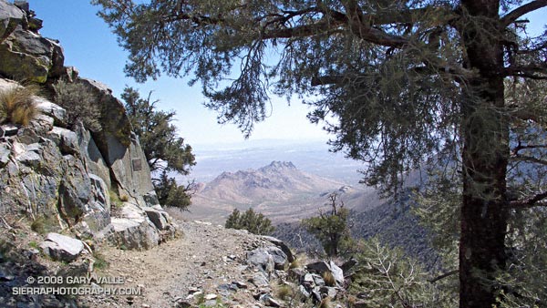
Pacific Crest Trail, north of Walker Pass, in the Southern Sierra.

I was headed home from a whitewater slalom training camp on the Kern River, and wanted to take advantage of being in the Southern Sierra and run an unfamiliar section of the Pacific Crest Trail.

Yes, it was windy and there were lenticular clouds in the lee of the Sierra, which meant it might get REALLY windy. No, I didn’t have my regular trail shoes or a hydration pack. Yep, there was some snow on the north side of the peaks on either side of the highway.

The plan was to do an out and back run north on the PCT from Hwy. 178 at Walker Pass (5250′). I didn’t know how far. I hoped far enough to check out the approach to Owens Peak. But that would depend on the amount of snow on the trail, how cold and windy it became, and how much elevation gain my legs had left in them.

It might not seem that paddling a kayak would be hard on the legs, but your legs are your primary connection to the boat, and my legs were worked following several days of strenuous paddling.


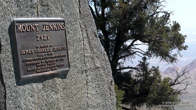
Plaque on the PCT north of Walker Pass, that commemorates the naming of Mt. Jenkins.
This post’s photograph was taken about five miles into the run. The plaque commemorates the naming of Mt. Jenkins. It honors J.C. Jenkins, whose Exploring the Southern Sierra and Self Propelled in the Southern Sierra books have inspired many an adventure. It was placed where the south ridge of Mt. Jenkins intersects the PCT.

I continued a mile and a half to a point where I could see the saddle and ridge leading to the summit of Owens Peak. Rounding a corner, I emerged from a wind protected traverse, and was slammed with a cold gust of wind. Ahead, I could see another long stretch of snow covered trail. Owens Peak would have to wait…

Notes: There’s an automated weather station at Walker Pass. This hill of wildflowers was a short distance from the pass.

Google search: $g(Southern Sierra), $g(Pacific Crest Trail), $g(PCT), $g(trail running)