Category Archives: clouds

Rainbow Colors in Cirrus Clouds Over Los Angeles

Circumhorizontal Arc Segment Over the San Fernando Valley, Near Los Angeles

Colors in the sky other than blue and white quickly catch the eye. This afternoon, just before driving over to Ahmanson for a run, I noticed a peculiar band of vivid spectral colors mixed in with a patchwork of high altitude cirrus clouds.

The bright band of color was in the wrong place to be a sundog, but because of its association with the cirrus clouds was likely some type of halo. Ice halos are formed by the refraction and reflection of light by the facets of an ice crystal, such as those found in cirrus.

When I got back from the run I checked online and found Les Cowley’s Atmospheric Optics web site. This site provides a wealth of info about ice halos and other optical atmospheric phenomena. The web site even makes available software to simulate various halos.

Circumhorizontal arc fragment over the San Fernando Valley, near Los Angeles, on May 29, 2019.
Circumhorizontal arc fragment over the San Fernando Valley, near Los Angeles, on May 29, 2019. Click for larger image.

The height of the sun above the horizon, the height of the band of color, and the prismatic sequence of the colors and their brightness all suggest the band is a segment of a circumhorizontal arc.

While not an everyday phenomenon, the circumhorizontal arc is more common at Los Angeles’ latitude than a higher latitude city such as Seattle or London. If 0 degrees is the horizon and 90 degrees is directly overhead, the circumhorizontal arc can only be seen when the sun is higher than about 58 degrees. When the photo above was taken, the sun was at 69 degrees.

The circumhorizontal arc is typically formed by hexagonal flat plate crystals oriented with their large flat faces horizontal. Rays of sunlight enter through one of the edge faces and then exit through the bottom face of the crystal.

Now that I know when and what to look for, I’ll be keeping an eye out for more ice halos.

Running to Ray Miller

Mountain bikers enjoying the view of Boney Mountain from Overlook Fire Road in Pt. Mugu State Park.

The Ray Miller Trailhead in Pt. Mugu State Park marks the western end of the Backbone Trail, a 68-mile scenic trail along the spine of the Santa Monica Mountains. The Ray Miller Trail’s long, winding descent into La Jolla Canyon is a favorite of runners and hikers, and a fitting end to those traversing the BBT from east to west.

My run this morning was to the Ray Miller Trailhead (and back) from Satwiwa, starting at the Wendy Drive trailhead in Newbury Park. The Wendy Drive Trailhead is very popular and is the starting point for many good runs, hikes and rides. To get an idea of the route options, see the detailed trail maps on the Pt. Mugu State Park page of VenturaCountryTrails.org.

Today I was looking to do a longer run, so didn’t take the usual route. On the way down Big Sycamore Canyon, I skipped the turns at Wood Canyon (Hell Hill), Wood Canyon Vista Trail (BBT) and Fireline Trail and at Overlook Fire Road, some eight miles into the run, finally headed uphill.

View of the Pacific, Anacapa Island and Santa Cruz Island from the Ray Miller Trail
View of the Pacific, Anacapa Island and Santa Cruz Island from the Ray Miller Trail.

The top of the Ray Miller Trail is a stout 2.5 -mile climb from the bottom of Overlook Fire Road. Along the way there were excellent views of Sycamore Canyon, Serrano Valley and Boney Mountain.

About a half-mile down the Ray Miller Trail there is a popular overlook of the coast. The day was clear and there were stunning views of the Pacific and the Channel Islands. Brushed by whispers of wind, the cerulean blue Pacific filled my view for much of the descent to the parking lot.

It was an odd feeling to run down to the parking lot with runners who were cheerfully finishing their morning run, knowing that I had many more miles to go. After a quick stop at the water spigot, I turned, and sighed, and took the first steps back up the hill and toward Satwiwa.

Here are a few photos taken along the way.

Related post: Ray Miller Training Run

Simi Valley Snow Shower

Simi Valley Snow Shower

There were many reports of snow, sleet, hail, and graupel around the area yesterday.

It was definitely cold! The afternoon temperature at 1700′ at the Cheeseboro RAWS was around 42°F. And the temperature was probably cooler in the vicinity of convective showers, such as the one above.

The photograph is from Sage Ranch, at an elevation of about 2000′. I was hoping to see some snow on the ground — but no cloud buildups cooperated.

Related post: Snow on Oat Mountain (December 2008)

Running Mt. Wilson’s Rim Trail

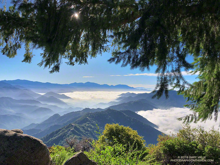
San Gabriel Mountains from the Rim Trail on Mt. Wilson. Photograph by Gary Valle.

This morning’s run from Mt. Wilson started with striking views of the Southern California’s mountains from the Rim Trail. An extensive marine layer heightened the contrast between the highlands and the lowlands, with peaks such as Mt. Baden-Powell, Mt. Baldy and Monrovia Peak standing starkly above the ocean of clouds. Beyond Mt. Baldy, San Gorgonio Mountain could be seen, more than 75 miles distant.
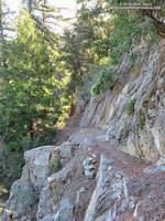
A section of the Rim Trail between Mt. Wilson and Newcomb Pass.

The Rim Trail connects Mt. Wilson (5710′) to Newcomb Pass (~4100′). A trail and firebreak between Mt. Wilson and Newcomb Pass are shown in the 1934 “Advance Sheet” for the the first USGS 1:24000 map of the area, the Mt. Wilson Quadrangle. The route of the trail depicted in the finalized 1939 edition of the map is essentially the same as the Rim Trail today.

The somewhat primitive and adventurous character of the Rim Trail makes it a favorite. Most often I run the Rim Trail as the first leg of a loop that follows the Gabrielino Trail down to Chantry Flat and then returns to Mt. Wilson on the Upper Winter Creek and Mt. Wilson Trails.
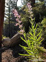
Poodle-dog bush (Eriodictyon parryi) near the top of Mt. Wilson.
Poodle-dog bush .

There is still some Poodle-dog bush along the Rim Trail and also on the connector trail between the top of the Kenyon Devore Trail and the Mt. Wilson Trail parking lot. As long as you see it, it is easily avoided. Poodle-dog bush is a fire-follower — in this case from the 2009 Station Fire — that can cause contact dermatitis. Here’s a closer look at the flowers.

Today, instead of turning right at Newcomb Pass toward Chantry Flat, I turned left on the Gabrielino Trail, . This leads down to Devore Camp — an isolated trail camp along the W.F. San Gabriel River. (Think creek!) From Devore Camp the Gabrielino Trail is followed up-canyon to West Fork Camp and then to the Kenyon Devore Trail. The Kenyon Devore Trail is then used to get back up to Mt. Wilson. There are other variations as well.
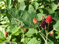
Blackberry along the Gabrielino Trail between Devore Camp and West FOrk.
Blackberry along the Gabrielino Trail

While the Gabrielino Trail between Spruce Grove and Chantry Flat is one of the most used in the range, the Gabrielino Trail between Newcomb Pass and West Fork is a rustic trail that sees far less use. On previous outings, I had not seen anyone on this segment of the trail. Today, I was surprised to find a backpacker at Devore Camp. I had to laugh when the first thing he said was, “Man, there is a lot of poison oak around here!”

There sure was…

Some related posts: Mt. Wilson – Newcomb Pass – Chantry Flat Loop; Bigcone ENSO Prediction, Poodle-dog Bush Blues, and a Surprise on Kenyon Devore; Why Won’t My Smart Key Work?