
Category Archives: trails|smmc open space
Under a Falcon’s Eye
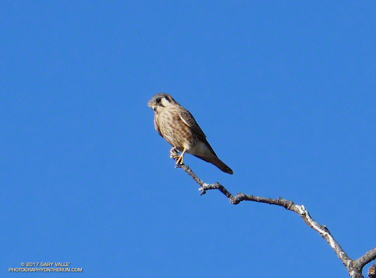
I was in that other-world you can reach when running, lost in thought and dreaming of dreams. As I approached the valley oak on the western edge of Lasky Mesa, I wondered if the tree was going to survive. Even though last Winter had been wet, it had been a hot summer, and this once-elegant star of TV and film was still struggling with the deleterious effects of five years of drought. Leaves grew in clusters along its spindly limbs as if it had been burned in a wildfire.
Nearly under the scraggly valley oak, I slowed to a walk to look at it more closely. Glancing upward I did a double-take… Perched on a bare limb at the top of the tree was a small raptor. So small, that it had to be an American kestrel.
Kestrels are extremely wary birds with acute vision, and I was surprised it had not flown as I had run toward the tree. I’ve seen and heard kestrels many times at Ahmanson Ranch, but never this closely. The diminutive falcon was only about 15′ above me. My camera was in my pack and just about any movement was going to spook the bird.
Ever so slowly, I turned my back to the bird and walked a few steps away from the tree. Wishing I had eyes in the back of my head, I carefully removed my camera from my waist pack, turned it on, made sure it was set correctly, and partially extended the zoom lens. Turning back toward the tree, I expected the falcon to be gone, but it had not flown.
I took a set of bracketed photos and then another. I needed to be a little closer. I took two or three slow steps toward the tree. As I raised the camera, the female kestrel — burnt orange across the back and upper wings — had had enough. With a powerful stroke of her wings she turned and leapt to flight, once again leaving me to my thoughts.
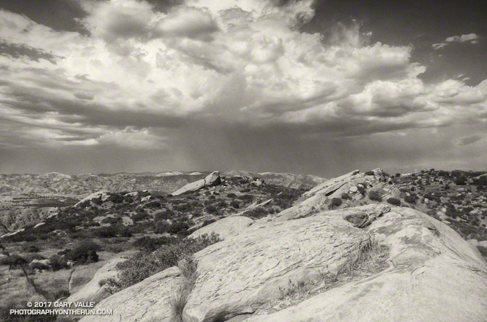
Oak, Hawks and Clouds
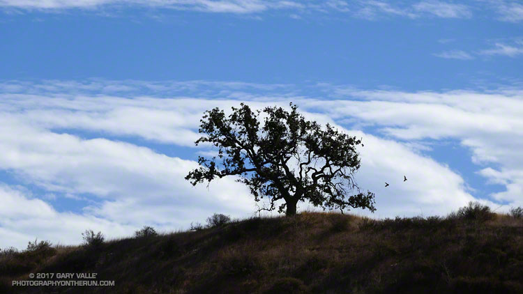
From this afternoon’s run at Ahmanson Ranch.
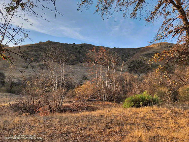
Groundwater Replenished in Upper Las Virgenes Canyon
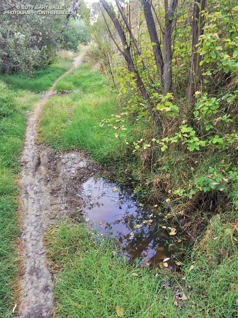
The groundwater in upper Las Virgenes Canyon appears to have been replenished by the above normal rainfall last rain season.
The little spring pictured above has persisted through the dry season and farther up the canyon a tiny stream has trickled defiantly through the Summer. The mainstem creek in upper Las Virgenes Canyon isn’t flowing as it was during the Winter, but the sand at the crossing near the Cheeseboro connector trail remains damp.
It shouldn’t take a huge amount of rain to get the creek flowing again. We’ll see!
Related post: Los Angeles Rainfall Above Normal, But…
Some Summers Are Hotter than Others
The photo above is from an afternoon run at Sage Ranch Park on August 31, 2017, during our recent heat wave. The thunderstorm in the distance is over Santa Clarita.
Around the time the photo was taken the temperature at the Cheeseboro RAWS was 110 °F, with an “in the sun” fuel temperature of 119 °F. The temperature at Ahmanson Ranch, where I often run on weekdays, was probably higher. I was running at Sage Ranch to try and take the edge off the heat — even if the reduction in temperature was only a few degrees.
During the heat wave the high temperature at Pierce College in Woodland Hills in the West San Fernando Valley exceeded 100 °F on nine consecutive days (August 24 to September 3) and exceeded 110 °F on five consecutive days (August 28 to September 1). Numerous temperature records were broken in Southern California and across the state. On September 1, Downtown San Francisco set a new all-time record high temperature of 106 °F.
At my West Hills weather station the high temperature for the month of June was 109 °F; for July 111 °F; for August 112 °F; and so far this September the high has been 113 °F. If I’m not heat-acclimated by now, I never will be.
A Fashion Show on Lasky Mesa?
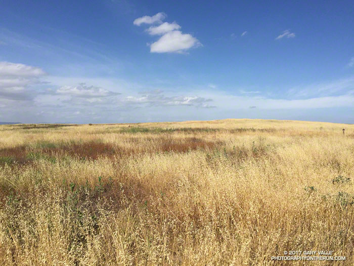
From Gone with the Wind to the bridge scene of Mission Impossible III, there have been some big productions on Lasky Mesa. I’ve seen TV shows, commercials, music videos, photo shoots, and even an online game being filmed on Lasky Mesa. But as I ran past the complex of canopies and tents on the grassland site, I never would have guessed that this time the production was a fashion show.
It was not only a fashion show, but a runway show by the French fashion house Dior, introducing their “Cruise 2018” collection. Given the dry-golden-grass character of Lasky Mesa in May, I jokingly wondered if the designs were all going to be in tones of beige, tan and brown. Not quite, but from a photographer’s perspective of color and texture Lasky Mesa appears to have been a surprisingly complementary location for the event.