Category Archives: trails|smmc open space

East Las Virgenes Canyon

East Las Virgenes Canyon

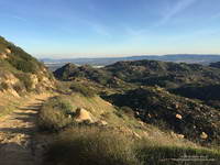
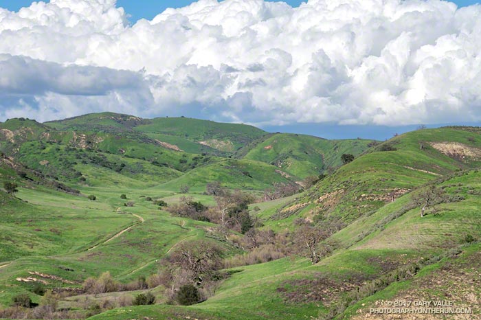
This is a view of East Las Virgenes Canyon from the power line service road that connects the Las Virgenes Canyon Trailhead to Cheeseboro Ridge. East Las Virgenes Canyon is part of the Upper Las Virgenes Canyon Open Space Preserve (formerly Ahmanson Ranch).

From this afternoon’s keyhole loop run from the Victory Trailhead to Cheeseboro Ridge.

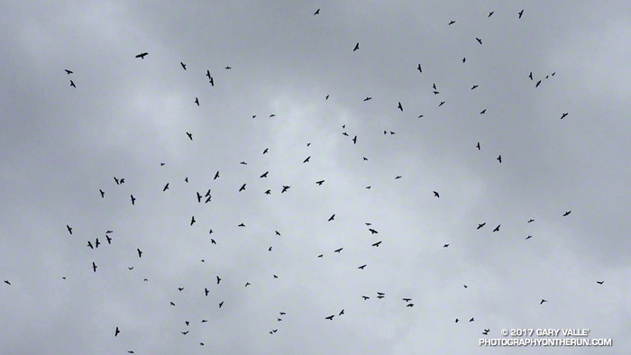
Winter Colony of Crows in Cheeseboro Canyon

Winter colony of crows in Cheeseboro Canyon

With a storm approaching and rain only an hour or two away, I’d been debating where to turn around. I’d just climbed the steep hill between Upper Las Virgenes Canyon and Cheeseboro Ridge and decided to continue down to Cheeseboro Canyon. As I drew closer to the trail’s junction with Cheeseboro Canyon, I began to hear a cacophony of cawing crows.

At the junction crows literally filled the sky (video). It seemed the call was out and crows were coming from all directions to join the flock.

Though I’d never seen such a large aggregation in Cheeseboro Canyon, it is common for the American crows (Corvus brachyrhynchos) to form large foraging and roosting flocks in winter. Winter is tough on animals and isn’t surprising that the social and intelligent crow would cope with Winter in this cooperative fashion.

Leaving the crows behind I started the trip back to the Victory trailhead. It would take about an hour and I hoped the rain didn’t get there before I did!

Los Angeles Rainfall Above Normal, But…

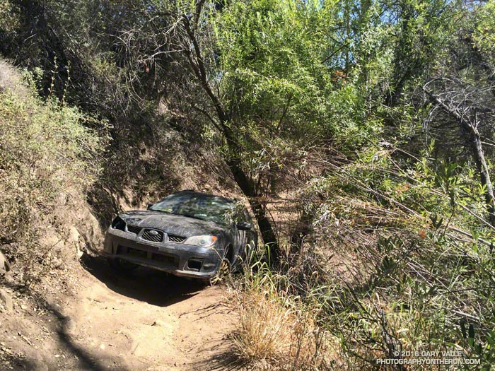
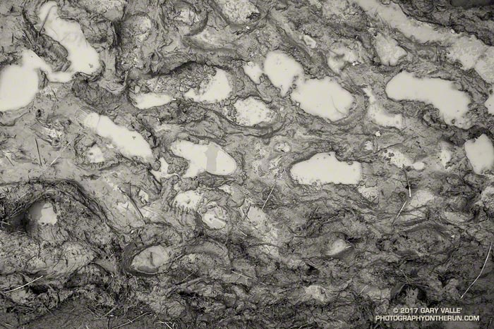
Study of mud on the Musch Trail in Southern California

As of yesterday Downtown Los Angeles (USC) has recorded 8.80 inches of rainfall for both the Rainfall Year (July 1 – June 30) and Water Year (October 1 – September 30). By either measure Los Angeles rainfall is well above normal, and with three well-advertised storms in the forecast it looks like Los Angeles rainfall could remain above normal for at least a few weeks.

Even if it has been a bit wet — and muddy — it’s been great to have a more normal rain season. The rain has been very beneficial and has impacted the drought, at least in the short term. Just how much a continued wet rain season would impact the drought in the long term is a question that has to wait for future analysis.

There has been a five year precipitation deficit of nearly 36 inches at Downtown Los Angeles (USC). It’s hard to appreciate the size of this deficit while running in the rain, splashing through puddles, and trying not to slip in the mud. One tangible indicator of this deficit is that despite above average rainfall, many creeks in the Santa Monica Mountains and Simi Hills have remained dry or are barely flowing. Some have been dry for years.

Update Wednesday, March 1, 2017. The atmospheric river event on February 17 produced high flows on many local streams and many of these streams continue to flow. Rainfall totals in Los Angeles, Ventura and Santa Barbara Counties for the storm generally ranged from 4 to 8 inches with some higher totals recorded. On subsequent trail runs flooding, debris flows and erosion were noted in Upper Sycamore and Blue Canyons in Pt. Mugu State Park. Remarkably, some groundwater monitoring stations in Santa Barbara and San Bernardino Counties remain well below normal.

As of February 28, 2017, Downtown Los Angeles (USC) had recorded 18.50 inches of rain for the Rain Year and Water Year. This is 165% of the normal amount of 11.24 inches for the date, and 124% of the normal amount of rainfall for an entire year. This is the wettest Rain Year (July 1 – June 30) and Water Year (October 1 to September 30) to date since the very wet year of 2004-2005.

Update Tuesday, January 24, 2017. From Wednesday, January 18 through Monday, January 23, Downtown Los Angeles (USC) recorded 5.53 inches of rain, bringing the Rain Year and Water Year precipitation totals to 14.33 inches. This is 217% of the normal amount of 6.65 inches for the date, and 97% of the normal amount of rainfall for the entire Rain Year. It has been the wettest start to the Rain Year (July 1 – June 30) and Water Year (October 1 to September 30) since the very wet year of 2004-2005. There were high rain rates on Sunday, January 22, and Upper Las Virgenes Creek did finally flow for a period of time.

Update Saturday, January 21, 2017. From Wednesday, January 18 through Friday, January 20, Downtown Los Angeles (USC) recorded 2.53 inches of rain, bringing the Rain Year and Water Year precipitation totals to 11.33 inches. The average annual rainfall for Downtown Los Angeles is 14.93 inches. The rain, which was heavy at times on Friday, produced some flooding, rockslides and debris flows. Both branches of upper Garapito Creek are flowing as a result, but Saturday afternoon Upper Las Virgenes Creek was still not flowing.

Upper Las Virgenes Creek – February 22 the flow on Upper Las Virgenes Creek near the Cheeseboro connector and the two downstream crossings was enough that you couldn’t cross without getting your shoes wet. Previously, on January 24, there was no flow near the connector and only a slight trickle downstream. On January 21 the creek was not flowing and there was no evidence it had flowed during a recent storm.

Garapito Creek – On Saturday, January 21, 2017, both branches of upper Garapito Creek were nice burbling brooks. Previously, on January 15, the north branch was just starting to flow, but the south branch was dry.

Upper Sycamore Creek – Flash flooding, debris flows and erosion occurred on this creek following the heavy rain on February 17-18. Nearly 6 inches of rain was recorded at Circle X Ranch, which is also in the western Santa Monica Mountains. Previously, was flowing on February 4, but not on January 1, 2017.

Serrano Creek – Was flowing on February 4, but not on January 1, 2017.

If the wet forecast holds will these streams start to flow? We’ll see!
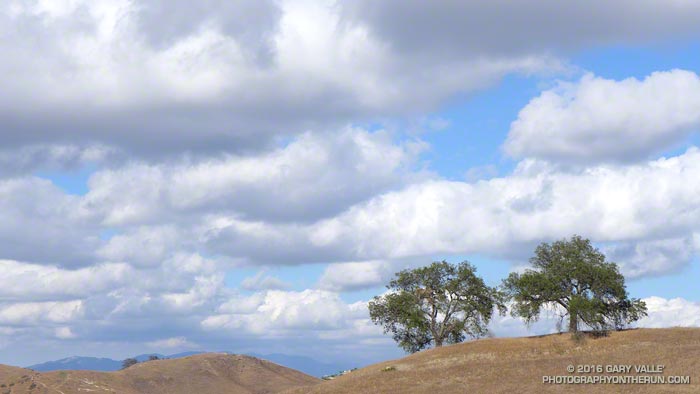
Glimpse of Autumn

Oaks and clouds Upper Las Virgenes Canyon Open Space Preserve

I was running in the hills along the western margin of the San Fernando Valley and reveling in the Autumn-like weather. The hills were parched, brown, and the soil dessicated. In 128 days it had not rained.

An area of low pressure was producing some clouds and even a little rain in some parts of Los Angeles County. The last time it had been this cool in the afternoon was in mid-June. The pleasant temperature was a welcome change from the 80s, 90s and 100s of Summer.

Precipitation from the 2015-16 Godzilla El Nino fell short of expectations, with Downtown Los Angeles only recording 65% of normal rainfall and the drought continuing into its fifth year. How long would we have to wait  until we received widespread rainfall?

At the moment the expectation is for ENSO Neutral conditions to prevail this Winter. Neutral conditions give forecasters little leverage on which to base their Winter outlook, but based on last year’s Southern California precipitation forecasts, we didn’t have much leverage then either.

With a warming planet, we appear to be in a new regime. Forecasts based on 1950-2000 analogs may no longer be applicable. As of September 15 the Climate Prediction Center’s Precipitation Outlook for Southern California for December, January and February is the equivalent of flipping a three-sided coin.

We may just have to wait and see what the Winter brings.

Races, Ravens and Running in Rocky Peak Park

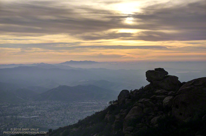
Simi Valley with Boney Mountain in the distance

Been enjoying the views from Rocky Peak Road a lot this past month. That’s Simi Valley, with Boney Mountain in the distance. On a clear day the view extends to the Channel Islands.

That viewpoint is at about mile 4.5 of the Bandit 50K/30K/15K and there are many other superb views along the way. This year, as a result of the L.A. Marathon date change, the Bandit races were moved from President’s Day weekend to January 30. El Nino or not, we had near perfect running weather for the event. Thanks to Randy, Sarita & crew and all the volunteers for all the work putting together the eight edition of the Bandit Ultra Trail Run!

Rocky Peak Road
Rocky Peak Road

The Tuesday following Bandit I’d run farther than planned, so on Wednesday the plan had been to drive over to Simi Valley and do a short recovery run/hike up the Chumash Trail. As I parked on Flanagan Drive, it occurred to me it would be a good day to see if the linkup from the Chumash trailhead to the Hummingbird trailhead was once again possible. The 9.3 mile Hummingbird-Chumash loop used to be a favorite, but because of construction I had not done the loop since 2010. An out and back to check out the first couple of miles of the loop would be the perfect recovery run!

I was happy to discover the trails east of Chumash Park and behind the cemetery had not changed. Construction of the extension of Mt. Sinai Drive appears to be mostly complete, but residential construction along the street is ongoing. The work day was ending, so running the quarter-mile stretch of Mt. Sinai Drive to get to Kuehner didn’t seem to be an issue.

Once on Kuehner my thought was, “What now?” The run was going to be too short if I turned around, so I decided to go just “15 minutes up the Hummingbird Trail.”

Greening hills along the Chumash Trail

Right… I soon found myself most of the way up the trail and estimating what time I needed to get to the top of Hummingbird in order to make it to the Chumash Trail and complete the loop before dark. I’m sure my pace was not too far off what it had been in the 50K, just a few days before. At some point an official trail is supposed to link the bottom of the Chumash and Hummingbird Trails, and I hope that is in the not too distant future.

The single track trails in Rocky Peak Park — and even Rocky Peak Road — tend to be technical. It’s excellent training and I try to run there at least once a week. A run I’ve been doing frequently is an out and back from the Chumash trailhead to an airy overlook near Rocky Peak. (This run also passes the point on Rocky Peak Road where the title photo was taken.) Today, as I approached the overlook I saw that it was occupied by a pair of large ravens.

Often seen in pairs, ravens are perceptive, intelligent birds. Depending on the situation, they can be somewhat tolerant of humans. Sometimes it is possible to pass within a few feet of them and not make them fly. They really don’t want to waste the energy if they don’t have to.

Overlook near Rocky Peak

As I worked up the path to the overlook I could see that the birds were watching me intently and trying to decide if I posed a threat. Knowing they are curious birds, I clucked my tongue in an attempt to mimic one of their more simple calls. Perhaps they were perplexed by the garbled raven-talk coming from the troublesome, large, bipedal, wingless creature. In any case they didn’t fly and continued to watch me. As “politely” as I could, I moved up and about four feet to their left, sharing the high point. For seconds I stood by them on the overlook, enjoying the view.

I’d flown a hang glider from a point such as this and understood why it was so special to the birds. With care, I turned away from them and walked down an alternate path. Slowly turning my head, I could see they had not flown.

Note: The Bandit Trail Runs event is now Rocky Peak Trails.