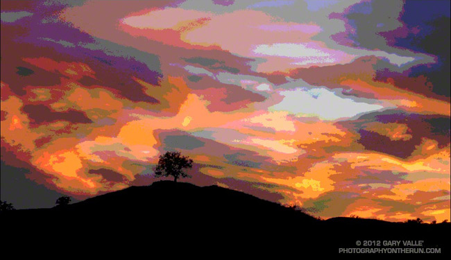
An alternative rendition of an image posted in November 2007. Did this version in 2007, but didn’t post it at the time. A Photoshop filter was not used.

An alternative rendition of an image posted in November 2007. Did this version in 2007, but didn’t post it at the time. A Photoshop filter was not used.
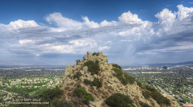
Thunderstorms rumbled across the eastern and northern San Fernando Valley and San Gabriel Mountains while I was running up to Castle Peak yesterday afternoon.
I like to do a short recovery run the day after a 50K. An early morning run helps smooth out the tweaks and twinges of the race, and a lingering runner’s high brightens the senses and the day.
Weather-wise, the timing of the Bulldog 50K/25K was perfect. Yesterday was one of the coolest of the cool wave. Today temps were already on the way up. Here’s a chart comparing the air temperature in the shade at the Malibu Canyon RAWS (near Tapia Park) for the last seven Bulldog races, and a similar chart with the fuel temperature in the sun.
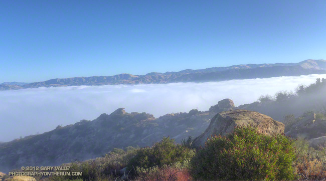
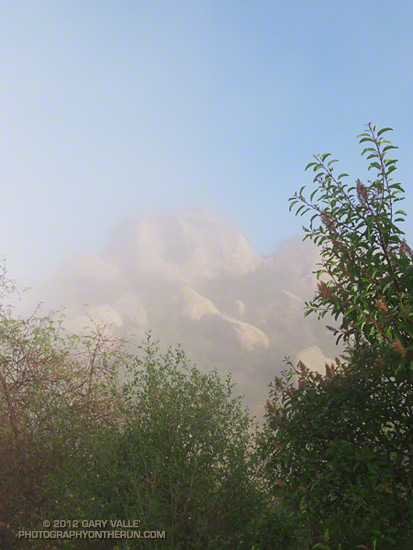
As at the top of the Bulldog climb, vaporous clouds drifted among the rocks, trees and chaparral at Sage Ranch Park. Heavy dew coated the plants along the trail, and the night-cooled droplets felt like splashes of ice water on my legs. Below, a pillowy layer of clouds filled Simi Valley. I jogged along the trail, legs tired, but feeling good.
Updated Thursday, August 30, 2012.
Following two weeks of scorching temperatures and a torrid Mt. Disappointment 50K, it looks like we’re going to catch a break and the weather for the Bulldog 50K/25K this Saturday is going to be cooler — cooler than last year and cooler than what we’ve been seeing recently.
How much cooler? During our recent heat wave the Malibu Canyon Remote Automated Weather Station (RAWS) near Tapia Park recorded temps as high as 102°F, and highs were routinely in the 90s. On race day last year temps here topped out at 101°F. Yesterday the high was 80°F and forecasts suggest the high Saturday should be about the same.
But for runners these temps don’t tell the whole story. These are “in the shade” temps recorded by a specially shielded and ventilated sensor. In addition, the humidity — even if it’s not East Coast humid — can have a big impact on what the temperature feels like and how it affects running performance.
In my experience a better measure of the temperature a trail runner experiences in races such as Bulldog is the “fuel temperature.” This is the temperature of a ponderosa pine dowel in direct sun. In the recent heat wave and at last year’s Bulldog race the “in the sun” fuel temps at the Malibu Canyon RAWS topped out at a fiery 112-115°F. Yesterday, when the air temperature was 80°F, the fuel temperature at that station was around 100°F.
Humidity can also play an important role and it doesn’t have to be super-high humidity to affect a runner. The NWS Heat Index attempts to account for the combined effect of temperature and humidity. Heat index tables can be misleading. As the NWS notes, “…heat index values were devised for shady, light wind conditions, exposure to full sunshine can increase heat index values by up to 15°F.”
Last year at around 3:00 pm when the last few runners were making their way up the Tapia Spur Trail the “in the shade” air temperature recorded by the Malibu Canyon RAWS (near Tapia Park) was 99°F, but the “in the sun” fuel temperature was 114°F. The dew point (a measure of humidity) at the time was 63°F, and this would have pushed the “feels like” temperature even higher.
We shouldn’t see anything like that this year.
Update Thursday, August 30, 2012. Here’s a chart comparing the air temperature in the shade at the Malibu Canyon RAWS (near Tapia Park) for the last seven Bulldog races, and a similar chart with the fuel temperature in the sun.
Update Sunday, August 26, 2012, 12:00 pm. Race day (Saturday) at Malibu Creek State Park dawned cool and cloudy with the marine layer once again about 2200′ deep. At the beginning of the race the temperature at the Malibu Canyon RAWS (near Tapia Park) was 63°F. As on Friday the marine layer didn’t start to break up until around 9:45 am, so for many runners the entire first loop was cloudy and relatively cool. The first time up Bulldog we ran up into the clouds and eventually broke out above the cloud deck near the top of the climb — it was spectacular! The clouds had cleared by the time I reached the Bulldog aid station on the second loop. Even though temps were warmer the second time around, it seemed that just when you needed it there was always a cooling breeze!
At 11:00 am at the Malibu Canyon RAWS the “in the shade” temperature was 73°F and the fuel temperature was 96°F. This was only about an hour after the clouds cleared, so the actual “in the sun” temperature was lower than the RAWS fuel temperature. Even though the air temperature stayed under 80°F all day, and “in the sun” temps were not as hot as they might have been, the ice water sponges at the aid stations still felt really good! It was a great day for a 50K!
Update Friday, August 24, 2012, 2:00 pm. Satellite imagery showed clearing in the Malibu Creek State Park area in progress around 10:00 am. An hour later the temperature at the Malibu Canyon RAWS (near Tapia Park) was 73°F and the “in the sun” fuel temperature had jumped to 96°F. At 2:00 pm the “in the shade” temperature was up to 78°F and the “in the sun” fuel temperature was still 98°F. Temps should be similar tomorrow for the race. We’ll see!
Update Friday, August 24, 2012, 8:00 am.
NWS Los Angeles/Oxnard reports marine layer about 2200′ deep this morning. The top of the Bulldog climb is at about 2400′ ASL. The extent of the low clouds and fog can be seen on various CalTrans cameras along the 101 Frwy via SigAlert.com. A marine layer this deep will probably delay clearing and keep temps cooler. Yesterday at 11:00 am the Malibu Canyon RAWS (near Tapia Park) reported an “in the shade” air temperature of 71°F and an “in the sun” fuel temperature of 90°F. Temps peaked at about 2:00 pm with an air temp of 79°F and a fuel temp of 100°F. We’ll see what happens today!
Thursday, August 23, 2012. At the moment it looks like the “in the shade” temperature at 11:00 am race day near Tapia Park should be around 78degF, with an “in the sun” temp approaching 100degF. The marine layer depth at the start of the race should be around 1000′ with a layer of low clouds (possibly broken) that should clear before most of us complete the first 25K. We’ll see!
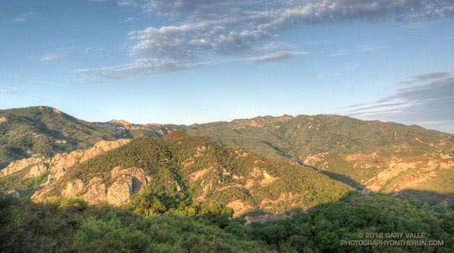
The title photo is from a run in Malibu Creek State Park on Saturday. The Bulldog climb is on the right side of the photograph. The Corral Canyon aid station is on the low point of the skyline a little left of center, and the “gateway” rocks farther left on the skyline.
Some related posts: Bulldog 50K 2010 Notes
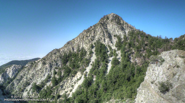
Mt. Markham From Near Mueller Tunnel
Note: The Mt. Disappointment Endurance Run is now the Angeles National Forest Trail Race.
The water felt surprisingly chilly, and for a moment I hesitated before completely immersing myself in the cool, clear water. More a creek than a river this time of year, this crossing of the West Fork San Gabriel River was at mile 17 of the 2012 Mt. Disappointment 50K. At 2760′, it’s the lowest point on the course and marks the beginning of the tough 5.4 mile climb up Edison Road to Shortcut Saddle (4790′).
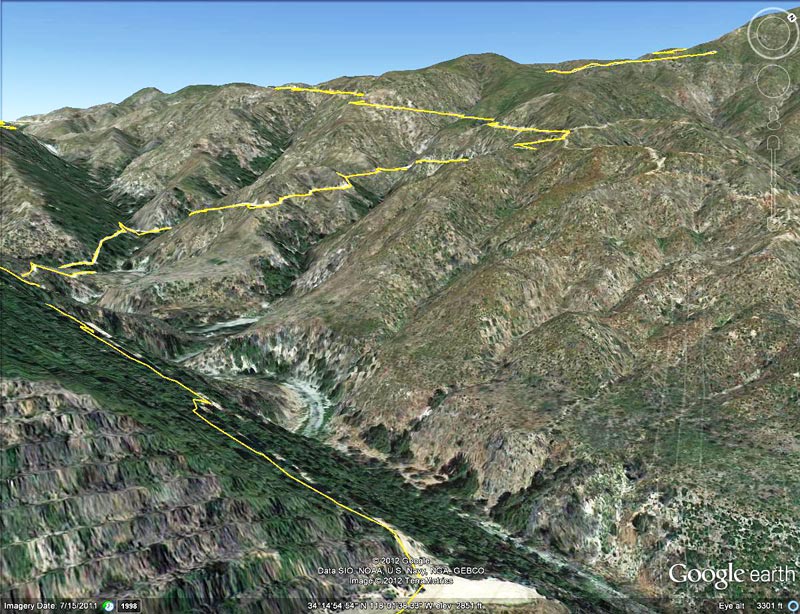
Edison Road (FS Road 2N23) zigzags up an exposed, south-facing chaparral slope. The climb is warm on the coolest of days — today it was going to be torrid. Southern California was locked in the grasp of a record-setting, multi-day heat wave. During the week I’d taken a thermometer on a run and measured a temperature of 107.6°F on a breezy day at Ahmanson Ranch. All week I’d been checking the computer weather models and watching the temps in the San Gabriel Mountains, hoping for a break in the weather. Nada. The day before the race the “in the sun” temps at the Clear Creek RAWS, near the race course, reached a blistering 120°F.
The performance hit from running in the heat is similar to running at higher elevation. Acclimatization helps, but hot weather reduces performance. The following is from Daniels’ Running Formula:
“You can’t perform as well in a distance race in the heat as you can in a cooler environment… As soon as the body starts to heat up, blood is diverted to the skin, where cooling (through evaporation of sweat from the skin’s surface) takes place. A greater portion of the body’s blood volume is at the body’s surface to facilitate cooling, leaving less blood available for carrying oxygen to the exercising muscles. In effect, to prevent overheating, the body reduces the amount of blood available to enhance performance.”
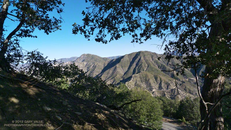
Submerged up to my neck in sublime coolness, I dunked my head. To this point the heat hadn’t been too bad. Much of the first 17 miles had been shaded and tolerable, and I’d been doing everything I could to stay cool. The “not too bad” part was about to end. Most of the next 9 miles would be brutally exposed and facing directly into the sun.
The dip in the pool only took a couple of minutes, but was worth every single second. Even if my shoes were wet and my jelly beans and salt tabs melted gobs of sugar and salt it was worth it!
Incredibly, the cooling soak made the Edison climb almost enjoyable. Almost — it still took about 50 minutes to get to the Edison Road aid station and another 50 to get up to Shortcut. At Shortcut the fantastic aid station volunteers filled my Camelbak with Heed and ice, and I ate a couple of big chunks of watermelon (really good watermelon) and drank a little cola. I felt good, but should have been thinking ahead and taken a couple of minutes to really cool down here. The ice water sponges were just sitting there waiting to be used and I passed them by. A little too soon I was on my way, and in a few minutes was jogging down the Silver Moccasin Trail.
In the extra-strength rays of the noontime sun, the rocky canyon was a solar blast furnace. Temps were well beyond what I had experienced on afternoon runs earlier in the week. At any instant I thought I might spontaneously combust. I kept watching the runner ahead of me, expecting him to disappear in puff of smoke. And there wasn’t much relief lower in the canyon. Most of the trees along the creek had been burned in the Station Fire. There was almost no shade, and in the recovering vegetation the humidity (and heat index) was elevated.
After an interminable time I finally reached West Fork. The pooled water in the W.F. San Gabriel wasn’t as cool as at the lower crossing, but was still refreshing. (The hose from the water tank that Gabor sets up at the aid station was probably cooler and cleaner.) I refilled my Camelbak, and with a cup of cola and ice in hand, headed up the Gabrielino Trail toward Kenyon Devore.
The climb up the Kenyon Devore Trail was — and always is — grueling. Edison Road is tough because some of it is steep and most of it is exposed and hot. KD is tough because most of it is steep, parts of it are hot, and you’ve already done 26+ miles. I took it easy on the Gabrielino Trail, which has some runnable sections, with the hope of being able to maintain a steady pace on KD.
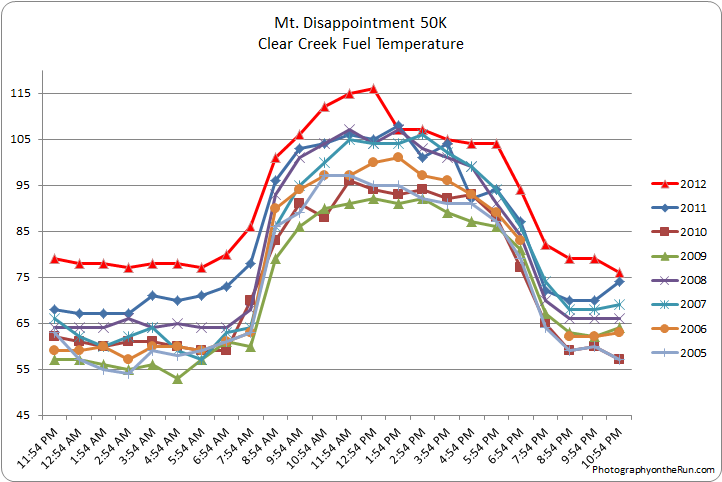
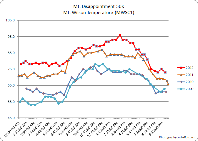
It was warm on the upper part of Kenyon Devore, but at least there was some shade. Last year’s race was unusually hot, but this year’s race was even hotter. This year the temperature (in the shade) on Mt. Wilson hit 86°F a little past 8:00 am and climbed to 96°F by the midafternoon. The temperature (in the shade) at nearby Clear Creek was over 90°F for most of the race, and “in the sun” temps topped out at 116°F!
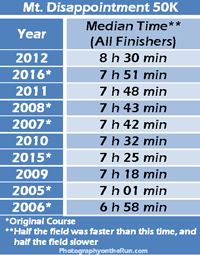 This was my eighth Mt. Disappointment 50K and by far the hottest and most difficult. How difficult? This year’s middle-of-the-pack time — the median time for all the finishers — was 8 hours 30 minutes. This was nearly 45 minutes longer than the median time in 2011, and 90 minutes longer than in 2006.
One of the main challenges of the Mt. Disappointment 50K is that it starts and ends on Mt. Wilson — the high point of the course. The original course was run from 2005 to 2008, but because of the Station Fire and Mueller Tunnel closure variations of the original course have been done since 2009. This year Mueller Tunnel reopened and we were able to do the part of the original Mt. Disappointment course that goes from Eaton Saddle up the San Gabriel Peak Trail to the shoulder of Mt. Disappointment and down to Red Box.
In this interactive Cesium browser View of the 2005-2011 courses the 2012 course followed the 2005-2008 (green) course to Red Box and then the 2010 (red) course for the remainder of the race. Checking a few GPS track files with SportTracks and using DEM corrected elevations, it looks like the 2012 course distance and elevation gain/loss were about the same as 2011.
Many thanks to Gary & Pam Hilliard, Fausto & Cindy Rowlan, and all of the Mt. Disappointment 50K Staff, volunteers, HAM radio operators, Sierra Madre SAR personnel, runners, and sponsors that helped to make this event happen! Check out the results and photos on the Mt. Disappointment web site!
Related post: Mt. Disappointment 50K 2011 Notes
I didn’t catch the late evening update of the forecast when the 20% chance of showers and thunderstorms in the San Fernando Valley was extended into Saturday morning, but the raindrops on my car and the towering cumulus to the west were pretty good clues that I might get wet on my run.
A friend was doing the Baldy Run to the Top course, but one week out from the Mt. Disappointment 50K I’d opted for something a little more moderate — a 13.1 mile keyhole loop through Cheeseboro Canyon from the Victory trailhead at Ahmanson Ranch. The Mt. Disappointment course has a lot of elevation gain, and today the 1,300′ of gain/loss on the Cheeseboro Canyon run sounded a lot better than the 3900′ gain/loss on Baldy!
It sprinkled on and off as I made my way out East Las Virgenes Canyon and up Las Virgenes Canyon. A little while after turning onto the single track that leads to Shepherds’ Flat, the rain drops grew bigger and soon after I was running in a shower.
It is a rare thing to run in the rain on an August morning in the Simi Hills. It added a dimension not often found here in Summer, dampening sun-parched chaparral and refreshing its scents, smells and colors.
I reached the junction at Shepherds’ Flat and turned south onto the Cheeseboro Canyon Trail. As if signaling my turn, thunder rumbled through the hills behind me. It sounded like the active cell was a few miles to the north — probably over Simi Valley. The running in upper Cheeseboro Canyon was outstanding. I was there early and the main wave of cyclists were still working their way up the canyon, after waiting for the Cheeseboro parking lot to open.
The rolls of thunder were now growing more distant, and from time to time a shaft of sunlight would break through the clouds. Along the trail laurel sumac and Datura had captured small puddles of water in the V of their leaves, and occasionally the sun would glint from one leaf and then another.
With the showers and clouds, the temperature was almost chilly. If only we could have cool weather for Mt. Disappointment! Not likely — the MRF medium range computer model was forecasting a heat wave in Southern California over the next several days. Inland temps were forecast to peak race day (Saturday) with temps at the lower elevations of the San Gabriel Mountains reaching around 100 degrees. Some clouds and an afternoon thunderstorm were a possibility, but the degree to which monsoonal moisture would be pushed up into Southern California was a big question mark.
Update Wednesday, August 8, 2012. Measured some temperatures on a run at Ahmanson yesterday. Temperatures generally ranged from about 103°F to 108°F. There was a pretty good breeze with a lot of mixing. These were temps out in the open a few feet off the ground. Even with the breeze ground temps in full sun were over 120°F. Today’s 12z and 18z NAM shows valley temps peaking on Friday, with a little cooling on Saturday. An increase in monsoonal moisture is forecast into Saturday above about 10,000′, but dewpoints/humidities below that level remain relatively low. Hot temperatures (95°F to 105°F) are still forecast for Saturday in the lower elevations of the San Gabriel Mountains.
Update Tuesday, August 7, 2012. Yesterday Woodland Hills tied the record high temperature for the date of 108°F. This morning’s NAM weather model forecasts warming to continue inland through at least Friday, and this morning’s MRF still has the hottest inland temps on Saturday. The amount of monsoon moisture is still uncertain. The high pressure system is in a position that could transport moisture into Southern California, but so far the models are not forecasting a strong monsoonal flow.
Some related posts: Las Virgenes Creek Near the Sheep Corral Trail, Classic Cheeseboro Canyon