Category Archives: weather|la nina

Looking for Snow in the Santa Monica Mountains

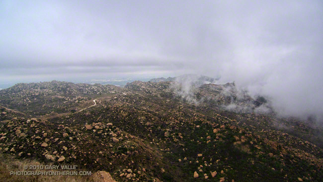
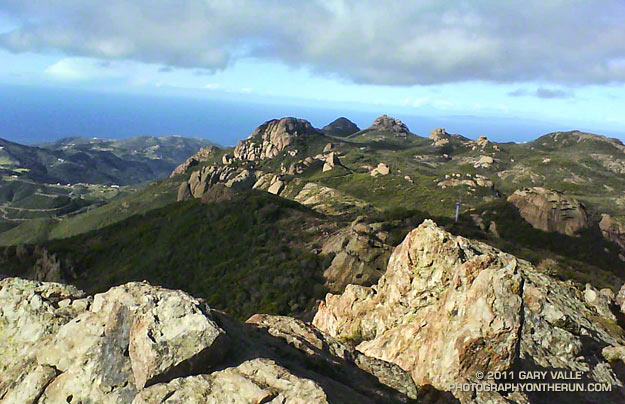
View from Sandstone Peak, the highest point in the Santa Monica Mountains

Perhaps the only thing more difficult than forecasting rain in Los Angeles is forecasting snow in Los Angeles. A NWS Winter Weather Advisory issued Friday evening for the Santa Monica Mountains Recreation Area forecast the snow level to drop overnight from above 3000′ to between 1000′ and 1500′. Snow accumulations from 1 to 3 inches were expected.

When getting ready for a run on those searing 100 degree days at Ahmanson Ranch, I look longingly at the Lasky Mesa snow photos from 1943 displayed in the information kiosk at the Victory Trailhead. Would that rare snow scene be repeated? If so, I wanted to see it. I’m a skier from way back, but snow in the hills near my Los Angeles area home is an altogether different thing.

Last weekend it looked like we might get some snow on the higher parts of Rocky Peak Road for the Bandit 15K/30K/50K trail runs. There was some snow on Oat Mountain, but not down to Rocky Peak. The Rocky Peak area is about 500′-1000′ higher than Lasky Mesa, so snow there isn’t quite as rare. The last time I ran in the snow on Rocky Peak Road was in December 2008, and before that in March 2006.
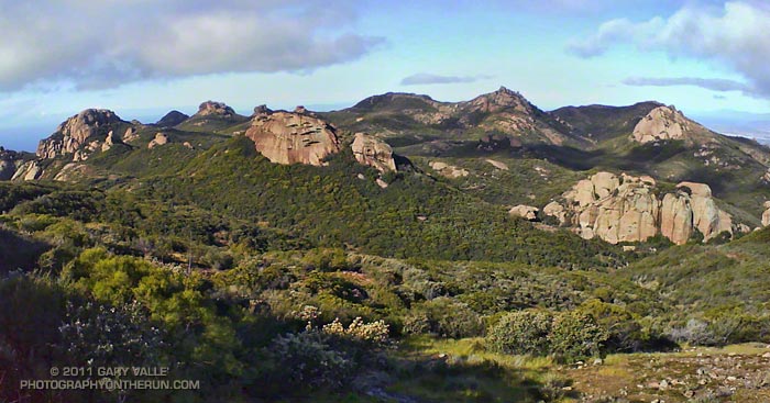


Snow is an iffy thing in the Los Angeles area. The ocean is the dominant moderating influence. Storms generally bring in air warmed by the ocean, and the coldest air often doesn’t move in until after most of the precipitation has ended. To get low elevation snow, the timing and conditions have to be just so. Whether it snowed or not, it looked like it would be an interesting weather day, so I planned to get up early and do a morning run.

At dawn the lack of snow on the local foothills made it plainly evident that all the ingredients required for very low elevation snow had not come together.  Overnight there had plenty of snow — four feet of it at 7500′ at Mt. Baldy — just not much low elevation snow. (Later in the day post frontal convection would produce some isolated showers of icy snow in the east San Fernando Valley and La Crescenta.)

On the off chance there had been a dusting of snow at the higher elevations of the Santa Monica Mountains, I decided to do the Mishe Mokwa – Backbone Trail loop and check out the conditions on 3111′ Sandstone Peak, the highest peak in the range.
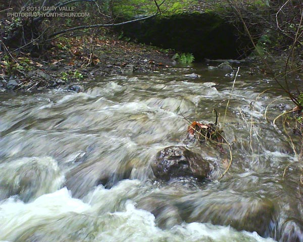


What a great morning for a trail run! When I started the loop, it was partly cloudy and the temperature at the Mishe Mokwa trailhead (el. about 2100′) was a chilly 37 degrees. The ground was soaked, and the chaparral wet with rain. Streams filled every gulch and gully, and the gorge along Echo Cliffs roared with runoff. Level sections of the Mishe Mokwa Trail were nearly one continuous puddle. Two creek crossings — one at Split Rock and another near the Backbone Trail — were wide enough to require wading.

Running the rocky trail with care, it took a little under an hour to reach the Backbone Trail junction. As I puffed up the trail toward Sandstone Peak, each exhalation was visible. I found myself reveling in each frosty cloud, as it would hang briefly in the morning sun, and then dissipate.

Although I could see no snow, it was cold enough that I thought there was a chance there might be some residual snow in the shade on the northwest side of the peak. Rounding the corner, I started up the makeshift stairs at the beginning of the spur tail leading to the summit. On top it was cold, windy, wet and spectacular, but — sigh — there was no snow.

Note: The rain from this storm pushed the water year rainfall total for Downtown Los Angeles to above the 100% mark. Although this might seem unusual in a La Nina influenced rain season, during two of the strongest La Ninas in the past 60 years — 1955-56 and 1973-74 — Los Angeles recorded 99% and 106% of normal rainfall.

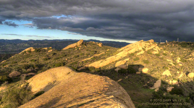
Departing Storm

Departing Storm

As skies cleared Monday afternoon, we thought we had put a wrap on the wet weather — at least for a while. But the Sunday-Monday system left a cutoff upper low spinning off the coast of Southern California, and as that low moves east over the next couple of days it could produce some showers.

That’s the way it’s been this rain season. Looking back through NWS rainfall data, since October 1 we’ve gone no more than 10 days at a stretch without measurable rain at Downtown Los Angeles (USC).

Even if our weather becomes more typical of what occurs during a La Nina episode, 81% of our normal annual rainfall is already in the bucket. To have an average year all we need is 2.86 inches between now and June 31. Downtown Los Angeles normally records about two-thirds of its annual rainfall in the months of January, February and March — around 10 inches — so (theoretically) 2.86 inches shouldn’t be hard to do. But we’ll see!

The title photograph is from a run in the Simi Hills on Monday.

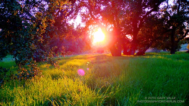
Oaks, Grass & Sun

Oaks, Grass and Sun

It’s unusual to see this much green in Southern California in mid November. The growth is the result of a wet October, with some areas recording several times the normal amount of rainfall.

Although water year rainfall totals for many areas of Southern California are still near or above normal for the date, November is the customary start of the rain season, and so far this month, we’ve been drier than normal.

That might change this weekend. Models have been having a tough time with the evolution of a low and trough that is already producing rain and snow in the Pacific Northwest. In true La Nina fashion, the high amplitude flow might result in the southern part of the trough being more offshore (wetter), or more onshore (drier), as it sets up over the West. We’ll see!

The photograph is from this afternoon’s run in the Simi Hills.

La Nina and the 2010-2011 Southern California Precipitation Outlook

Clouds on Rocky Peak road

The second of two vigorous upper level lows to batter Southern California this Autumn has pushed the water year rainfall totals for many stations around the area to above normal.  Does that mean we’re likely to see the wet weather continue through the 2010-2011 rain season?


Probably not. Since last Winter, ENSO conditions in the equatorial Pacific have flip-flopped. The Multivariate ENSO Index (MEI) has plunged from the fifth strongest El Nino for Feb/Mar to the strongest La Nina for Aug/Sep. The Aug/Sep value of the MEI is the lowest since Jul/Aug of 1955. Generally, El Nino conditions result in wetter weather in Southern California, and La Nina drier.

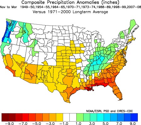
A precipitation composite for eight years in which ENSO was transitioning from El Nino or Neutral conditions to La Nina indicates that “on average” the coastal Southern California climate division recorded about 4 to 5 inches less precipitation than normal for the period November through March. The percent of normal water year rainfall recorded at Downtown Los Angeles (USC) ranged from a low of 53% (1988, 8.08″), to a high of 99% (1973, 14.92″). The average rainfall for these years was 77%, or 11.7″.

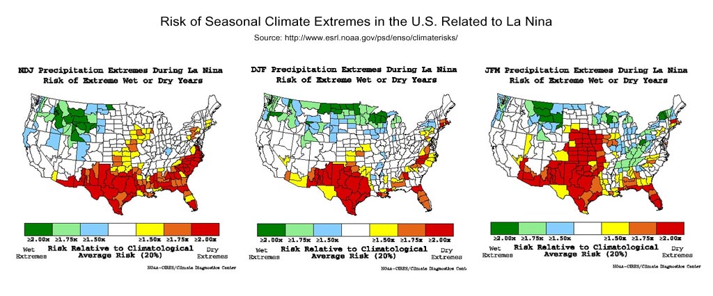
Maps generated using the ESRL/PSD page Risk of Seasonal Climate Extremes in the U.S. Related to ENSO do not indicate a higher than normal risk for an extremely dry rain season in Southern California when La Nina conditions are present.


0

La Nina composites from CPC’s ENSO Temperature & Precipitation Composites page suggest the period Jan-Feb-Mar may be particularly dry, but this is not reflected in CPC’s official seasonal precipitation forecasts.

CPC’s Three-Month Precipitation Outlooks and NOAA Winter Outlook were updated yesterday. The precipitation outlook for Nov-Dec-Feb in the Coastal Southern California climate division shows equal chances of above average, near average, or below average precipitation. As the rain season progresses, these probabilities become only slightly skewed toward below normal precipitation. The skew becomes more pronounced in Feb-Mar-Apr when the probability of below normal precipitation increases to 45%.

The title photograph is from Sunday’s out and back run from Chatsworth Reservoir to Rocky Peak.