
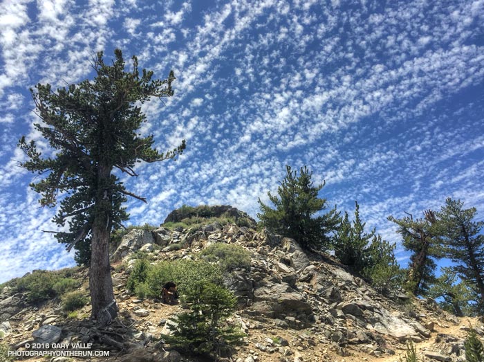
Crest and clouds on the Pacific Crest Trail at 8900′ near Mt. Burnham in the San Gabriel Mountains. From Saturday’s 30 mile training run on the PCT and AC100 course.
Temps were a bit more manageable on Saturday than Sunday. Saturday the Big Pines RAWS (6964′) recorded a high of 79°F with an “in the sun” temperature of around 101°F. Sunday the Big Pines high was 89°F with a sizzling “in the sun” temperature of about 109°F.
In addition to the air temperature many Remote Automated Weather Stations (RAWS) report the fuel temperature. The air temperature is the temperature inside a ventilated, sun-shielded enclosure approximately 6 ft. off the ground. The fuel temperature is the temperature of a pine dowel in full sun near the ground. The fuel temperature is a good indicator of the much higher temperature runners and hikers can experience in exposed areas facing the sun.
Some related posts: Postcard Weather on the Pacific Crest Trail, What’s the Current Weather on the AC100 Course?