Angeles Crest Highway was still closed between Red Box and Vincent Gap, and the heatwave continued. I was trying to decide where to run.
I briefly considered the Circuit Around Strawberry Peak, but yesterday at 10:00 a.m., the “in-the-shade” temperature at Clear Creek was already 92°F, and the “in-the-sun” fuel temperature 109°F. By 1:00 p.m., the fuel temp reached a scorching 122°F!
Although trailheads such as Three Points and Islip Saddle couldn’t be accessed using Angeles Crest Highway, the highway was open from Wrightwood to Inspiration Point and Vincent Gap. After seeing the temps at Clear Creek, it took about two seconds to make the decision to head to the San Gabriels’ high country.
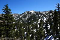
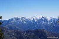
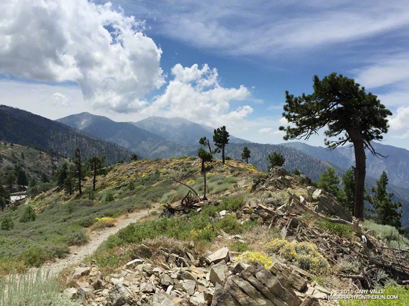
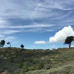
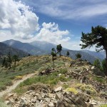
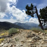
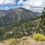
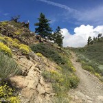
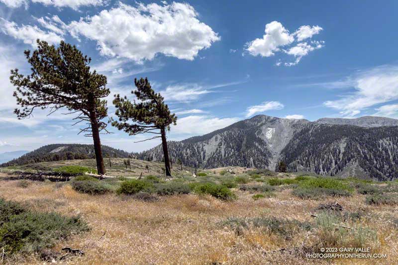
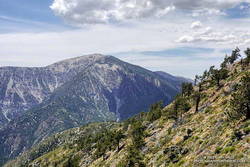
From Inspiration Point (7,365′), I ran east on the PCT about 7 miles to the North Backbone Trailhead on Mt. Baldy. Over most of that stretch, the temperature was a blissful 60-something degrees. Other times, I’ve driven to this trailhead — which requires a high-clearance vehicle — or run to the trailhead from Wrightwood. But the run along Blue Ridge is a favorite. It is especially scenic, with fantastic views of Mt. Baden-Powell, Iron Mountain, Pine Mountain, and Mt. Baldy.
About a quarter-mile east of the top of the Acorn Trail, the PCT passes within a few feet of one of the Wright Mountain landslides. The canyon-size landslide is prehistoric, but smaller landslides and mudflows occur periodically within the primary scar. The debris cone of a dramatic 1941 mudflow is an unmistakable feature on satellite photos.
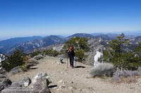
Less than a mile beyond the overlook of the landslide, I left the PCT and jogged down to the North Backbone Trailhead. After a short descent, I started up the steep use trail toward Peak 8555. On the way up, San Gorgonio Mountain and San Jacinto Peak were visible in the haze to the east.
Peak 8555 is the first high point on Baldy’s North Backbone. It is an idyllic spot with a great view of Mt. Baden-Powell and the surrounding terrain. But you might not want to linger here in a thunderstorm — spiral scars on the trunks of trees suggest the point is repeatedly struck by lightning.
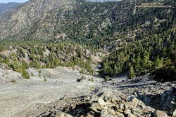
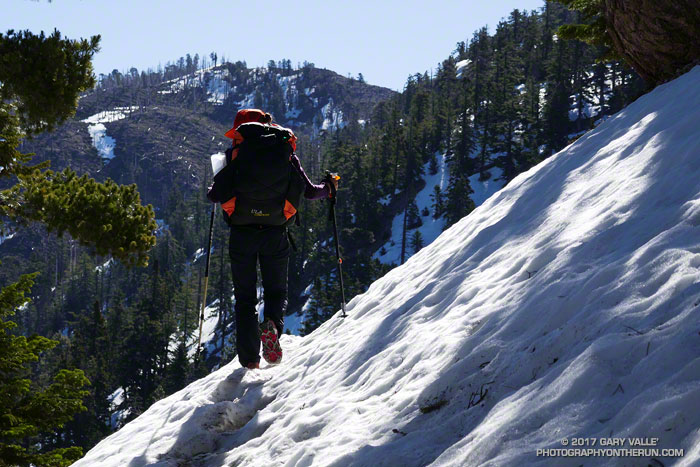
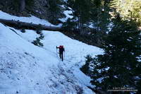
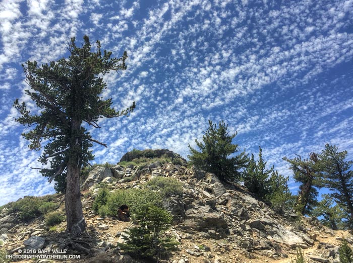
Following a short descent, I resumed climbing the steep, somewhat loose ridge. After about ten minutes, I scrambled onto the crest of the ridge and crossed the top of a prominent, rocky chute. More than a thousand feet below, avalanche-hardened snow gleamed white in the sun at the base of the chute.
Another 10 minutes of climbing and I reached the Pine Mountain Juniper. Straddling the rocky crest at an elevation of about 9000′, this stalwart tree is estimated to be 800 – 1000 years old. It is a remarkable tree in a remarkable location. Except for one short, steep, eroded section, the remainder of the trail to the top of Pine Mountain (9648′) was relatively straightforward.
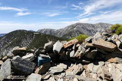
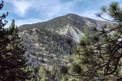
Pine is the second-highest peak in the San Gabriels and has excellent views of the surrounding terrain. It is higher than Mt. Baden-Powell (9399′) and Dawson Peak (9575′) but a few hundred feet lower than Mt. Baldy (10,064′).
From Pine Mountain, the North Backbone trail continues over Dawson Peak another 2.5 miles to Mt. Baldy. There was still a long ribbon of snow along the east side of the upper North Backbone, but it looked like the trail might avoid it. I would have liked to confirm that, but today the top of Pine was my planned turnaround point. As it was, with the warm weather, I thought I might run short on water on the return to Inspiration Point.
Leaving Pine behind, I started back down — jogging when it made sense — but trying not to do anything stoopid. On the way down, I kept reaching behind me and squeezing the bladder in my hydration pack. I guess I was hoping that it would magically be more full than the last time I checked. It never was.
Back at the North Backbone Trailhead, and definitely low on water, I decided it was a good time to run the dirt road back to the top of the Acorn Trail and see how much shorter it was than the PCT. The answer was not much — only about a tenth of a mile.
I’d been willing to push the water envelope because it had been a heavy snow year. I expected the spring near Guffy Camp would probably be running. I’d passed the side trail to the spring a bunch of times but never ventured down the steep slope. My impression was that the spring was often low or nearly dry. This time when I reached the side trail, I headed down.
And down and down… It sure seemed like a long way to the spring, but when I checked the track, it was less than a quarter-mile with an elevation loss of about 200′.
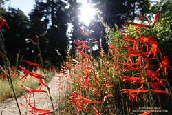
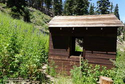
As I walked up to the spring, a flurry of birds scattered in every direction. Eight-foot-tall larkspurs surrounded the spring, and an old pump house was adjacent to it. While not exactly gushing, the flow from the spring was more than adequate and refreshingly cold. I drank several cups of water and added some to my hydration pack.
Back on the PCT, the temperature was generally in the mid-eighties but was warmer on south-facing slopes. At about 1:00 p.m., the in-the-sun fuel temperature at the Big Pines RAWS was 109°F. I was very happy to have the extra water.
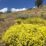
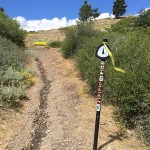
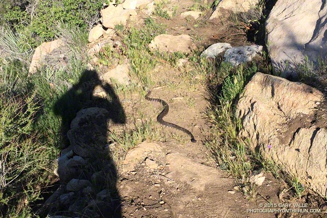
Here are a few photos from the out and back trail run to Pine Mountain from Inspiration Point.
Explore the scenery and terrain of this out-and-back trail run and hike from Inspiration Point to Pine Mountain using our high resolution, interactive, 3D viewer. The imagery is so detailed, it’s almost like being there! To change the view, use the control on the upper right side of the screen, the CTRL key and your mouse, or touch gestures. Track and placename locations are approximate and subject to errors. Snow, ice, poor weather, and other conditions may make this route unsuitable for this activity.
Some related posts: Inspiration Point to the Pine Mountain Juniper and Pine Mountain, Mt. Baldy from Wrightwood Via the Acorn and North Backbone Trails, North Backbone Trail Revisited