The out and back to Mt. Baden-Powell from Islip Saddle has become a springtime running ritual for me. Sometime in April, May or June, I like to get back to the high country, and see what there is to see — including whether there’s any snow left on Baden-Powell or Mt. Baldy.

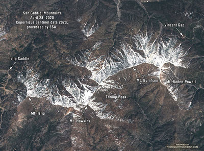
Sentinel satellite imagery showed a lot of snow along the crest at the end of April, but hot weather and dry winds in May accelerated the melt. By early June most of it was gone. It didn’t seem likely I would see any today.
I hadn’t seen any snow along the trail this morning. I’d run past Little Jimmy Camp, Windy Gap, Peak 8426, and was now at an elevation of about 8700′, near Mt. Hawkins. Above me, I could hear the excited voices of a couple of hikers near its summit. Thinking they might be part of a group, I looked up the trail toward the crest.
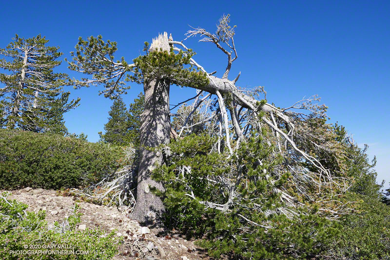
Something was missing… Where was it? Usually prominent on the skyline at this point, the “Mt. Hawkins Lightning Tree” was gone. I walked up the trail to look for the familiar landmark. The trunk of the lightning-scarred Jeffrey pine had been snapped like a twig. The crown of the tree lay 50 yards down the steep slope, jammed against two trees.

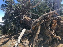
It must have been a hard Winter. Several other live trees along the crest between Mt. Hawkins and Mt. Baden-Powell were either blown down or broken in half. In some cases, the damaging winds appeared to be from the south side of the crest and in others from the north. December 2019 was stormy in Southern California, particularly around Christmas. Weather data suggests this might have been when most of the damage was done.
Today, only two large trees blocked the trail. One, on the west side of Mt. Burnham, was easy to go under or around, but the other, west of Throop Peak, was a bit more of a challenge. Given the brush on either side, climbing over the tree worked for me. Some others had detoured well above or below the tree.

Surprise, surprise! It turned out there were a couple of small patches of snow on the north side of the crest near Baden-Powell. These were the remnants of an area of wind-deposited snow on the lee (north) side of the crest between Mt. Baden-Powell and Mt. Burnham. Large drifts can collect here, and in a heavy snow year, can persist into July. The deposition area can be seen in the Sentinel satellite image.
With its long views, sub-alpine elevation, and weather-worn limber and lodgepole pines, Baden-Powell is a rewarding summit. Just a few miles to the southeast, Mt. Baldy looms above a mile-deep canyon. If the visibility is good, San Jacinto Peak and San Gorgonio Mountain can be seen beyond Mt. Baldy, many miles in the distance.
The distance from Islip Saddle to Mt. Baden-Powell (9,399′), and back, is about 16 miles. The cumulative elevation gain is about 3800′. Here’s an interactive, 3D view of the out and back route.
Trail note: I ran into a “misplaced” hiker that didn’t know what trail they were on or where they started. Take the time to familiarize yourself with the adventure you have planned!
Some related posts: Mt. Hawkins Lightning Tree (2008), No Worries About Snow Flurries (2019), Mid January Trail Run from Islip Saddle to Mt. Baden-Powell (2014), Snowless San Gabriels (2007)
