Seeing Red

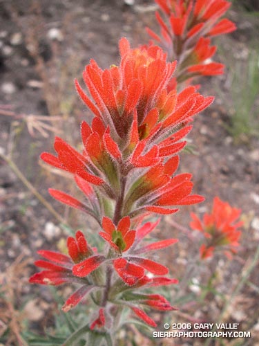
Indian Paintbrush (Castilleja affinis) in Cheeseboro Canyon.

In this case, Indian Paintbrush (prob. Castilleja affinis), Scarlet LarkSpur (Delphinium cardinale), and Indian Pink (Silene laciniata) in the Cheeseboro Canyon area of Southern California.

As is the case with many wildfires, one of the side effects of the 2005 Topanga Fire has been to promote a population explosion in many species of wildflowers. Scarlet Larkspur has been especially prevalent in some areas, such as upper Cheeseboro Canyon.

These photos were taken on a run to Simi Peak from the Las Virgenes Rd. trailhead of the Upper Las Virgenes Open Space Preserve on June 11, 2006. I like to go out via upper Las Virgenes Canyon, and come back through Cheeseboro Canyon. This variation is about 16 miles, with an elevation gain and loss of about 2000 ft. The run can be extended to about 21 miles by starting at El Scorpion Park, near Vanowen and Valley Circle. Following are links to trail maps for Upper Las Virgenes Canyon Open Space Preserve and Cheeseboro/Palo Comado Canyons.

Related post: Simi Peak Out & Back

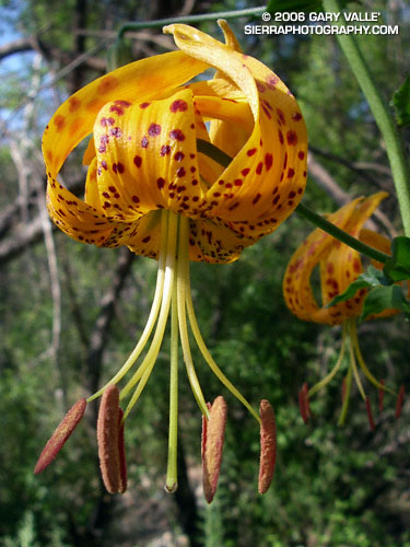
Humboldt Lily

Humboldt Lily (Lilium humboldtii ssp. ocellatum) in Upper Las Virgenes Canyon Open Space Preserve.

I had been running for nearly an hour, and the heat was oppressive. Following an unusually cool Spring, it had been tough to adjust to afternoon temperatures of nearly 100 degrees. Running from the Victory Trailhead of the Upper Las Virgenes Canyon Open Space Preserve, the exposed “main drag” had been like an oven. The refreshing green hills of Spring had turned a golden brown, and the muddy ruts of a Ranger’s truck had been baked to the hardness of concrete. In Las Virgenes Canyon there had still been a little water in the creek, and I had scooped water into my hat and poured the cooling liquid over my head and down my back.

That had been a couple miles ago. Now the best the stream could do is turn the trail sandy as it snaked along the canyon. Running through the broken shadows of Oaks, Willows and Sycamores, I rounded a corner, and could only exclaim, “Wow!”

If the red of a Snow Plant is startling to see on the forest floor, then seeing the gold and burgundy of a Humboldt Lily (Lilium humboldtii ssp. ocellatum) in a shaded corner of this sizzling landscape is at least surprising. This showy lily is a California native, not an escaped ornamental. It occurs sporadically in shaded canyon bottoms, often near stream courses. Because of its specific habitat, it is relatively uncommon. As a result it is listed in the California Native Plant Society’s Inventory of Rare and Endangered Plants as being uncommon and fairly endangered in California.

(Photograph from yesterday, June 22, 2006.)

Old Santa Susana Stage Road

Old Santa Susana Stage Road

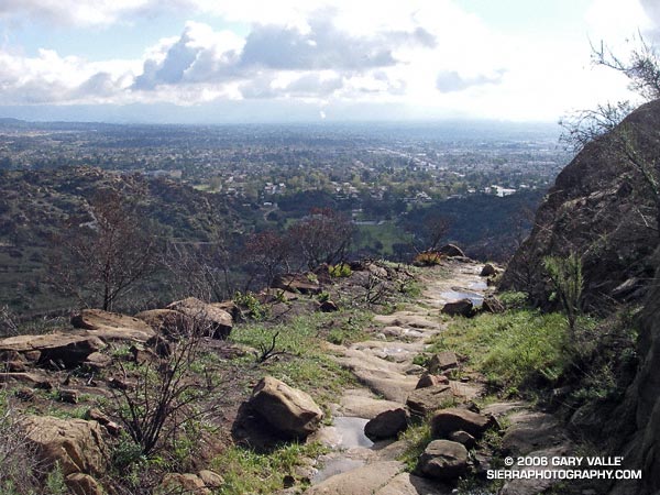
Running or hiking up the Old Santa Susana Stage Road, if you stop and listen carefully, you may hear a sharp whistle, a raspy shout, or a few choice expletives echoing from the canyon walls. It would have taken a barrage of such oaths, and a lot more, to get a stage up and over this harrowing grade.

The image of the Simi Pacific Coast Stage in the book Simi Valley: A Journey Through Time, helps to complete the mental picture. Steep, narrow, and unforgiving, the Stage Road must have produced stark terror in more than a few passengers.

Established in 1861, the “Devil’s Slide” stage road was a link in the Pacific Coast Stage Line between Los Angeles and San Francisco. It follows the route of the original Spanish trail connecting the San Fernando and Santa Buenaventura Missions. Prior to the arrival of the Spanish, the route is said to have been “an old Indian trail,” connecting Chumash communities in Simi Valley to Gabrielino communities in the San Fernando Valley.

Old Santa Susana Stage Road is located in Santa Susana Pass State Historic Park. The park was created in 1998 to protect the Stage Road and other cultural resources in the area. A General Plan characterizing the purpose and long-term vision for the park is in under development, and through a series of meetings, public input on the plan is being requested. The second such meeting is scheduled for Tuesday, June 20, 2006 at 8:30 P.M. at Chatsworth Park South. See the General Plan web page for additional details.

There is currently no “official” trail leading to the Stage Road. Since the area was burned in the Topanga Fire last Fall, it’s important to stay on existing dirt roads and trails to help promote recovery, and avoid damaging sensitive habitat or species.

(Photograph from a run on February 19, 2006.)

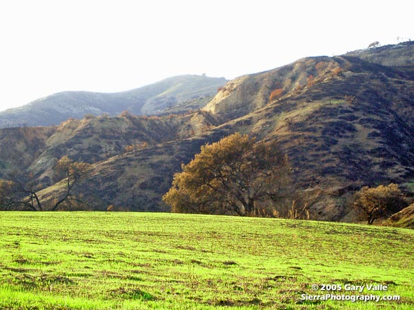
New Grass at Ahmanson Ranch Following the Topanga Fire

New sprouts of grass at Ahmanson Ranch less than a month after the Topanga wildfire burned 24,175 acres in the Simi Hills, northwest of Los Angeles.

New sprouts of grass at Ahmanson Ranch less than a month after the Topanga wildfire burned 24,175 acres in the Simi Hills, northwest of Los Angeles. More photos and information regarding the Topanga Fire can be found in my Coyote Oak Journal article The Topanga Fire, Part I: Rain, Wind and Fire. (Photo from October 25, 2005.)

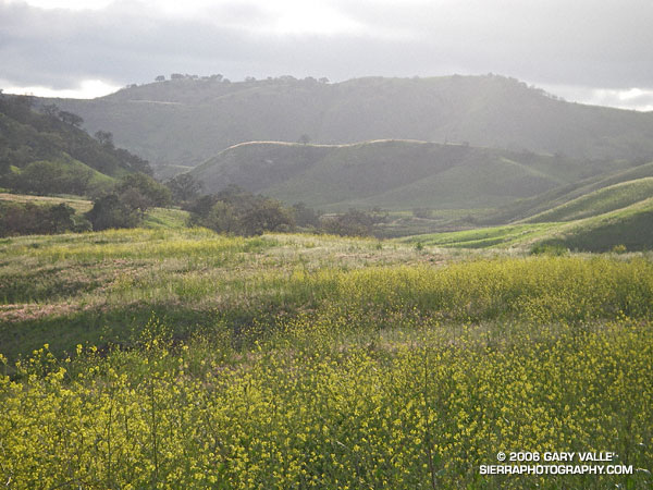
Chumash Trail Snow

Snow along the Chumash Trail - March 11, 2006
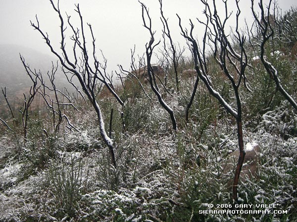
Snow along the Chumash Trail – March 11, 2006

Snow highlights skeletal fingers of burned chaparral along the Chumash Trail in eastern Simi Valley. The chaparral was burned in the 2003 Simi Fire. More info and a couple of additional photos can be found in my Coyote Oak Journal entry Chaparral Snow.

Related post: Chumash Trail Rocks & Snow (December 2008)