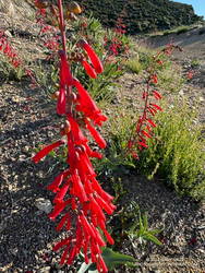
The repeated cries of a falcon called from high on the north face of Strawberry Peak. Along the sandy trail, lupine, paintbrush, penstemon and yarrow bloomed in a profusion of blues, reds, and yellows. Tracks from running shoes, bikes, boots, and a black bear proclaimed the trail to be truly multi-use.
I sighed and took it all in. I’d been doing this classic 16-mile route for more than 20 years. A favorite of mountain bikers and runners alike, the loop can be broken down into the following segments.
Josephine Fire Road Climb
From the Clear Creek Trailhead, Josephine Fire Road climbs about 1250′ over 2.5 miles to a divide connecting Josephine and Strawberry Peaks. At the junction, the route turns right (east) onto a trail along the divide that goes to Josephine Saddle. A left (west) turn goes to Josephine Peak.
On the way up from Clear Creek, the switchbacks on the fire road look intimidating, but the climb goes relatively quickly. There are good views of Strawberry Peak along the way. In the Spring and early Summer, the bright yellow flowers of invasive Spanish broom line the road.
An out-and-back ascent of Josephine Peak from the junction adds about three miles to the loop.
There is a Remote Automated Weather Station (RAWS) at Clear Creek Station. The “2.0m Temperature” is more or less the temperature in the shade and the “Fuel Temperature” is a good indicator of the temperature in the sun.
Colby Canyon Trail
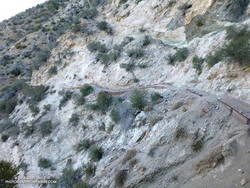
The route joins the Colby Canyon Trail at Josephine Saddle. A large cistern is found here. Just past the saddle, the climber’s trail to Strawberry Peak branches off the main trail and goes up the ridge. The Colby Canyon Trail contours along the left (northwest) side of the ridge and traverses a steep slide area. After that, it works around the shoulder of Strawberry, then turns east and descends, winding in and out of the small canyons on the northwest and north slopes of Strawberry.
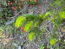
In the Spring and Summer colorful patches of lupine, paintbrush, and other wildflowers are found on this stretch of trail. Long-limbed big cone Douglas-firs grow on these cooler north-facing slopes.
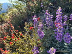
The bare trunks of trees burned in the 2009 Station Fire are mixed in with surviving trees. Today, I was surprised to find another reminder of the Station Fire — poodle-dog bush. The plant can cause a poison oak-like rash and was much more common following the 2009 Station Fire.
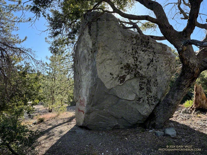
On this stretch, the large rock face on the north side of Strawberry Peak comes into view, and shortly after, the trail passes a huge boulder. The flattish area that follows is Strawberry Protreo. The “meadow” reminds me of lower elevation areas of the Southern and East Side Sierra.
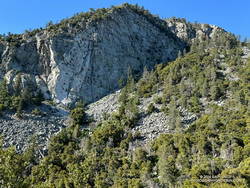
Several climbing routes have been done on Strawberry’s formidable north face. The consensus seems to be that the rock quality is poor and the risk high.
Beyond Strawberry Protreo, the trail descends along the margin of a moraine-like landslide. Then it turns south, reaching a flat, sandy area just before the Colby Canyon Trail – Strawberry Trail junction. I’ve often seen bear tracks on this stretch of trail. The loop takes the right fork onto the Strawberry Trail and climbs to Lawlor Saddle.
Climb to Lawlor Saddle
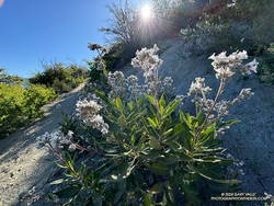
The Strawberry Trail gains about 750′ over two miles on its way to Lawlor Saddle. As the post “Trail Games” mentions, this stretch will tell you a lot about how your day is going. It dips in and out of side canyons, passing Strawberry Spring along the way. Today, Strawberry Spring was running, but the spring was dry during our recent drought. It is generally not a dependable water source.
Lawlor Saddle to Red Box
The 2.5 miles to Red Box are enjoyable single-track trail. Most of it is flat or downhill. On the weekend, numerous hikers are on the trail, heading up to climb Strawberry Peak. It is by far the busiest trail on the loop.
There’s a water faucet at Red Box at the Haramokngna American Indian Cultural Center which generally (but not always) has water.
Gabrielino Trail to Switzer’s
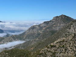
The 4.4 miles down to Switzer’s include some fast-paced stretches and some of the most technical sections of the loop. It is popular with mountain bikers and V-ed and rutted in places. At one point, the trail drops down to the stream (if it’s running) and crosses the creek twice.
Among the many wildflowers found along this trail is crimson-spotted rock rose.
As the trail nears Switzer’s, derelict nature signs are seen along the trail, which the Forest Service apparently can’t afford to repair or remove.
Nature’s Canteen Trail to Clear Creek
The Nature’s Canteen Trail is roughly half a mile long and connects Switzer’s to Clear Creek. It starts a third of a mile up the steep access road between Switzer’s and Angeles Crest Highway. The trail is sometimes overgrown.
Strawberry Peak Variation
There is a more adventurous variation of the Strawberry Peak Circuit that goes over the top of Strawberry Peak instead of around it. This variation requires good route-finding and rock-climbing skills.
Some related posts:
– Showers on the Strawberry Peak Circuit
– Strawberry Peak Summit Loop – Spring 2023 Update
– Strawberry Peak Circuit
