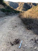
Running south in upper Las Virgenes Canyon, I’d passed the connector to Cheeseboro Canyon and was nearing Las Virgenes Creek. Before reaching the creek, I turned left off the main road onto a path that has a log bridge across the creek.
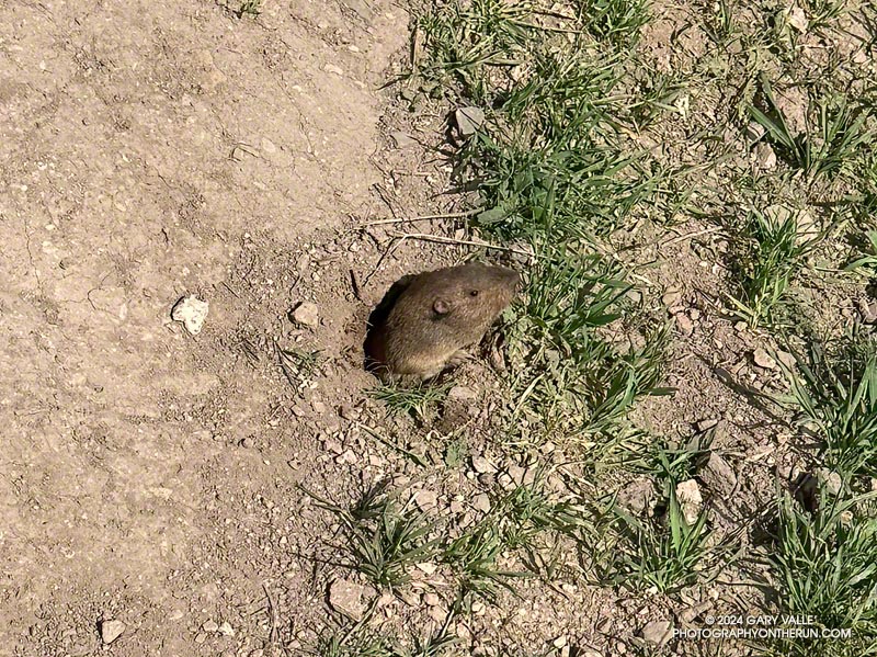
As I stepped onto the berm at the edge of the road, I caught a glimpse of something small and furry moving at my feet. I stopped and stepped back.
That’s when the vole poked its head from a burrow. I could almost see it squinting as it assessed whether or not I was a threat. Deciding to continue foraging, it emerged from the hole as far as it dared, and worked to free a small clump of grass at the margin of the burrow. Mission accomplished, in a flash of fur it returned to its burrow.
Bighorn sheep blend into the rocky terrain near Windy Gap
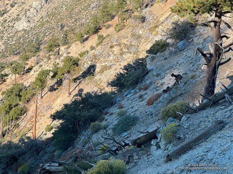
Had they not dislodged some rocks, I doubt I would have seen the three bighorn sheep in the photo above. They are easier to see in this zoomed-in photo of the sheep descending the rocky slopes just below Windy Gap (7,588′) in the San Gabriel Mountains. They crossed a brush-covered rib and disappeared from view.
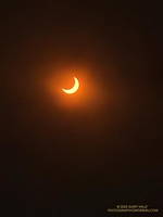
The partially-eclipsed sun crests a ridge east of Windy Gap.
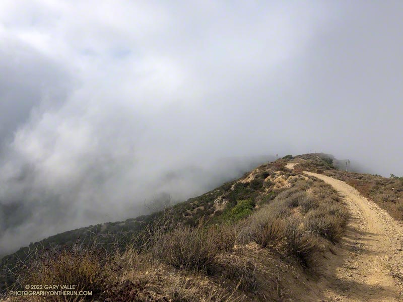
A few minutes after seeing the sheep, I reached Windy Gap and stopped to put my arm sleeves away. It had been cool at the trailhead — about 40 degrees — but the temperature had warmed as I worked up the trail. As its name suggests, the wind can be fierce at Windy Gap, but this morning there was almost no wind, foretelling nearly ideal weather for today’s adventure.
Windy Gap was still in shade, and the sun was just peeking over the ridge to the east. You couldn’t tell, but the eclipse had already begun. The eclipse would be nearly total in parts of Oregon, Nevada, Utah, New Mexico, and Texas. In the Los Angeles area, the moon would obscure more than 70% of the sun’s disc.
Partially eclipsed sun.
From Windy Gap, I headed east on the Pacific Crest Trail toward Mt. Hawkins. From time to time, I would stop and check the progress of the eclipse using eclipse sunglasses. In sunny areas, I looked for lensed images of the sun in the shadows of trees but didn’t see any. Having needles instead of leaves, conifers don’t produce the myriad images of the eclipsed sun seen under trees with leaves.
With nearly three-quarters of the sun obscured, the light from the sun had become enfeebled. The feeling was more than that of a cloud passing in front of the sun. I stopped and listened… to nothing. It was eerily quiet. No birds called or sang, and only chill zephyrs of wind wafted about the area. Somehow, the sun was broken.
The south ridge of Mt. Lewis can be accessed from the CalTrans shed at Dawson Saddle.
As the eclipse slowly waned, I continued east in the corrupt light, past Mt. Hawkins and Throop Peak, to the PCT’s junction with the Dawson Saddle Trail. In what seemed fitting for the day, instead of continuing to Baden-Powell, I turned left and headed down the trail toward Angeles Crest Highway (Highway 2).
Why? Angeles Crest Highway was closed from Red Box to Vincent Gap, transforming Dawson Saddle into one of the more isolated areas of the Angeles National Forest. I hadn’t been on the Dawson Saddle Trail in years, and with Highway 2 closed, it would be a quirky way to climb Mt. Lewis. Instead of having one of the shortest approaches in the San Gabriels — a few feet from the CalTrans shed at Dawson Saddle — it would involve a trail run of nearly eight miles just to get to the base of the peak.
Angeles Crest Highway from the shoulder of Mt. Lewis.
The eclipse was nearly over when I reached the bottom of the Dawson Saddle Trail on Highway 2. From the trailhead, I ran up an empty Angeles Crest Highway a short distance to Dawson Saddle. Mt. Lewis’ south ridge was accessed from here.
Only about a half-mile long, the south ridge isn’t technical, but the first third is steep and rocky. The elevation gain from the saddle to the summit is about 500′. Offset from the crest of the San Gabriels, the flat summit of Mt. Lewis has unique views of the crest extending from Mt. Baden-Powell to Mt. Islip and beyond.
After a few minutes enjoying the summit, I turned southward and began working my way back down to Angeles Crest Highway, up to the PCT, over to Windy Gap, and back down to the trailhead in the Crystal Lake Recreational Area.
Low clouds spilling over Rocky Peak Road near the Chumash Trail.
Wait a minute… I stopped running down the hill and walked back to look at the sizable pile of scat.
I was on Rocky Peak Road, at about mile 3 of an extended version of the Chumash – Las Llajas loop, and just past the top of the Chumash Trail.
Bear scat on Rocky Peak Road. Click for a larger image.
No doubt about it. It was bear scat. The bear had been eating holly-leaved cherries, and the scat was full of cherry pits. Over several decades of running Rocky Peak Road, this was the first time I’d seen evidence of a bear in the area.
This morning, I looked for bear tracks around the scat, but thunderstorms and bike traffic had erased them. After taking a couple of photos, I continued toward the high point of the loop, “Fossil Point.”
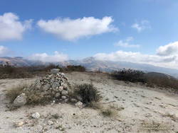
Cairn at “Fossil Point” — the highest point of the Chumash – Las Llajas Loop.
What had started as a very foggy morning was transitioning to a cool Fall day with a mix of sun and clouds. From the cairn at Fossil Point, Oat Mountain was still partially shrouded by clouds. Below the overlook, I spotted a couple of mountain bikers working up the road. The ride up Las Llajas Canyon has become a popular e-mountainbike ride, and e-bikes would be the only type of bike I would see on my way down the canyon.
The run down Las Llajas Canyon was pleasant and fast-paced. Lately, I’ve been doing a variation of the loop that jumps over to the Marr Ranch Trail using a trail that splits off the Coquina Mine trail. This route gets you up and out of the canyon and onto a ridge with good views of the surrounding terrain. It’s a bit more adventurous and adds a little mileage and elevation gain to the usual loop. The Coquina Mine trail is easy to miss — it branches off Las Llajas Road after passing the towering cliffs.
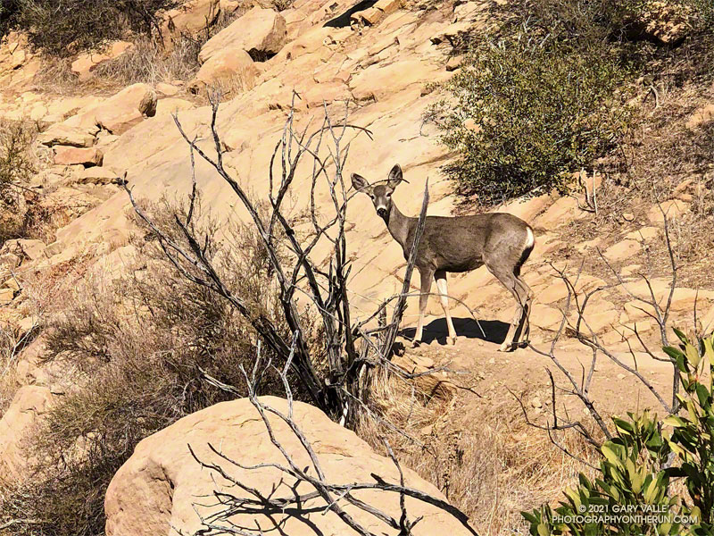
I saw a flash of brown through the bushes on the trail ahead. I stopped as a deer emerged from a switchback. The doe was walking slowly up the trail with her mule-like ears turned back toward me. I said something like, “Where are you going?”
She turned toward me and stared quizzically. As I slowly pulled the phone from my pack, I continued to talk. Her expression was a mix of caution and curiosity. It was as if she couldn’t quite make up her mind what I was about.
Mule deer at Trippet Ranch
This was peculiar behavior for a deer in this area. It wouldn’t be so strange if I was at Trippet Ranch. The deer there graze around the oaks and grasslands near the parking lot and are used to seeing people. But in decades of running the Chumash Trail, I’ve only occasionally seen deer, and they have always been skittish and quick to react.
This doe watched me as I slowly walked around the bend and toward her. I was reminded of a friend’s experience, when he was hit on the shoulder by a spooked deer. Not wanting to force a reaction, I stopped. The deer casually stepped off the trail and disappeared down the ravine.
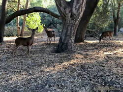
Later, running down Las Llajas Canyon, I was startled by the sound of something large moving in the brush. This time I got only a fleeting glimpse, as the deer bounded uphill through the trees, rocks, and brush.
The rattlesnake track above was one of several snake tracks on Eagle Springs Fire Road this morning. This area, which is below Eagle Rock in Topanga State Park, was severely burned in the May 2021 Palisades Fire.
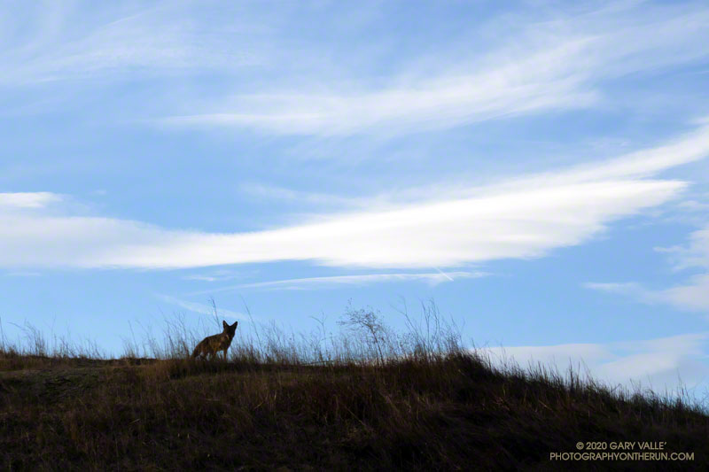
This afternoon I was running down a single-track trail at Upper Las Virgenes Canyon Open Space Preserve (Ahmanson Ranch), when I noticed a coyote on a parallel track across a small ravine. From time to time I would stop and watch the coyote, and from time to time it would pause and watch me. After a few minutes, it went its way, and I went mine.
Earlier in the run I’d been in the same area when a coyote, running at full speed, came blasting down a single-track trail. It turned into the brush about 30 yards in front of me. I’d seen similar behavior once before when one coyote was chasing another. In this case a hiker followed the coyote down the trail. In my experience, it usually take more than a simple encounter with a hiker to panic a coyote.
Another curious coyote. Click for a larger image.
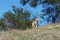
Update February 18, 2021. The coyote pictured on the right was in the same area as the coyote in the title photo. When I first encountered the coyote, it had just crossed the trail and was below me. For some reason it reversed its course and climbed to a viewpoint above me, and watched as I ran up the trail. After a few moments it ran back down hill, retracing its original course across the trail. It was one of the most well-conditioned coyotes I’ve seen out at Upper Las Virgenes Canyon Open Space Preserve (Ahmanson Ranch).
I have had a couple of unusual encounters with coyotes out at Ahmanson. One time, a coyote decided to run with me, as if on a leash.