Also from the run yesterday evening.

Also from the run yesterday evening.
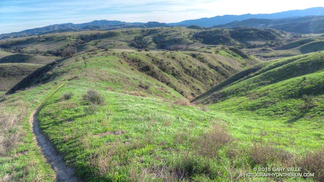
East Las Virgenes Canyon from Lasky Mesa. The hilltop in the background is the highest point of Ahmanson Ranch.
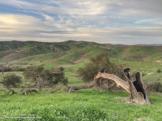
Last year on this date (January 14) Downtown Los Angeles (USC) had recorded just under an inch of rain for the water year beginning July 1. Here’s what it was like out at Ahmanson Ranch, near upper Las Virgenes Canyon, on January 14, 2014.
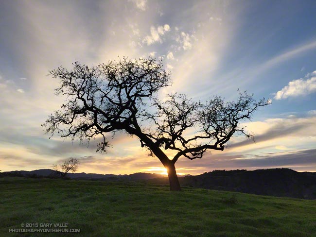
Today’s photo was also taken at Ahmanson Ranch, the difference being that this year, as of January 14, Downtown Los Angeles has recorded 5.64 inches of rain since July 1, which is about 98% of normal.
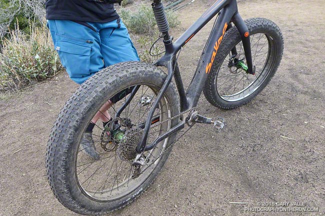
As I was chugging up the Strawberry Peak Trail toward Lawlor Saddle, I heard Craig say something about a mountain biker. That’s no surprise on this trail, but what was surprising was the bike he was riding. When we got to the saddle I asked him about it.
The tires are big, but low pressure, negating the need for suspension. And check out the drivetrain — one small chainring used in combination with a massive cassette.
The bike looked heavy and I asked the rider how much it weighed. He said, “Pick it up.” Wow! I guessed 24-25 lbs and now I’m thinking that may have been too high. Based on what the rider said and what I could find on the web, I think the bike is a custom version of the Salsa Full Carbon Beargrease XX1 and could be under 24 lbs. Insane!
Did the circuit around Strawberry Peak with Craig this morning. There was a little rain on the last few miles of the run, but the changeable weather just made the run better.
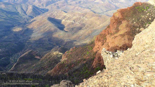
The photo above was taken from the edge of the western escarpment of the Boney Mountain massif in the western Santa Monica Mountains. The western side of the mountain is a huge bowl that funnels runoff into Blue Canyon. Blue Canyon can be seen on the left side of the photograph. It is a tributary of Big Sycamore Canyon. More than 60% of the Blue Canyon drainage was burned in the May 2013 Springs Fire.
In the early morning hours of Friday, December 12, 2014, a very strong cold front, enhanced with moisture from an atmospheric river, produced a line of strong storms that produced rain rates in the Springs Fire burn area as high as 2 inches per hour. This resulted in widespread flash floods and debris flows in the burn area, much of which is in Pt. Mugu State Park. Mud and debris flows originating from the burn area inundated homes below Conejo Mountain and closed Pacific Coast Highway.
This slideshow includes photos of the aftermath of the flash floods and debris flows in Blue Canyon, Sycamore Canyon and Upper Sycamore. These were taken on a trail run on December 14, 2014. Also included are some NWS Los Angeles/Oxnard tweets and some additional meteorological images and info.
Note: According to the Pt. Mugu State Park web site, the Park is closed until “at least January 12, 2015.”