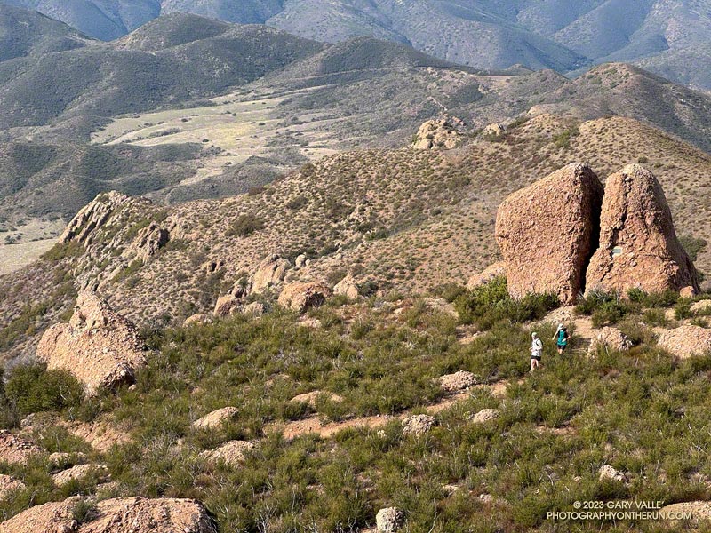
Runners descending the Backbone Trail pass Chamberlain Rock.
It’s a section of the westbound Backbone Trail that starts two miles west of Sandstone Peak and continues down the Chamberlain, Old Boney, and Blue Canyon Trails to the Danielson Multi-Use Area and Big Sycamore Canyon Fire Road. At the point where the trail turns south on the fire road, it has dropped about 2400 feet in 4.8 miles. Continuing south on the fire road, the Backbone Trail gradually descends another 100 feet over a mile and a half until it starts up the Wood Canyon Vista Trail.
What about the long downhill between Saddle Peak and Malibu Canyon? That would be a contender if it weren’t for a gradual uphill that starts a little east of the Piuma Road crossing. It gains about 180 feet over 0.8 mile. If that break in the downhill is ignored, then the stats for the two descents are similar.
Boney Mountain from Satwiwa.
This morning, I did the Backbone Trail segment from Sandstone Peak to the Danielson Multi-Use Area as part of a loop from the Wendy Drive Trailhead on Potrero Road in Newbury Park. Including the optional side trip to Sandstone Peak, the loop totals about 18 miles with around 4000′ gain/loss.
Fires and heavy rain the past decade have taken their toll on the Backbone Trail and other trails in the Santa Monica Mountains. Today, except for a short stretch near Chamberlain Rock, most of the long downhill was in decent shape and enjoyable to run.
Here’s an interactive, 3D terrain view of a GPS trace of my route. The eastern ridge route is also shown. The map can be zoomed, tilted, rotated, and panned using the navigation control on the right. Track and placename locations are approximate and subject to errors. Poor weather and other conditions may make this route unsuitable for this activity.
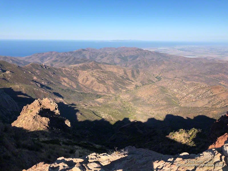
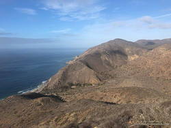
Sycamore Canyon, Laguna Peak, and the Channel Islands from Boney Mountain.
Update on August 17, 2022. As of today, my West Hills weather station has recorded a high of 100 degrees or higher for 12 consecutive days.
It was another triple-digit Sunday. Once again the high in the west San Fernando Valley was forecast to hit one-hundred and something. I’d hope to beat most of the heat by getting an early start and running where it wouldn’t be quite so hot.
I hadn’t been able to get out to Stoney Point Saturday morning, so was looking to do a little easy climbing as part of my Sunday run. I was considering three options: Topanga Lookout Ridge, Strawberry Peak, and Boney Mountain.
Boney Mountain from connector trail above Danielson Road
While none of the three are difficult by rock climbing standards, all require the use of handholds and footholds, good route-finding skills, and good judgment. It is entirely possible to fall on any of them.
The Topanga Lookout Ridge loop is about 8.5 miles long with 2000′ of gain/loss. There are a few short climbing segments on the crest of the ridge that can be accessed from the use trail.
The basic loop up the Western Ridge of Boney Mountain and over Tri Peaks to the Backbone Trail and back to Wendy Drive is about 15.5 miles long with 3400′ of gain/loss. It is longer and more difficult than the Topanga Lookout Ridge loop.
The loop over the top of Strawberry Peak from the Colby Canyon Trailhead is about 12 miles long with 3100′ of gain/loss. There is some class 2/3 climbing on the west side of Strawberry, and it is essential to stay on route. There have been a number of rescues of those attempting to climb the peak.
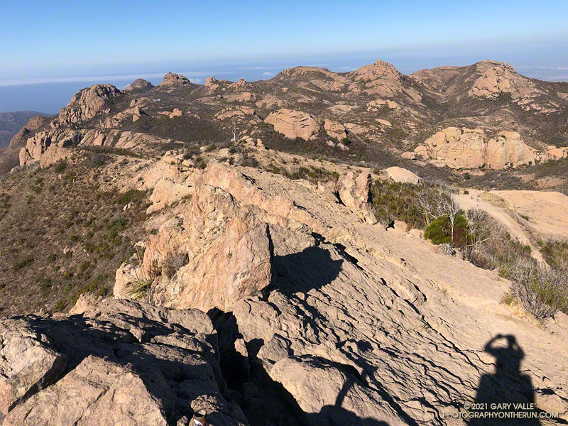
View along the top of Boney Mountain’s western escarpment.
It was a few minutes past six when I pushed the start button on my Garmin and jogged down the hill from the trailhead at Wendy Drive. I’d run about a half-mile when I heard another runner behind me. We chatted for a couple minutes and I learned he was preparing to do the Wonderland Trail around Rainier and then the Bear 100.
We were both going to the same area, but by different routes. I was climbing Boney Mountain’s Western Ridge and then working over to the Backbone Trail. He was doing an out and back to Sandstone Peak via Upper Sycamore, Sycamore Canyon, and the Backbone Trail. We would run into each other again at the Danielson Multi-Use Area on the way back to Wendy Drive.
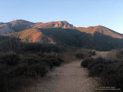
Morning shadows on Boney Mountain’s western escarpment
As always, the climb up the Western Ridge (Mountaineer’s Route) was enjoyable. The rock climber in me always wants to check out potential lines, but this morning there wasn’t much time for that. The longer it took to get up Boney, the hotter it was going to be later in the run!
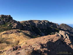
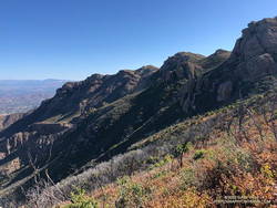
The temperature was already in the eighties when I reached the Backbone Trail. Before the fires and floods of past decade, the run down the Chamberlain segment of the Backbone Trail was one of the better running descents in the Santa Monica Mountains. From the Tri Peaks Trail junction to the Old Boney Trail it drops about 1500′ over three miles. Today, except for the stretch of trail near Chamberlain Rock, it was nearly back to its original form.
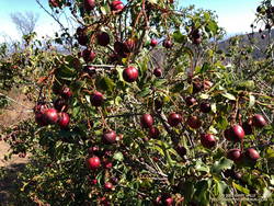
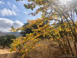
Holly-leaved cherries along the Chamberlain segment of the Backbone Trail
As in other areas of the Santa Monica Mountains, the effect of the heavy December rains was evident. The red shanks, and chaparral in general, seemed to be greener. This year there is a bumper crop of holly-leaved cherries, which must make the coyotes happy. Unlike last year, it looks like there should be some Christmas berries this Winter, since a number of Toyon were covered in green berries.
On the way down the Chamberlain Trail I started to fret that the water at Danielson might not be turned on. The water faucets in Sycamore Canyon are usually dependable, but on a run a few years ago the water system was turned off for servicing. Or what if there had been a drought-related water supply issue?
It turned out the water was still on, and I drank a lot of it. The remainder of the run went well, although I was a little surprised that the sensor on my pack recorded temps in the nineties in Sycamore Canyon. I had expected the south-facing stretch on Danielson road to be torrid, but a nice breeze kept the temperature tolerable.
When I parked at the Wendy Drive trailhead, there was just enough light to see a wide band of high clouds overhead. That was good news. With a well-advertised storm expected to move through the area the next day, I hadn’t been sure what weather to expect for today’s run.
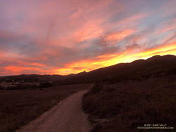
Colorfully illuminated clouds a few minutes before sunrise on the Wendy Connector Trail
The general forecast was for low clouds and fog in the morning, giving way to partly cloudy skies in the afternoon. I was going to be running one of the more scenic trails in the Santa Monica Mountains — the Ray Miller Trail. High clouds and sunshine were a much better option than running in the fog or with gloomy, overcast skies.
Shortly after leaving the trailhead, the band of high clouds became underlit by the reds, oranges and yellows of the rising sun. It was going to be a good run.
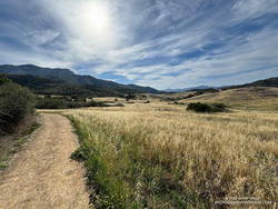
The route-finding on this run is relatively straightforward. From the Wendy Drive trailhead on Potrero Road, run over to the Satwiwa Native American Indian Culture Center (see Satwiwa map). From the Culture Center run 4+ miles on Big Sycamore Canyon Road/Trail toward the beach. Some of this is paved.
La Jolla Canyon, PCH and Mugu Peak from the Ray Miller Trail
Once past the junction of Sycamore Canyon and Wood Canyon fire roads, take either the Wood Canyon Vista Trail (Backbone Trail) or Fireline Trail up to the Overlook fire road. From the top of the Wood Canyon Vista Trail turn left on Overlook fire road, or from the top of Fireline turn right, and follow the road to the top of the Ray Miller Trail. The Fireline option is about 0.4 miles longer. Here’s a map from the State Park website. Note that the La Jolla Canyon Trail is closed.
The Ray Miller Trail drops about 1000′ over 2.6 scenic miles. There is usually water available at the parking lot at the trailhead. Today the conditions were about as good as they get. The trail was in excellent condition. The temperature was in the mid-70s. The marine layer was holding offshore and a few puffy clouds had formed over the higher peaks.
One of the things about the Ray Miller Trail is that run/hike up it is almost as enjoyable as the run down. It is a very popular, and there are almost always runners and hikers on the trail. Running up a section of trail, I thought I recognized someone going down. It was nine-time Badwater finisher Chris Frost. We talked for a while about trails, running and races.
Fall color on a California sycamore along Wood Canyon Fire Road
From Overlook Fire road the route back to Wendy was a familiar one — Hell Hill, Wood Canyon Fire Road, Two Foxes Trail, Big Sycamore Canyon Road, Upper Sycamore Canyon Trail, Danielson Road, and the Satwiwa Loop Trail. Including a short jog over to PCH the run was a little over 24 miles with about 3100′ of elevation gain.
Here’s an interactive, 3D terrain view of the Wendy Drive – Ray Miller Out & Back trail run. The map can be zoomed, tilted, rotated, and panned. To change the view, use the control on the upper right side of the screen. Track and placename locations are approximate and subject to errors. Poor weather, and other conditions may make this route unsuitable for this activity.
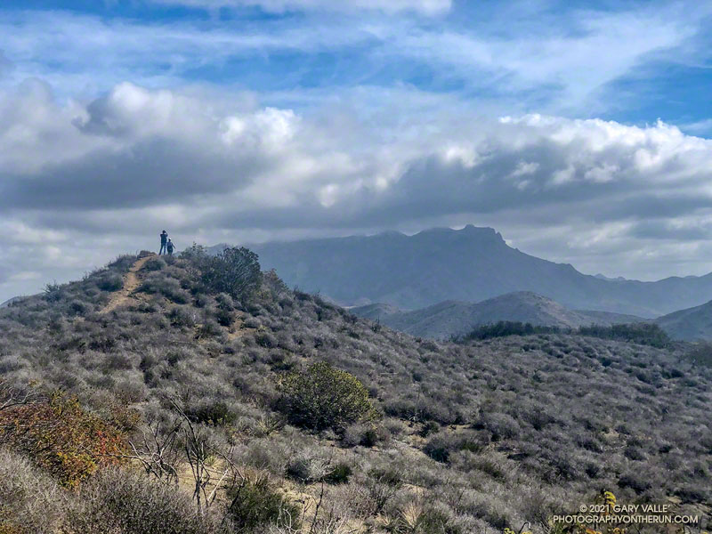
Boney Mountain area peaks from the top of Sandstone Peak.
With the closure of Los Padres, Angeles, San Bernardino, and Cleveland National Forests until Thursday, I did not expect to find the summit of the highest peak in the Santa Monica Mountains empty. Even if it was by happenstance, I’ve rarely found the summit of Sandstone unoccupied on a Saturday or Sunday morning.
Like last weekend’s run, this morning’s trail run started at the Wendy Drive Trailhead on Potrero Road in Newbury Park. But today’s route had a lot more elevation gain, and some steep scrambling up the rocks of Boney Mountain’s Western Ridge. It’s an adventurous way to do Boney Mountain, Tri Peaks, and Sandstone Peak, and get in some excellent running on a very scenic stretch of the Backbone Trail.
Overall, the route was in the best shape I’ve seen since the 2018 Woolsey Fire. The path that works up the north side of Tri Peaks and around the east side of its summit blocks was relatively clear. Following trailwork by the Santa Monica Mountains Trails Council, the Chamberlain Trail segment of the Backbone Trail was once again an enjoyable downhill run.
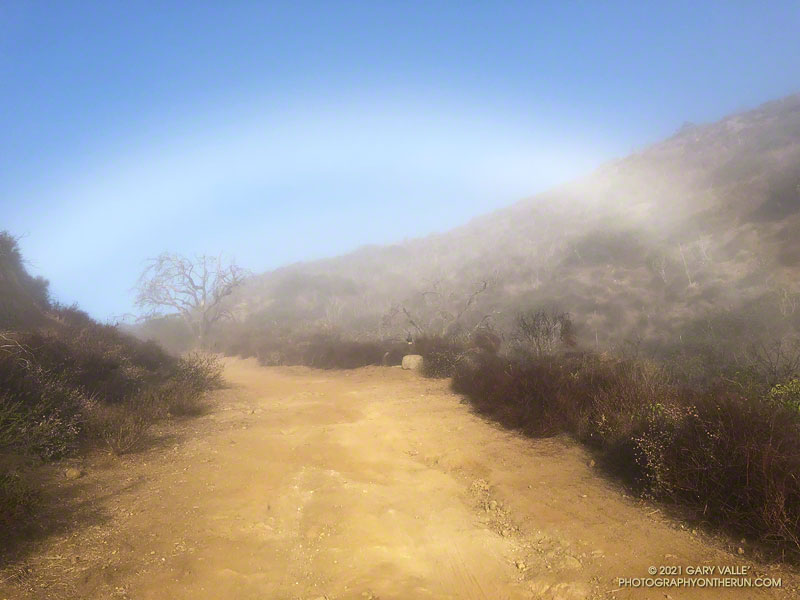
Fogbows form opposite the sun in a manner similar to rainbows, except the water droplets that create a fogbow are much smaller than raindrops. Because a fog droplet is so small, the physics of the interaction is different. The result is often a diffuse, primarily white bow.
The photograph of the fogbow was taken Sunday morning on an out and back run from Wendy Drive to Mugu Peak. The sun was about 14 degrees above the horizon. More about fogbows and other atmospheric phenomena can be found on Les Cowley’s Atmospheric Optics website.
Morning on the Hidden Pond Trail, Boney Mountain in the distance.
The Hidden Pond – Old Boney Loop is a variation of the XTERRA Boney Mountain Trail Run 21K course. The route is about a half-mile longer and has a couple hundred feet more of elevation gain, but all the key trails are the same. It starts/ends at the Wendy Drive & Potrero Road Trailhead.