Malibu Creek State Park: Lake Vista Ridge, the Forest Trail, and September Wildflowers

View of Castro Peak, Malibu Creek, and Malibou Lake from Lake Vista Ridge.
View from “Lake Vista Ridge.”

I took a few tentative steps into the dense brush and stopped. It was just too overgrown. I backtracked a few feet to the overlook at the top of Lake Vista Trail and reconsidered. If it was this overgrown all along the ridge, it was going to take a long time to get to the summit.

First sun on Lake Vista Butte and Ridge in Malibu Creek State Park.
First sun on Lake Vista Butte and Ridge.

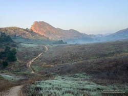
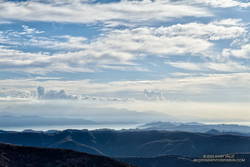
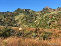
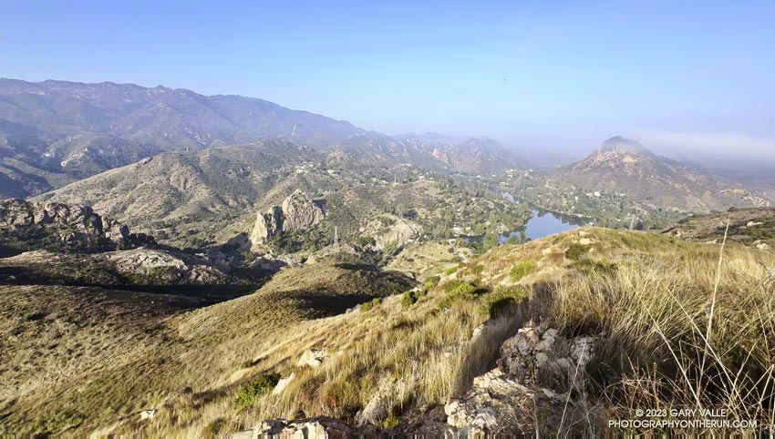
I was trying to get to the top of “Lake Vista Butte,” a high point along a prominent ridge of volcanic rock that stands between Reagan Ranch and Malibu Creek. The ridgeline and summit provide a unique perspective of Malibu Creek, Century Lake, Goat Buttes, Malibou Lake, and much of Malibu Creek State Park.

I dove back in, walking on top of a dense mat of dried deerweed and then working around a thicket of laurel sumac. Even if it was buried in a tangle of chaparral, it helped to know there was a path along the ridge. As I worked east along the ridgeline, the path would briefly emerge, only to disappear under another mass of scrub and brush.

Wishbone bush blooming in September in Malibu Creek State Park.
Wishbone bush blooming along Lake Vista Ridge.

In places, enterprising orb-weaver spiders had constructed intricate webs across remnants of trail. Their artwork was easy to spot in the morning sun, and even though their webs blocked the trail, they could not be disturbed. At least the spiders were out in the open. A rattlesnake could be anywhere in the rocks and brush and might not be kind enough to give a warning.

The route along the ridge wasn’t technically challenging, but like the spider’s web, required patience to complete. Low in the sky, the morning sun complicated the route-finding, making it more difficult to see sections of the trail and link them together.  Far outweighing these inconsequential difficulties were the exceptional views of Malibu Creek State Park’s crags, canyons and mountains while traversing the ridge.

The Forest Trail along Century Lake in Malibu Creek State Park.
The Forest Trail along Century Lake.

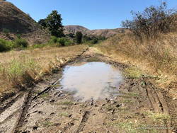
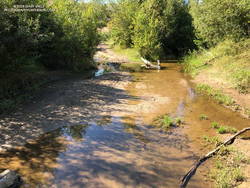
As often happens, the return to the Lake Vista Trail took less time than the ascent. Back at the overlook, I began retracing my steps down the Lake Vista and Deer Leg Trails and over to the top of the Cage Creek Trail. I was headed down to Malibu Creek to check the condition of the Forest Trail.

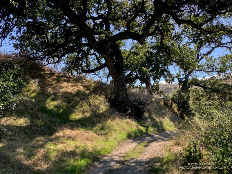
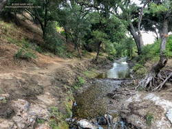
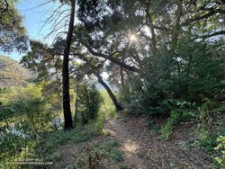
The Forest Trail is the “Walden Pond” of Malibu Creek State Park. Bordered by Century Lake on one side and the steep slopes of a rocky butte on the other, it is a contemplative place and one-of-a-kind habitat. It is home to towering coast redwoods, sprawling live oaks, sweet-smelling California bay, and water-loving California sycamores. Deer, ducks, bullfrogs, herons, hawks, falcons, and other wildlife may be seen here.

Fallen trees have been accumulating on the Forest Trail for months. On my last visit, following T.S. Hilary’s passage, another large oak had fallen near the beginning of the trail, making it unusable. Today, I was happy to find that the trees had been cleared, and the Forest Trail could be followed to its end at Century Lake Dam.

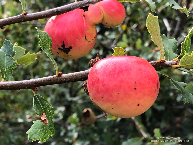
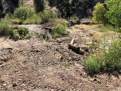
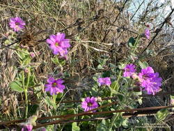
Here are a few photos taken along the way, including some wildflowers that usually don’t bloom this time of year.

Some related posts: Exploring the Lake Vista Trail and Ridge, Malibu Creek State Park Redwoods: Fighting the Drought

Apple Galls on Scrub Oak Along the Stunt High Trail

Apple Galls on Scrub Oak Along the Stunt High Trail

The eye-catching colors of apple galls are like nothing else in chaparral and impossible to miss. These are on scrub oaks along the Stunt High Trail in the Santa Monica Mountains.

The galls are chemically induced by the larva of the California gall wasp, which uses the gall for food, protection, and to pupate. The rose color appears to result from exposure of the gall to sunlight.

I was descending the Stunt High Trail after visiting Saddle Peak while doing the Topanga Ridge Loop. As in other parts of the Santa Monica Mountains in which I’ve run following Hilary’s deluge, the trails were somewhat more eroded than usual but in OK shape.

Some related posts: Scrub Oak Apple Gall, Looking for Snow on Topanga Lookout and Saddle Peak, Topanga Lookout Loop, Plus Saddle Peak

Looking For Local Impacts of Tropical Storm Hilary

New grass in Upper Las Virgenes Canyon Open Space Preserve (Ahmanson Ranch), 10 days after the passage of Tropical Storm Hilary
Rare Summer grass at Ahmanson Ranch as a result of Hilary’s rain.

Update September 14, 2023. Mustard is sprouting along Ahmanson’s fire roads, and more surprising — a few mushrooms.

Update September 8, 2023. The new grass from T.S. Hilary’s rain is coming in nicely at Upper Las Virgenes Canyon Open Space Preserve (Ahmanson Ranch).

Tropical storms are a different kind of weather beast than usually seen in Southern California. The warmer air associated with such storms can carry much more water and produce unusually high amounts of precipitation.

The first hints of Hilary approaching Los Angeles
The first hints of Hilary approaching Los Angeles.

The rain resulting from Tropical Storm Hilary shattered many daily and monthly records. Over decades of record keeping, most stations in the greater Los Angeles area had previously measured only a trace of rain on August 20 or 21, or at best, a few hundredths of an inch. Some stations had never recorded any rain on these days.

This Google Earth image with precipitation data from the California-Nevada River Forecast Center (CNRFC) shows the remarkable rainfall totals across Southern California for the 24-hour period ending at 5:00 a.m. on Monday, August 21, 2023.

A little mud in Las Virgenes Canyon after Tropical Storm Hilary. August 22, 2023.
A little mud in Las Virgenes Canyon.

The highest rainfall amounts occurred where the precipitation was enhanced by mountainous terrain. The northeast-facing slopes of the eastern San Gabriel Mountains, near Wrightwood, were ideally positioned in Hilary’s circulation to enhance rainfall. The Big Pine RAWS recorded over 6 inches of rain for the storm, Lewis Ranch slightly over 7 inches, and Lytle Creek nearly 10 inches.

Detailed observation and impact reports for Hilary are available from NWS Los Angeles/Oxnard, NWS San Diego and the Center for Western Weather and Water Extremes.

Crossing of Las Virgenes Creek, south of the pipeline station, on August 22, 2023, following Tropical Storm Hilary.
This crossing of Las Virgenes Creek was about the same as before Hilary.

Curious to see some of the local impacts of the storm, I ran at Ahmanson Ranch on August 22 and then a few days later at Malibu Creek State Park.

My West Hills weather station, about three miles from Ahmanson Ranch’s Victory Trailhead, recorded 3.86 inches of rain for the storm. After an initial technical hiccup, the Cheeseboro RAWS, overlooking Las Virgenes Canyon, recorded 3.52 inches of rain. This and other data suggest rainfall amounts in the Ahmanson area of at least 3.5 – 4.5 inches.

My Ahmanson run started at the Victory trailhead, went out East Las Virgenes Canyon, through part of Las Virgenes Canyon, and then up to Lasky Mesa. With that much rain, I was sure I would be wallowing in the mud and wading the creek crossings. But my shoes didn’t even get muddy!

Dry streambed of Las Virgenes Creek, north of the Las Virgenes Trailhead, on August 22, 2023, after Tropical Storm Hilary
Dry streambed of Las Virgenes Creek, north of the Las Virgenes Trailhead

There was certainly some mud, puddles, and a little erosion, but the impact of Hilary on Ahmanson was surprisingly minor. The ground must have been desiccated because Las Virgenes Creek had almost no increase in flow. The creek crossings near the pipeline station and south of the station were essentially the same as before Hilary. Even more surprising, there was no water at the crossing a little north of the Las Virgenes Trailhead.

As Hilary moved northward in California, the counterclockwise circulation of the storm increased the rainfall in the Santa Monica Mountains. Automated RAWS stations in Topanga, the Malibu Hills, and in Malibu Canyon recorded 4.0 to 4.5 inches of rain during the storm. CNRFC gridded precipitation data indicated higher amounts in some parts of the range.

Las Virgenes Creek, about 5 miles downstream of Ahmanson Ranch, in Malibu Creek State Park, a few days after the passage of Tropical Storm Hilary.
Las Virgenes Creek in Malibu Creek State Park, about 5 miles downstream of Ahmanson Ranch.

On August 27, I ran the Bulldog Loop in Malibu Creek State Park. The run started at a small parking area at the junction of Malibu Canyon & Piuma Roads. As I was running up the Tapia Spur Trail, I wondered if State Parks had — as a precaution — removed the seasonal bridge across Malibu Creek on the Crags Road Trail. On August 19, the day before Hilary drenched the area, the bridge had been in place for the Bulldog Ultra. If it wasn’t removed, did Malibu Creek get high enough to damage it?

Once again, I need not have worried. The bridge was just fine, and the reeds in the water near the bridge suggested only a modest increase in streamflow.

Slopes along Bulldog fire road following Tropical Storm Hilary.
It’s unusual for the slopes along Bulldog fire road to be this green in Summer!

It looked like Malibu Creek State Park received more rain than Ahmanson Ranch. There was slightly more erosion on the dirt roads and some small sluffs/slides, including one tree that slid onto Mesa Peak Mtwy fire road. A tree had also fallen near the beginning of the Forest Trail.

Back at Ahmanson on August 31, things were drying out, but it was beginning to look like Spring. Grass was sprouting all over Ahmanson Ranch. It will be interesting to see if the grass survives the inevitable heat and grows enough to turn the hills green. The little bit of rain and cooler weather over Labor Day weekend will help. Some out-of-season wildflowers could also result from a false Spring.

Yesterday, I did a run in Topanga State Park, and the story was much the same. There was some minor erosion on the fire roads, but none of the larger sluffs and slides seen during the rainy season. There was no new damage to the Musch or Garapito Trails. It did look like the flow had increased on Garapito Creek with Hilary’s rain, and there was a still little water in the mainstem of the creek.