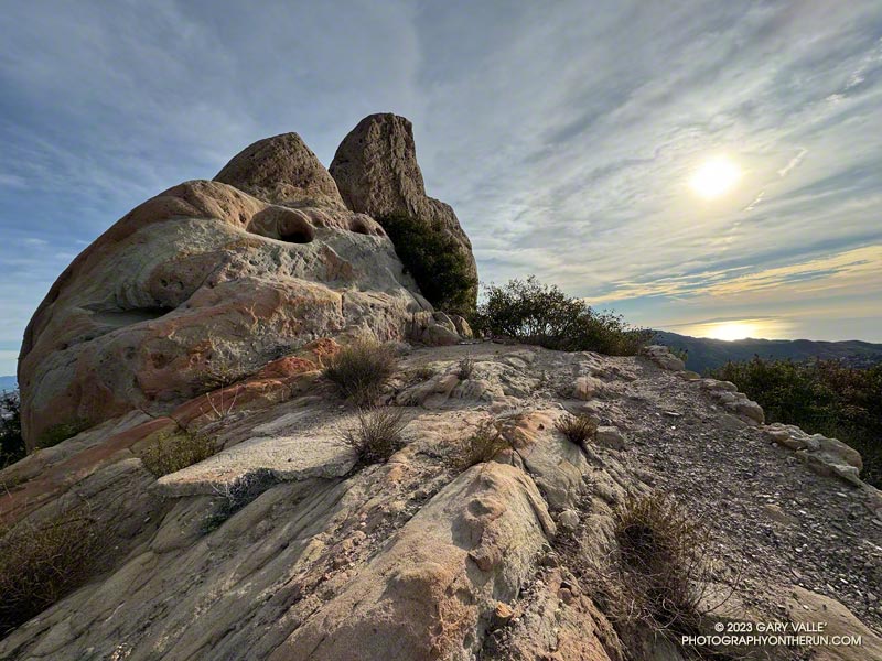
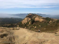
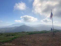
The photograph above was taken a few steps off the Backbone Trail, between the Corral Canyon Trailhead and Mesa Peak Motorway fire road. Also in the area was a set of table and chairs that might be used for an ocean-view card game or a lunch break.
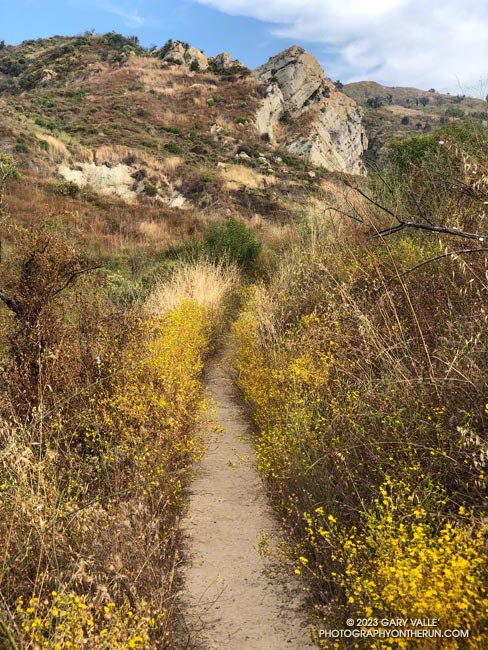
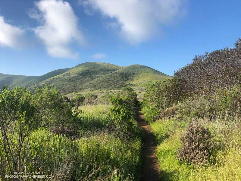
These scenes were about halfway through a variation of the Bulldog Loop that starts/ends at the Cistern Trailhead on Mulholland Highway. The route follows the Cistern, Lookout, and Cage Creek Trails down to the Crags Road Trail, just east of where it crosses Malibu Creek.
A permanent bridge used to span the creek, but after being washed out several times in Winter floods, a “seasonal” bridge was put in place. The seasonal bridge is removed when there is a threat of flooding, such as during the rainy season.
This morning, the temperature in the canyon was in the mid-thirties. That was cool enough that I didn’t want to get wet, and I hoped the removal of the bridge had been delayed. But several days of rain were in the forecast, and as I neared the creek, I could see the bridge now lay alongside trail.
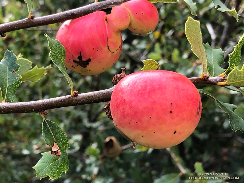
The eye-catching colors of apple galls are like nothing else in chaparral and impossible to miss. These are on scrub oaks along the Stunt High Trail in the Santa Monica Mountains.
The galls are chemically induced by the larva of the California gall wasp, which uses the gall for food, protection, and to pupate. The rose color appears to result from exposure of the gall to sunlight.
I was descending the Stunt High Trail after visiting Saddle Peak while doing the Topanga Ridge Loop. As in other parts of the Santa Monica Mountains in which I’ve run following Hilary’s deluge, the trails were somewhat more eroded than usual but in OK shape.
The 17.5-mile Trailer Canyon – Santa Ynez Canyon Trail – Trippet Ranch Loop is a longer version of the venerable Trippet Ranch loop from the Top of Reseda. It might also be called the Three Vistas Loop because it visits three high points in Topanga State Park with 360-degree, panoramic views.
Eagle Rock from Temescal Peak.
The run starts and ends the same as the Trippet Ranch Loop. After running up to the Hub on Fire Road #30, instead of continuing straight on Eagle Springs Fire Road, this route turns left on Temescal Ridge Fire Road. The fire road is followed up to where the Backbone Trail single-track forks left off the road. The Backbone Trail is followed a tenth of a mile east, where a path leads up and left to the top of Temescal Peak.
The view from this little peak is superb. On a day with good visibility, the view can extend beyond Mt. Baldy to San Gorgonio Mountain and San Jacinto Peak. The next overlook on this route, Temescal Lookout, is about a half-mile (as the crow flies) to the south. The third overlook, Eagle Rock, is about a mile to the west.
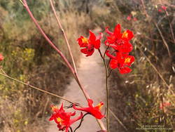
Scarlet larkspur.
From Temescal Peak, the route returns to Temescal Ridge Fire Road. I usually follow the use-trail back down and across the Backbone Trail and then continue on the use-trail to the fire road.
The next stop, Temescal Lookout, is about a mile from the top of Temescal Peak and just off Temescal Ridge Fire Road. When doing this loop, I run up a dirt access road on the north side of the lookout and then descend a use trail on the south side. Once the site of a fire lookout, it also has an excellent view. This photo of Downtown and San Jacinto Peak was taken from the viewpoint.
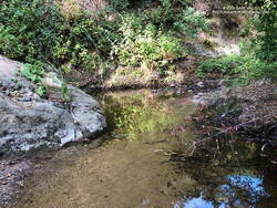
Pool on Santa Ynez Creek.
Once back on Temescal Ridge Fire Road and headed south, it’s less than a half-mile to the turn-off down Trailer Canyon Fire Road and then another 2.3 miles down to Michael Lane in Pacific Palisades. On the way down, there are good views of where the loop is headed next — Santa Ynez Canyon. A large part of Santa Ynez Canyon was burned in the May 2021 Palisades Fire.
After turning right (west) on Michael Lane, the street is followed around and down to Vereda de la Montura. A right turn here leads to the Santa Ynez Canyon Trailhead in about a quarter-mile. This is where some route-finding fun begins.
A bit more than a mile from the trailhead, the Santa Ynez Canyon Trail climbs out of the bottom of the canyon and up onto a broad ridge. Another mile of uphill, and it tops out at Eagle Springs Fire Road. After turning left, it’s less than a half-mile down to the Trippet Ranch parking lot.
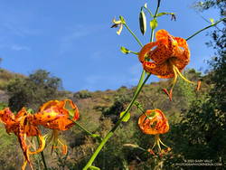
Humboldt lily.
The previous weekend I’d done the Trippet Ranch Loop, so knew what the expect on the remainder of the run. Other than being a little overgrown, the Musch Trail was in reasonable shape. There were still some late-season blooms of showy penstemon, yellow monkeyflower, and white snapdragon along the trail. This time of year, the round pincushions of buckwheat are common. Water was available at the start of the Musch Trail and at Musch Camp.
Eagle Rock is the third viewpoint on the loop, and the most popular. The massive rock formation overlooks Santa Ynez Canyon and has an airy, 360-degree view. On a clear day, Santa Monica Bay, Palos Verdes Peninsula, and Catalina can be seen to the south. On weekends, it’s rare to find the top empty. The summit had just been vacated as I climbed up and was reoccupied by another hiker as I walked down.
Returning to Eagle Rock Fire Road, I turned right and continued northeast a tenth of a mile to the top of the Garapito Trail.
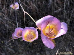
Plummer’s mariposa lily.
A little more than three miles long, the Garapito Trail is one of my favorite trails in the Santa Monica Mountains. Several sections of the trail are overgrown at the moment. At one point, not too far from Fire Road #30, it was necessary to bushwhack through a dense patch of six-foot-tall giant rye grass.
Two lilies listed on the CNPS Inventory of Rare and Endangered Plants of California were blooming along the Garapito Trail — Plummer’s mariposa lily and Humboldt lily. Both plants have a Rare Plant Rank of 4.2, which indicates they are of limited distribution and moderately threatened in California. Thanks to our very wet rain season, the eye-catching red of scarlet larkspur was unusually prevalent along the trail.
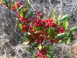
Redberry.
The Garapito Trail ends at Fire Road #30. Normally the route would cross the fire road and follow the Bent Arrow Trail to dirt Mulholland, but the trail was damaged by rainy season storms and is still closed.
Turning left onto Fire Road #30, I retraced my steps from earlier in the morning and in a few minutes was back to the trailhead at the Top of Reseda (Marvin Braude Mulholland Gateway Park).
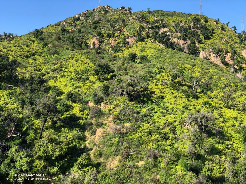
Canyon sunflowers covering a hillside burned in the 2018 Woolsey Fire
Update May 5, 2023. Did a run this afternoon in Malibu Creek State Park and the seasonal bridge across Malibu Creek on the Crags Road Trail is back in place!
As I approached the M*A*S*H site, I could see some people taking photos. I stopped to say hi, and without skipping a beat, one of them asked, “Did you wade across the creek?”
He was asking about the creek crossing where Crags Road crosses Malibu Creek upstream of Century Lake and east of the M*A*S*H site.
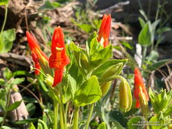
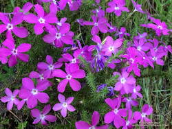
Prickly phlox along the Tapia Spur Trail.
There’s a substantial log spanning the creek at the moment, and I wanted to answer that I danced across it with my eyes closed. But instead, I explained that I decided to wade — and for sure keep my phone dry — rather than take a chance of falling uncontrolled into three feet of water, ker-splash.
Speaking of which, this morning, I talked to a mountain biker who saw the bridge pulled off to the side of the creek before any flooding had occurred and thought it may have been hauled away. Good news! According to the Malibu Creek Docents, the bridge is seasonal and was designed to be portable. It was removed and stored before this Winter’s rain. It is expected to be reinstalled when the threat of flooding is over — which should be soon.
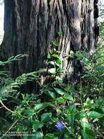
Vinca growing at the base of a coast redwood along the Forest Trail.
After crossing Malibu Creek and before continuing to the M*A*S*H site, I took a quick detour on the Forest Trail. Bordered by Century Lake on one side, and steep, rocky slopes on the other, the Forest Trail has a character all its own. It’s a wonderful place to observe, reflect, and enjoy nature. It’s also home to several coast redwoods. Unfortunately, less than half the trees originally growing along the trail survived the 2011-2015 drought. This morning, a redwood that died several years ago had fallen and was partially blocking the trail near its halfway point.
As has been the case in most of Southern California this Spring, the wildflowers on this run were spectacular. Canyon sunflower was particularly prevalent, with many thousands of the bright-yellow blossoms covering the hillsides burned in the 2018 Woolsey Fire.
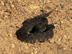
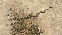
Southern Pacific Rattlesnake on Castro Peak Mtwy fire road.
Also exciting was my first rattlesnake encounter of 2023. I was running down Castro Peak Mtwy Fire Road from the Bulldog “T” when I saw something in the road that looked like a partially exposed root. As I neared, I could see it was a very dark — almost black — Southern Pacific Rattlesnake.
The snake was stretched out straight on the road, basking in the sun. As I approached, it did move, and it did not rattle. Usually, snakes in this state are pretty docile, and I can cautiously walk a few feet behind them. Yikes! This one was super-aggressive. In the blink of an eye, it turned and moved toward me, doubling back on itself. I jumped a mile! It coiled but still did not rattle! It must have recently emerged from its Winter hideaway.
After doing a climbing /trail running combo in Pt. Mugu State Park last Sunday, I headed back to Wendy Drive this morning to do a trail run to Mugu Peak and back.
The plan was to get in a long run (20 miles) with fewer “get your feet wet” stream crossings, and also check out the conditions on several trails I hadn’t done this year.
Boney Mountain (left skyline) from Mugu Peak
So much for keeping the feet dry! The temp was in the mid-30s when I turned off Big Sycamore Canyon fire road and onto Wood Canyon fire road. The main creek draining Sycamore Canyon cuts across the fire road here, and there was no way I was going to get across it without wading. Some smaller stream crossings followed, ending with Wood Canyon Creek.
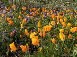
California poppies mixed with lupine along the Mugu Peak Trail
Several trails/roads converge at the top of Hell Hill, and I turned right onto the fire road that leads to the La Jolla Valley Loop Trail. I like to do Mugu Peak as part of a counterclockwise loop that combines segments of the La Jolla Valley Loop Trail and Mugu Peak Trails.
Long stretches of the La Jolla Valley Loop Trail between the walk-in camp and Mugu Peak were sopping wet. I’ll be curious to see how quickly it dries out, but today (April 2) it was really, really wet.
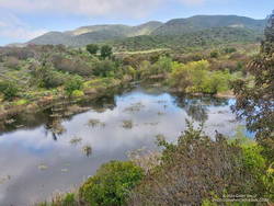
La Jolla Loop pond is rarely this large — or even a pond.
Mugu Peak was pretty much as it always is on this side — busy and steep. The steepness of the “Direct” trail helped wring the water from my Ultraglides and Injinji socks. By the time I reached the top, my feet were only damp.
Mugu Peak is VERY popular, and there are almost always a few people taking in the wide-ranging views from the summit. Most do the short, steep hike from PCH on the Chumash Trail. A few start at the Ray Miller Trailhead — or like I was doing today — the long route from Wendy Drive.
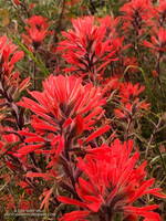
Vivid red paintbrush along the La Jolla Loop Trail
Although I usually climb the peak, two other options are worthwhile: the loop around the ocean-facing side of Mugu Peak and
the loop around La Jolla Valley.
The wildflowers along the Mugu Peak Trail and La Jolla Loop Trail were fantastic. California poppies were plentiful on the south-facing slopes. The vibrance of the bright orange poppies could not have been better accentuated than by purple lupine. Yellow bush sunflower, royal blue phacelia, and rich red paintbrush also decorated the trail.
Bright yellow collarless poppies along Danielson Road.
I followed my usual route on the way back to Wendy — returning to the Hub, descending Hell Hill, retracing my steps in Wood Canyon, then following the Two Foxes single-track trail north to a short connector to Sycamore Canyon Road. This is near the Danielson Multi-Use Area. Once on Sycamore Canyon Road, the route back was the same as last week — up 1.8 miles of paved road and then onto the Upper Sycamore Trail. After that, up Danielson Road and across Satwiwa to the Wendy Drive trailhead.
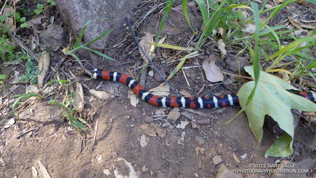
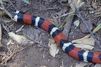
The patterned colors of a mountain kingsnake are hard to miss. The snake’s white-black-red-black-white triads attract attention in just about any habitat. (The amount of red can vary in an individual as well as subgroup.)
San Diego mountain kingsnake
Traditionally California mountain kingsnakes (Lampropeltis zonata) have been grouped into several subspecies according to subtle and variable pattern characteristics.
The kingsnake in the title photograph appears to belong to the San Diego mountain kingsnake pattern class (Lampropeltis zonata pulchra). The broken white ring on the head is common in this subgroup in the Santa Monica Mountains.
San Bernardino mountain kingsnake
This mountain kingsnake, photographed on Pleasant View Ridge in the San Gabriel Mountains, likely belongs to the San Bernardino mountain kingsnake pattern class, Lampropeltis zonata parvirubra.
Study of California mountain kingsnakes’ mitochondrial DNA (E. A. Myers, et. al., 2013) conservatively supports separate northern and southern species and potentially two lineages within the southern group.
California kingsnake
Mountain kingsnakes aren’t the only kingsnake found in the Los Angeles area. This California kingsnake (Lampropeltis getula californiae) was photographed at Ahmanson Ranch a couple of weeks ago. When I approached the snake, it immediately became defensive and started rapidly vibrating its tail. This behavior is often described as mimicking a rattlesnake, but could also predate the development of rattles in rattlesnakes.